NOAA’s National Geodetic Survey (NGS) provides the framework for all positioning activities in the nation. The foundational elements of latitude, longitude, elevation, and shoreline information impact a wide range of important activities.
NGS and NIST to Retire U.S. Survey Foot After 2022
SUPPORTS NOS PRIORITY: SAFE AND EFFICIENT TRANSPORTATION AND COMMERCE
The National Institute of Standards and Technology (NIST) and NGS co-issued a Federal Register Notice to retire the U.S. survey foot as part of modernizing the National Spatial Reference System. Since 1893, the United States has defined the foot based on the meter. The definition adopted at that time was 1 foot = 0.3048006 meter approximately. In 1959, the definition was revised to 1 foot = 0.3048 meter exactly. This change was made to support U.S. industry and international trade, and resolved a long-standing discrepancy between the definition used by U.S. industries and that used by other countries. The 1959 redefinition of the foot was legally binding and intended for the entire U.S. A single exception allowed temporary continued use of the previous definition exclusively for geodetic surveying. This joint decision by NIST and NGS will end that exception after 2022.
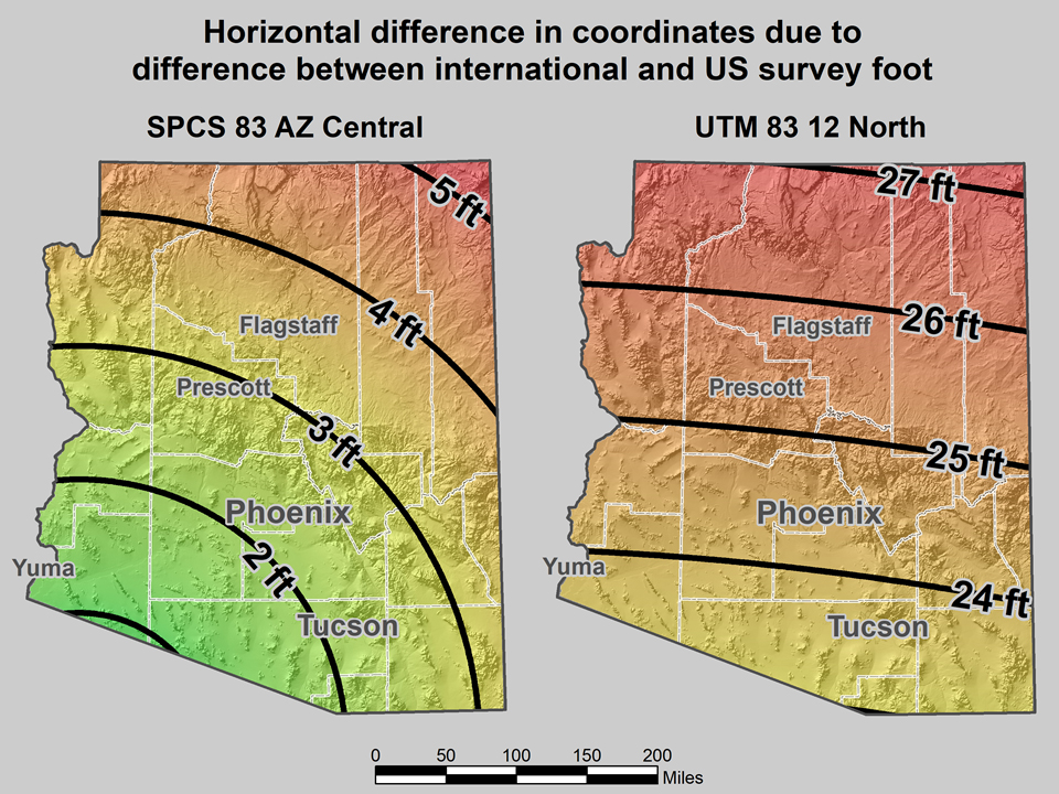
The map on the left shows the horizontal difference in feet when international feet and U.S. survey feet are interchanged for the State Plane Coordinates System of 1983 in the Arizona Central Zone (from 1 to 5 feet of error). The map on the right shows the positional error introduced when the two versions of the foot are interchanged in the Universal Transverse Mercator system in Arizona (from 23 to 27 feet of error).
Study Shows NGS Program Worth Billions to U.S. Economy
SUPPORTS NOS PRIORITIES: SAFE AND EFFICIENT TRANSPORTATION AND COMMERCE • PREPAREDNESS AND RISK REDUCTION • STEWARDSHIP, RECREATION, AND TOURISM
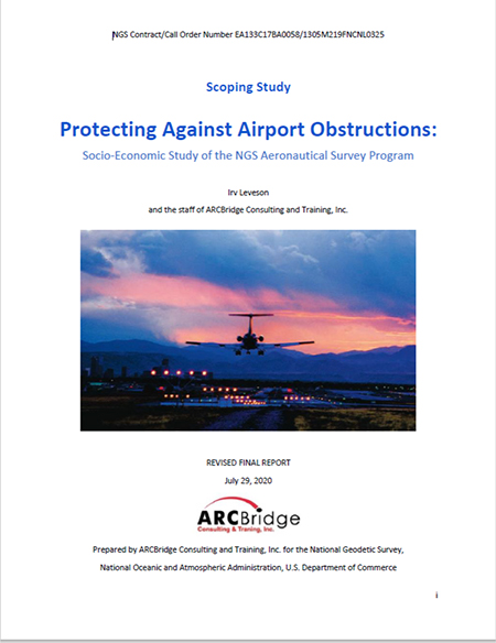
Cover of study detailing the socioeconomic benefits of NGS’s Aeronautical Survey Program.
A socioeconomic study estimates that the NGS Aeronautical Survey Program (ASP) is worth between $3 billion and $13.2 billion to the U.S. economy over the next decade. The study calculates the full value of ASP contributions to the 2019 economy at $229.5 million to $1.02 billion. Moreover, without the ASP, there would be an estimated 3,438 - 12,849 fewer jobs. The ASP, through interagency agreements with the Federal Aviation Administration (FAA), provides the critical information needed to fly safely into airports nationwide, including runway, obstruction, navigation, and airport feature information. Without proper surveys, the FAA imposes additional restrictions on flight paths and runway access to maintain safety. These restrictions can result in additional fuel usage, flight delays, and other inefficiencies. The ASP helps ensure efficient use of the national airspace, which is essential for local, national, and international economic activities.
NGS Releases Interactive Survey Mark Information Page
SUPPORTS NOS PRIORITIES: SAFE AND EFFICIENT TRANSPORTATION AND COMMERCE • STEWARDSHIP, RECREATION, AND TOURISM
As part of the effort to modernize the National Spatial Reference System, which is the nation’s coordinate system, NGS has released an interactive, beta version of its survey mark information page. Information about the locations and conditions of passive survey marks has historically been displayed online or in print as static NGS datasheets. The new mobile- and web-friendly BETA Mark Information Page color codes the GPS data for each survey mark based on the quality of the data, adds photographs of the mark and a map of its location, and includes descriptions and links to more information. NGS is currently seeking feedback on the usefulness of the page features and the ways users would like to interact with NGS datasheet information in the future.
NGS, COMET Release Survey Planning and Data Acquisition Training
SUPPORTS NOS PRIORITIES: SAFE AND EFFICIENT TRANSPORTATION AND COMMERCE • STEWARDSHIP, RECREATION, AND TOURISM
In Fiscal Year 2020, NGS released a lesson titled “GNSS Positioning: Survey Planning and Data Acquisition.” The lesson outlines best practices when using Global Navigation Satellite Systems (GNSS) in land surveys, and follows several surveyors as they plan a GNSS project, start field work, and begin processing their data. Developed in partnership with the COMET® Program, the lesson is online, self-paced, and participants receive a certificate after completing the quiz. The content is intended for land surveyors, but anyone with scientific literacy can benefit from this lesson.
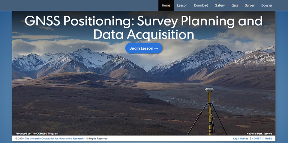
Screenshot from the GNSS Positioning: Survey Planning and Data Acquisition lesson.
NGS Collaborates Internationally on North American Geoid Model
SUPPORTS NOS PRIORITIES: SAFE AND EFFICIENT TRANSPORTATION AND COMMERCE • PREPAREDNESS AND RISK REDUCTION • STEWARDSHIP, RECREATION, AND TOURISM
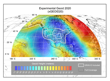
A multi-colored map showing geoid height in the United States.
For the first time, geodetic models of Canada, Mexico, and the U.S. will be combined into a new experimental geoid model (xGEOID20). Agreement on a North American geoid model will allow global navigation satellite systems like GPS to be used for determining mean sea level heights, which will help prevent flooding in coastal communities. Scientists at NGS, along with the Canadian Geodetic Survey (CGS) and the National Institute of Statistics and Geography of Mexico (INEGI), have been working closely together to this end. Each group’s independent datasets will be evaluated and the group will collaboratively agree upon the final model. The group will then turn their efforts to focusing on geoid differences — what’s causing the differences, and how to minimize them.
 An official website of the United States government.