U.S. IOOS produces, integrates, and communicates high quality ocean, coastal, and Great Lakes information that meets the safety, economic, and stewardship needs of the nation.
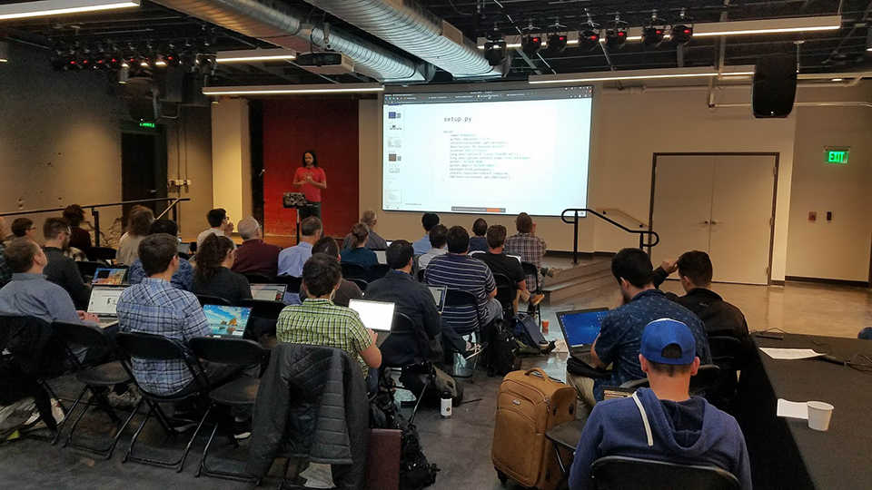
U.S. IOOS and GLOS Hold Inaugural Code Sprint
SUPPORTS NOS PRIORITIES: PREPAREDNESS AND RISK REDUCTION • STEWARDSHIP, RECREATION, AND TOURISM
In October 2019, U.S. IOOS® and the Great Lakes Observing System hosted the first IOOS Code Sprint in Ann Arbor, Michigan. Bringing together over 45 software developers, data managers, and technical professionals from IOOS, Canadian IOOS, the National Science Foundation Ocean Observatories Initiative, Ocean Biodiversity Information System, and other organizations, the group focused on advancing capabilities to publish physical, chemical, and biological ocean and lake observations.
Participants joined one of several parallel work sessions, called “sprints,” on pre-planned coding or technical topics, including: packaging and release of the first ‘ioos_qc’ Python library for quality control of oceanographic observations; development of a mobile-friendly app for real-time data plotting from ERDDAP data servers; biological data management best practices such as format and display of biological datasets in Darwin Core schema; and leveraging commercial cloud services for IOOS workflows. Daily tutorials on coding techniques were presented to the full group each morning to develop a knowledge baseline.
The sprint led to the formation of both the IOOS BioData Standards technical working group and an interagency Earth Science Information Partners ‘Biological Data Standards’ cluster. Since the follow-on release of the ioos_qc library, several IOOS Regional Associations and OOI have implemented it operationally for real-time QA/QC of ocean data.
Filipe Fernandes (SECOORA) presents a tutorial on Python code packaging best practices, and the 'ioos-python-package-skeleton’ GitHub repository that includes the recommendations in template form.
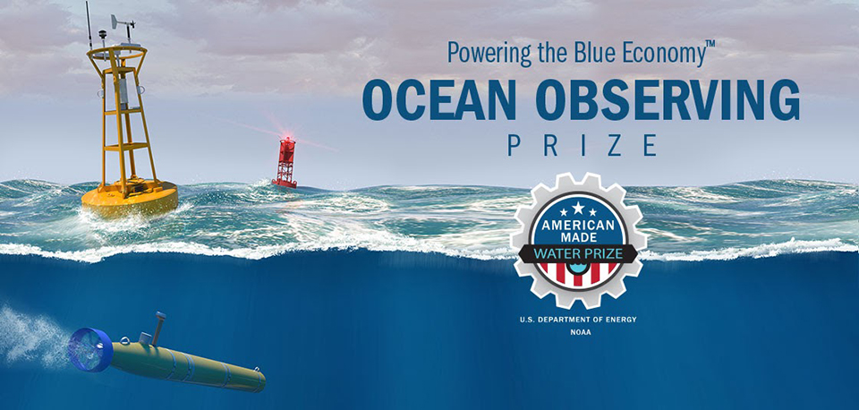
NOAA, DOE Announce First Stage of Ocean Observing Prize winners
SUPPORTS NOS PRIORITIES: SAFE AND EFFICIENT TRANSPORTATION AND COMMERCE • PREPAREDNESS AND RISK REDUCTION
In April 2020, NOAA and the Department of Energy (DOE) jointly announced the winners of the DISCOVER stage of the Powering the Blue Economy™: Ocean Observing Prize. The prize is an interagency effort that focuses on connecting NOAA and DOE with private sector innovation to expand the effective capacity of our observing systems at sea. The DISCOVER stage asked competitors to submit new ideas for marine power that would integrate with ocean observing technology. Eleven projects were selected for awards, with the Nautilus Grand Prize going to CalWave's XNode, a self-charging light-weight power, data, and sensor node-enabling buoy. The other 10 prizes were distributed to entries in the Unmanned Vehicles and Communications and Underwater Navigation categories.
The Ocean Observing prize, part of Energy's American-Made Challenges series, consists of three challenge stages: DISCOVER, DESIGN, and BUILD. Each stage is open to all competitors and the focus of each stage is chosen to best reflect market needs and innovative themes that emerge from the prior stage. The second stage, DESIGN, opened for competition in September 2020 and focuses on harnessing wave power for uncrewed (or unmanned) systems. Winners of stage two will be announced in 2021.
Promotional graphic for the Powering the Blue Economy™: Ocean Observing Prize.
U.S. IOOS Awards $7.8M to Manage Coastal Hazards
SUPPORTS NOS PRIORITIES: SAFE AND EFFICIENT TRANSPORTATION AND COMMERCE • PREPAREDNESS AND RISK REDUCTION • STEWARDSHIP, RECREATION, AND TOURISM
The U.S. IOOS® Ocean Technology Transition program announced six new multi-year project awards in Fiscal Year 2020. The new projects include improving harmful algal bloom (HAB), hypoxia, and carbon dioxide monitoring using autonomous vehicles, an animal-borne Conductivity, Temperature, and Depth profiling sensor, support for software tools to mitigate interference from wind turbines in high-frequency radar data, and operationalization of a webcam-based beach observing network. These projects will receive a total of $6.8M over the next three years. A complete list of funded projects is available here.
IOOS awarded an additional $1M in five grants to six of its regional associations for projects to support the National HAB Observing Network. These awards support monitoring through deployment of specialized technology to automate sampling and expand citizen science projects, dissemination of HAB data and information through regular bulletins and improved data integration, and supporting a nascent monitoring network in Alaska and the U.S. Arctic. These funds were provided to IOOS by Congress, which stipulated that the money should be used for projects that enhance the nation’s capacity for monitoring and detection of HAB activities in coordination with NOAA’s National Centers for Coastal Ocean Science. A full list of these projects is available here.
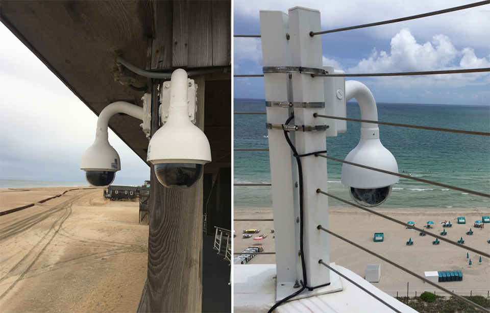
These cameras in Buxton, North Carolina (left), and Miami, Florida (right), were part of the Web Camera Application Testbed, a pilot project for the Webcams for Coastal Observations and Operational Support observing network. The transition from WebCAT to WebCOOS is supported by a Fiscal Year 2020 Ocean Technology Transition grant. Credit: Surfline, Inc.
Animal Telemetry Helps Make Cape Cod Beaches Safer
SUPPORTS NOS PRIORITIES: PREPAREDNESS AND RISK REDUCTION • STEWARDSHIP, RECREATION, AND TOURISM
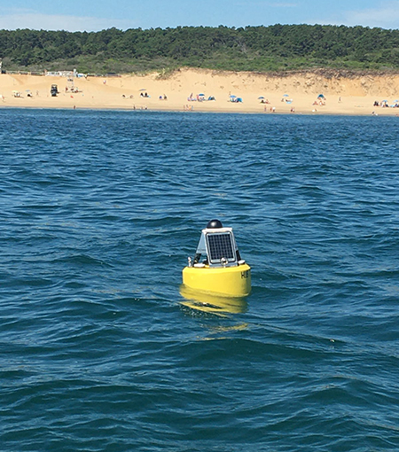
Real-Time Acoustic Tag Detection Buoy off Newcomb Hollow Beach, Wellfleet, Massachusetts. (Credit: Greg Skomal/Massachusetts Division of Marine Fisheries)
The U.S. Animal Telemetry Network (ATN), The Northeastern Regional Association of Coastal Ocean Observing Systems, and the U.S. Navy Office of Naval Research (ONR) partnered to deploy five real-time acoustic tag detection receivers/buoys along the outer beaches of Cape Cod, Massachusetts, to support white shark monitoring and research by Dr. Greg Skomal at the Massachusetts Division of Marine Fisheries. The acoustic tag detection buoys transmit 25-50 white shark detections per day in real-time through text messages to town managers, lifeguards, and Cape Cod National Seashore park rangers. As a result, these users have the information they need to make timely decisions to keep beachgoers safe.
This availability of real-time detection data of tagged sharks also provides more timely datasets for the examination of shark-specific movement and migration patterns, the development and validation of white shark forecast models, the development of essential beach management strategies, and public education and outreach efforts on the presence of this species.
IOOS-ACT Workshop Series Explores the Future of eDNA Sampling
SUPPORTS NOS PRIORITIES: PREPAREDNESS AND RISK REDUCTION • STEWARDSHIP, RECREATION, AND TOURISM
In June 2020, U.S. IOOS® and the Alliance for Coastal Technologies hosted the first in a series of workshops to consider novel solutions for known issues associated with eDNA sampling. Attended by 30 invited participants representing the research, management, and technology development/transfer sectors, this virtual workshop series brought manufacturers and researchers together to discuss how best to address these challenges.
Following a short introduction of the overall effort and presentation of the pre-workshop survey results, participants met in small groups to discuss current barriers and challenges associated with different aspects of eDNA sample collection and processing. The workshop report is available here. A second virtual workshop was held in September to more deeply explore what solutions to these challenges might look like. A potential next step will be to convene engineers and biologists to explore for new technology development.
The outcome of these workshops will inform IOOS and Marine Biodiversity Observing Network contributions to implementation of the NOAA ‘omics strategy, including coordination around data management solutions, development of new technologies to lower the cost of eDNA sampling, and expand applicability to new environments such as the deep ocean.
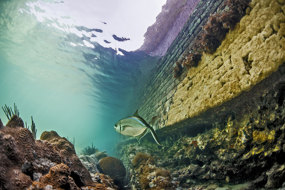
eDNA sampling is an important new technology that helps researchers understand the populations of different ecosystems and how they change over time. An MBON pilot project, Sanctuaries MBON, is examining the effectiveness of eDNA in the detection of change in biodiversity over time across National Marine Sanctuaries, such as in the Florida Keys National Marine Sanctuary (seen here), and other areas in response to shifts in environmental conditions.
 An official website of the United States government.
Social