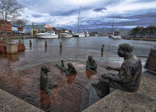
NOAA's Center for Operational Oceanographic Products and Services (CO-OPS) national network of long-term coastal water-level stations collects the highly accurate data required to determine local sea-level trends. A new analysis of the data, released in the report "Sea Level Rise and Nuisance Flood Frequency Changes around the United States," revealed that eight of the top 10 U.S. cities along the East Coast have experienced major increases in nuisance flooding caused by rising sea levels – from 300 percent to 925 percent in the last half-century. Nuisance flooding causes such public inconveniences as frequent road closures, overwhelmed storm drains, and compromised infrastructure from saltwater exposure. The report supports NOAA's coastal resilience priority by providing better understanding of the ongoing impacts of climate change in coastal areas. The report received extensive media attention at the national, regional, and local levels through print, radio, and TV.
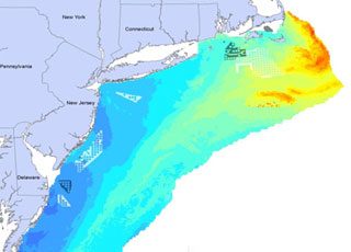
NOAA’s National Centers for Coastal Ocean Science (NCCOS) works closely with the U.S. Department of the Interior, including the Bureau of Ocean Energy Management (BOEM), the U.S. Geological Survey, and the U.S. Fish & Wildlife Service, to deploy mapping tools that support environmental assessment and planning for ocean energy development. Accurate maps and predictions of living marine resource distributions foster effective coastal and marine spatial planning, which reduces potential conflicts between human uses and sensitive marine ecosystems—thereby supporting healthy and resilient coastal communities and economies.
In FY14, NCCOS developed advanced statistical models of seabird and deep-sea coral distributions for the Atlantic Coast and the Gulf of Mexico. By merging large databases of seabird and coral observations with environmental data gleaned from NOAA satellites and ocean observations, NCCOS produced predictive maps of bird and coral distributions and disseminated them through a joint NOAA–BOEM Web service.
Also in FY14, a renewable energy transmission company used NCCOS’s coral distribution maps to help evaluate routing alternatives for a proposed undersea energy transmission cable into Maalaea Bay, Maui. The cable system under consideration would transmit renewable wind power generated in Maui County for consumption on Oahu, contributing to Hawaii’s 2030 goal of having 40 percent of its electricity sales come from renewable energy.
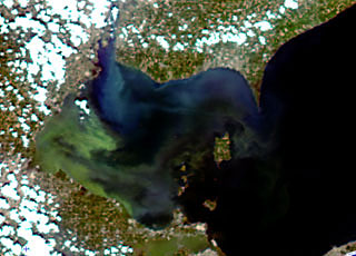
In August 2014, NOAA’s National Centers for Coastal Ocean Science (NCCOS) supported the response to a bloom of cyanobacteria, a toxic blue-green algae, that contaminated drinking water in Lake Erie. The bloom left nearly 400,000 people in Toledo, Ohio, without drinking water for two days.
NOAA’s weekly Lake Erie Harmful Algal Bloom Bulletin, produced by NCCOS and NOAA’s Great Lakes Environmental Research Laboratory, tracks the size and location of blooms and predicts their movement until the bloom season ends in the fall. This year, in response to requests from Ohio agencies, NOAA increased the frequency of the bulletins from once to twice a week. The August 1 bulletin caught escalation of the bloom and helped Toledo prepare for the hazard. NOAA currently provides, or is developing, harmful algal bloom and hypoxia (low dissolved oxygen) forecasts for Lake Erie, the Gulf of Maine, the Chesapeake Bay, the Gulf of Mexico, and the Pacific Northwest.
Also in FY14, NCCOS addressed paralytic shellfish poisoning (PSP)—a public health threat that affects Alaska’s residents more frequently than those residing anywhere else in the U.S. The remoteness of coastal communities in Alaska makes monitoring this threat challenging. NCCOS worked with the Food and Drug Administration and the biotechnology company Mercury Science to develop rapid laboratory and field test kits capable of detecting saxitoxins found in shellfish. Saxitoxins are produced by the microalgae Alexandrium and are the cause of PSP. Shellfish accumulate saxitoxins as they feed on Alexandrium. The saxitoxin field test can be used with minimal training, requires no expensive equipment, and is commercially available.
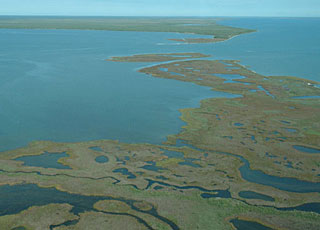
In FY14, scientists funded by NOAA’s National Centers for Coastal Ocean Science found that projected changes in coastal Gulf of Mexico land use and land cover (e.g., urban development) could increase the extent of storm surge flooding by up to 70 percent above the flooding that might be expected from projected sea-level rise alone.
The finding comes from a modeling study that investigated the ecological effects of sea-level rise in the Gulf of Mexico. The study is yielding predictive tools that assist coastal zone managers as they develop strategies to mitigate the future ecological and socioeconomic impacts of climate change.
The study is also the focal point of the Northern Gulf of Mexico Sentinel Site Cooperative, a federal-state partnership established to advance prediction and assessment capabilities for sea-level rise. The cooperative seeks to improve coastal data and research products to foster planning and adaptation to sea-level rise and inundation.
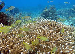
NOAA’s National Centers for Coastal Ocean Science (NCCOS) works with federal, state, and local management agencies to monitor and assess the condition of U.S. coral reef ecosystems within sanctuaries, reserves, and other special places. These productive ecosystems enhance biological diversity, fisheries, tourism, and cultural heritage, and protect shorelines from storm damage.
NCCOS and NOAA’s Southeast Fisheries Science Center (SEFSC) co-lead major components of NOAA’s National Coral Reef Monitoring Plan (NCRMP) – a framework for conducting sustained observations of biological, climate, and socioeconomic indicators at 10 priority coral reefs across the U.S. and its territories. In FY14, NCCOS and SEFSC conducted the first NCRMP fish and invertebrate monitoring missions, in the U.S. Virgin Islands and the Flower Garden Banks National Marine Sanctuary. Officials will use data from the missions to update management plans and ensure continued protection of coral resources at these locations. Also in FY 14, NCCOS conducted a biological assessment of the Florida coral reef tract and paired it with human-use information to develop management recommendations for the Florida Keys National Marine Sanctuary.
NCCOS is also studying the social and economic conditions of communities that depend on coral reefs in seven U.S. states and territories. In FY14, NCCOS scientists surveyed a random representative sample of the adult populations in American Samoa and South Florida. The survey data are being shared with local resource managers and other interested partners who will be able to use the information to improve a range of coral conservation efforts, including education and outreach initiatives and program evaluation.
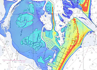
In FY 14, in response to post-tropical cyclone Sandy, NOAA’s National Geodetic Survey collected more than 2,600 square miles of near-shore light detection and ranging (LIDAR) data to improve coastal mapping. The data were acquired through a combination of contract and in-house resources using state-of-the-art topographic bathymetric (topo-bathy) LIDAR sensors. The sensors are able to penetrate the surface to a depth of 10 meters. In addition to being used to update the shoreline on nautical charts in Sandy-impacted areas, the data will also be used by federal and state agencies, universities, and others for coastal zone planning, emergency response, and coastal resilience efforts. Contracts and the new sensor were procured through the Disaster Relief Appropriations Act of 2013 in support of navigation services for coastal states affected by Sandy.
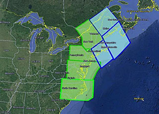
In FY 14, in response to post-tropical cyclone Sandy, the National Geodetic Survey's Gravity for the Redefinition of the American Vertical Datum (GRAV-D) Project collected airborne gravity data covering the East Coast from Maine to North Carolina. The geographically continuous data set collected in the surveys will allow NOAA’s National Geodetic Survey to produce more accurate models of heights above sea level, which is of significant benefit to the East Coast. When complete, the improved elevations from GRAV-D products will provide an estimated $4.8 billion in cost savings to the nation. Much of this work was funded through the Disaster Relief Appropriations Act of 2013.
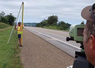
NOAA’s Geoid Slope Validation Survey of 2014 commenced in June 2013 with a National Geodetic Survey field crew setting approximately 200 official survey benchmarks in Iowa along U.S. Route 30. The survey line extended approximately 200 miles, from Denison to Cedar Rapids, Iowa. Field observations, including leveling, GPS, gravity, and astrometric surveys, began in May 2014 and concluded in September 2014.
Data collected from the survey will be used to evaluate the accuracy of a new gravity-based geoid model. The model, which is used to determine mean sea level and the direction of water flow, is an important component in creating the next-generation vertical datum. The survey is the second in a series of three large test projects to validate the new gravity-based geoid model and the new vertical datum, which are scheduled for release in 2022.
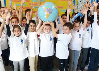
In FY 14, 100 new educators joined the NOAA Planet Stewards Education Project, which provides professional development opportunities and a collaborative online learning community to engage educators in active stewardship projects. Participants represent 43 states, Washington, DC, Guam, the U.S. Virgin Islands, and Panama, and include formal and informal educators from K-12 schools, community colleges, universities, and informal learning institutions including zoos, aquaria, and nature centers.
Project educators completed 2,060 contact hours of professional development through monthly webinars and book discussions, teleconferences, workshops, and online resources. The Project partnered with the U.S. Forest Service, U.S. Ice Core Drilling Program, American Meteorological Society, and National Science Teachers Association (NSTA) to offer participants a variety of experiences.
In cooperation with some of these partners, the NOAA team organized and hosted a climate workshop at the NSTA annual meeting that attracted more than 170 educators.

In response to a request for federal science specialists to work with the U.S. Embassy in Hanoi, the education team leader of NOAA's National Ocean Service (NOS) developed training materials about climate science and adaptation for leaders in Vietnam provinces. Vietnam's long coastline, geographic location, diverse topography, and microclimates contribute to its being one of the most hazard-prone countries in the Asia-Pacific region, with storms and flooding causing both economic and human losses.
Tasks included selecting and editing appropriate climate materials, selecting university professors as in-country trainers, and providing training for the trainers. A pilot training for 70 top government officials from Thanh Hoa province incorporated websites, resources, and new simulation strategies from NOAA and NOS, along with relevant local information and climate predictions for Vietnam. Topics included the causes and impacts of regional climate change, adaptation and mitigation strategies, climate vulnerability, disaster risk reduction, coastal resilience, and Green Growth opportunities for economic development.
Evaluation of the training outcomes showed a significant growth in understanding about climate change and a desire for additional training. The trainers will assist with climate training in other provinces and support Vietnam's growth in climate literacy.
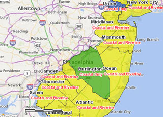
In FY 14, in response to post-tropical cyclone Sandy, a team of federal policy and science experts led by NOAA’s Office for Coastal Management created an interactive sea-level rise mapping and calculator tool to help people identify and prepare for flooding related to rising sea levels. Recognizing the need to inform Sandy-related rebuilding decisions, the tool was ready in a remarkably short time. The team’s efforts were recognized with the 2013 Presidential GreenGov Awards’ “Climate Champion” designation.

In FY 14, in response to post-tropical cyclone Sandy, NOAA’s Office for Coastal Management developed a new online tool called the Coastal Flood Exposure Mapper that gives coastal New York, New Jersey, Delaware, and Pennsylvania easy access to community-level flood information. The tool displays county-level data about shallow coastal flooding, flood zones, storm surge, sea level rise, and a composite view of flood hazards. An added bonus is the ability to include important data such as population centers, infrastructure, and evacuation routes. Maps can be downloaded or shared online. In addition to the Mapper helping make communities safer, it also helps them take actions to raise their scores in the National Flood Insurance Program’s community rating program. Plans are under way to expand the reach of the tool to include the rest of the East Coast and the Gulf of Mexico.
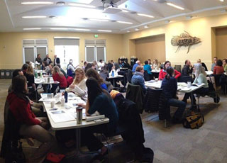
Building the capacity of coastal officials is the key to effective coastal management decisions. In FY 14, NOAA’s Office for Coastal Management updated several of its professional courses to respond to the changing needs of this community. An introduction to green infrastructure provides instruction regarding the use of natural areas to make communities less flood-prone. A project design and evaluation course is popular among coastal restoration practitioners, and a helpful video series focuses on implementing economic concepts for coastal ecosystem services.

The Social Coast Forum, developed by NOAA’s Office for Coastal Management, fills a unique niche by bringing together coastal practitioners and social scientists to advance coastal management goals. Participants shared information and lessons learned based on their social science and coastal management experiences. The forum focused on the ways that values and beliefs shape coastal policy and decision-making. Session topics included community benefits of green infrastructure, communication strategies and frameworks for adaptation, public perception of climate change, informing fisheries management with social science, and understanding stakeholder motives. More than 100 presentations, 32 roundtable demonstrations and discussions, and 14 entries in the visual gallery made the 2014 forum even more popular than the first one, held in 2012.
While climate change is a worldwide event, preparation for it is site-specific. NOAA’s Office for Coastal Management supports coastal management programs seeking adaptation measures that make the most sense for their particular situations. Examples include: Delaware, which signed an executive order requiring the incorporation of sea-level rise data when constructing state-funded projects, and the protection of green infrastructure that helps contain flood waters; Rhode Island, which created a guide to help homeowners understand climate change, erosion, and other natural and regulatory processes that may impact their property; Maryland, which issued a report with coastal construction and design guidelines to address the vulnerability of approximately 1,000 state-owned facilities in coastal areas; and Climate adaptation workshops held in Massachusetts, Rhode Island, New Hampshire, and Maine, which helped local leaders prepare for climate change challenges.
Restore America’s Estuaries, a NOAA Office for Coastal Management partner, submitted the first detailed methodology for quantifying real greenhouse-gas emissions for tidal wetlands and seagrass restoration. This groundbreaking work opens the door for tidal wetland and seagrass restoration projects that meet certain eligibility conditions to calculate net greenhouse gas benefits and generate carbon credits. Governments, industries, and private individuals can use carbon credits to offset damaging carbon emissions that they are generating. The work was made possible with funds from the National Estuarine Research Reserve Science Collaborative and NOAA’s Habitat Conservation and Restoration Center.

In the wake of events like post-tropical cyclone Sandy in October 2012, some coastal communities are showing a greater interest in engineered shorelines. NOAA’s National Estuarine Research Reserves in the Mid-Atlantic encouraged regional dialogue on the issue and began to identify ways to leverage existing resources for this purpose. Reserves in New York, New Jersey, and Delaware led workshops on the topic, where participants explored ways to implement ecologically enhanced shoreline projects and collaborated on the development of regional tools, resources, and guidance.
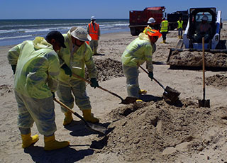
NOAA’s Office of Response and Restoration (OR&R) responded to the March 2014 collision of the bulk carrier M/V Summer Wind with the oil-tank barge Kirby 27706 in Galveston Bay at a dangerous intersection called the Texas City “Y,” where three lanes of vessel traffic converge: from the Port of Texas City, the Houston Ship Channel, and the Gulf Intracoastal Waterway. The collision closed the Houston Ship Channel for several days and resulted in the largest U.S. oil spill response since the 2010 Deepwater Horizon incident.
A substantial portion of the approximately 168,000 gallons of spilled fuel oil drifted 200 miles south and stranded on the beaches of Aransas National Wildlife Refuge, home to the endangered whooping crane. In addition to providing scientific support, such as modeling oil trajectories and identifying resources at risk, OR&R conducted aerial and shoreline surveys of the beaches to determine the degree of oiling, affected habitats, and cleanup recommendations. OR&R also worked extensively with NOAA’s National Weather Service, which provided spot weather forecasts, and NOAA’s National Marine Fisheries Service, which provided wildlife surveys and rehabilitation for marine mammals and sea turtles.
NOAA and other natural resource trustees are now in the process of conducting a Natural Resource Damage Assessment to identify injuries to natural resources, impacts to people’s use of resources, and restoration needs resulting from the spill.
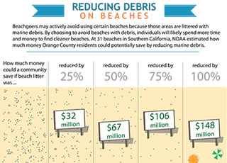
Southern California residents lose millions of dollars every year avoiding littered local beaches in favor of cleaner beaches that are farther away and may cost more to reach, according to an economics study released in FY 14 and funded by the NOAA Marine Debris Program. The study, led by Industrial Economics, Inc., is the first of its kind to consider how marine debris influences people’s decisions to visit the beach, and what it may cost. The study found that reducing marine debris on beaches can prevent financial loss and provide economic benefits to residents. For beaches in and around Orange County, for example, reducing marine debris by even 25 percent could benefit residents by roughly $32 million during the summer months.
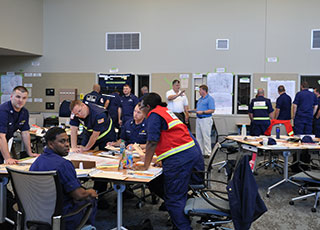
NOAA’s Gulf of Mexico Disaster Response Center sponsored or hosted 21 meetings, workshops, and training events in FY 14. These included a federal Regional Response Team meeting, a Homeland Security Exercise and Evaluation Program class, a tropical storm preparedness exercise co-sponsored by the National Weather Service, and NOAA’s Science of Oil Spills class. The center also hosted a class called Managing Floodplain Development (by the National Flood Insurance Program) for the Alabama Emergency Management Agency. In addition, the center provided meeting space for the Mobile County (AL) Emergency Management Agency for its annual Mass Care meeting. The center’s growing reputation as a central hub for all-hazards coordination fosters partnerships with NOAA and improves emergency preparedness throughout the Gulf region.
 An official website of the United States government.
Here's how you know we're official.


