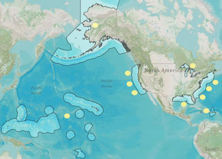
In June 2014, the NOAA-led U.S. Integrated Ocean Observing System (IOOS®) published a new rule in the Federal Register that established criteria and procedures to certify and integrate regional partners into U.S. IOOS in compliance with the Integrated Coastal and Ocean Observation System Act of 2009. Integration into the system formally establishes the role of the regions in U.S. IOOS and ensures that data collected and distributed by the regions are managed according to best practices as identified by NOAA.
Certification also offers the extension of the civil liability provision to certified regions, i.e., for purposes of determining liability arising from the dissemination and use of observation data, a certified region is considered part of NOAA, and its employees receive the same tort protections related to data usage as do federal employees.

The NOAA-led U.S. Integrated Ocean Observing System (IOOS®) funded two marine sensor innovation projects in FY 14. The multi-year work will put promising technologies into faster use, enhancing scientific understanding of the coastal and marine environment to improve decision making.
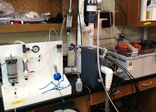
The first project aims to transition new ocean acidification sensor technology to support shellfish industry monitoring. Scientists installed two sensors, known as "Burke-o-lators," at two shellfish hatcheries in California and one in Alaska. The technology complements ocean-acidification monitoring equipment already in use in Hawaii, Oregon, and Washington. A data portal for ocean acidification will launch in the coming year, making the data from all five states readily accessible.
The second project focused on transitioning the Environmental Sample Processor (ESP) for harmful algae bloom monitoring. Scientists deployed three ESPs in the Gulf of Maine between May and June 2014. The processors expanded the network from one instrument to four that operate concurrently at various locations along the coast. Throughout the deployment, the ESPs detected A. fundyense at levels that correlated with existing models.

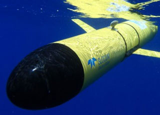
During hurricane season in the fall of 2013, partners of the U.S. Integrated Ocean Observing System (IOOS®) deployed 14 underwater robotic vehicles, called gliders, off the Eastern Seaboard. Each glider was in the water for 3-8 weeks. The large number of simultaneously deployed gliders provided unique data sets of both real-time and hindcast data, and demonstrated the potential of a national glider network. Part of the mission focused on collecting data to increase understanding of hurricane intensity, since the unmanned gliders can travel thousands of miles along the water column, collecting data in the middle of a storm and sending it back via satellite. The gliders also collected acoustic data about fish and mammal migrations to improve understanding of their behaviors. The gliders also produced a 3-D snapshot to improve researchers' understanding of the Mid-Atlantic Bight cold pool—a cold water mass that gets "trapped' along the ocean bottom and strongly influences ecosystems and important fisheries from Massachusetts to North Carolina. The project concluded by delivering real-time data to the National Weather Service's National Data Buoy Center, which makes the data available to the U.S. Navy and other users.

In FY14, the NOAA-led U.S. Integrated Ocean Observing System (IOOS®) led the nation's ocean observing community in data management. All 11 IOOS regions now serve data to customers in a common format, even when the data are collected and stored with different software. Through this effort, IOOS is making ocean information easier to access and use. Also this year, the 52North Initiative for Geospatial Open Source Software announced a major new release of its Sensor Observation Software (SOS), which incorporates IOOS-specific features. The partnership ensures a high-quality product for both 52North customers and IOOS data providers. Additionally, IOOS published its fourth (ocean temperature and salinity) and fifth (water-level measurements) Quality Assurance of Real Time Ocean Data (QUARTOD) manuals, which address standard quality assurance practices for oceanographic data variables.

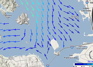
In FY 14, the NOAA-led U.S. Integrated Ocean Observing System (IOOS®) advanced the collection and use of surface current data with a new product called High Frequency (HF) Radar Surface Currents. The web-based product, produced in cooperation with NOAA's Center for Operational Oceanographic Products and Services (CO-OPS), provides near real-time surface current observations and tidal current predictions in coastal waters. Using IOOS data, the product offers broad spatial coverage of surface currents in areas vital to the maritime community. It is currently available for Chesapeake Bay and San Francisco Bay. In addition to supporting safe commercial navigation and recreational activities, the product fosters search-and-rescue operations, hazardous materials spill response, harmful algal bloom monitoring, and fisheries management.
Also this year, several IOOS regions collaborated to deploy a coordinated ocean observing network, the National Science Foundation's Project CONVERGE, along the Western Antarctic Peninsula. The network, which comprises a multi-platform field study including gliders, animal telemetry, acoustics, and HF radar, will increase scientific understanding of how local oceanographic processes influence ecosystems in this remote portion of the global ocean.
 An official website of the United States government.
Here's how you know we're official.


