In FY 14, the NOAA-led U.S. Integrated Ocean Observing System (IOOS®) advanced the collection and use of surface current data with a new product called High Frequency (HF) Radar Surface Currents. The web-based product, produced in cooperation with NOAA's Center for Operational Oceanographic Products and Services (CO-OPS), provides near real-time surface current observations and tidal current predictions in coastal waters. Using IOOS data, the product offers broad spatial coverage of surface currents in areas vital to the maritime community. It is currently available for Chesapeake Bay and San Francisco Bay. In addition to supporting safe commercial navigation and recreational activities, the product fosters search-and-rescue operations, hazardous materials spill response, harmful algal bloom monitoring, and fisheries management.
Also this year, several IOOS regions collaborated to deploy a coordinated ocean observing network, the National Science Foundation's Project CONVERGE, along the Western Antarctic Peninsula. The network, which comprises a multi-platform field study including gliders, animal telemetry, acoustics, and HF radar, will increase scientific understanding of how local oceanographic processes influence ecosystems in this remote portion of the global ocean.
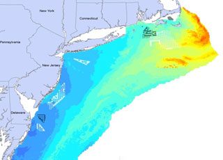
NOAA’s National Centers for Coastal Ocean Science (NCCOS) works closely with the U.S. Department of the Interior, including the Bureau of Ocean Energy Management (BOEM), the U.S. Geological Survey, and the U.S. Fish & Wildlife Service, to deploy mapping tools that support environmental assessment and planning for ocean energy development. Accurate maps and predictions of living marine resource distributions foster effective coastal and marine spatial planning, which reduces potential conflicts between human uses and sensitive marine ecosystems—thereby supporting healthy and resilient coastal communities and economies.
In FY14, NCCOS developed advanced statistical models of seabird and deep-sea coral distributions for the Atlantic Coast and the Gulf of Mexico. By merging large databases of seabird and coral observations with environmental data gleaned from NOAA satellites and ocean observations, NCCOS produced predictive maps of bird and coral distributions and disseminated them through a joint NOAA–BOEM Web service.
Also in FY14, a renewable energy transmission company used NCCOS’s coral distribution maps to help evaluate routing alternatives for a proposed undersea energy transmission cable into Maalaea Bay, Maui. The cable system under consideration would transmit renewable wind power generated in Maui County for consumption on Oahu, contributing to Hawaii’s 2030 goal of having 40 percent of its electricity sales come from renewable energy.
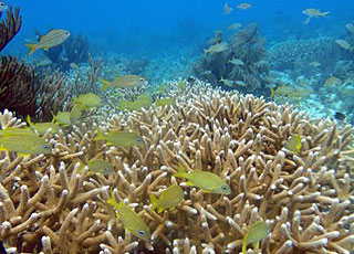
NOAA’s National Centers for Coastal Ocean Science (NCCOS) works with federal, state, and local management agencies to monitor and assess the condition of U.S. coral reef ecosystems within sanctuaries, reserves, and other special places. These productive ecosystems enhance biological diversity, fisheries, tourism, and cultural heritage, and protect shorelines from storm damage.
NCCOS and NOAA’s Southeast Fisheries Science Center (SEFSC) co-lead major components of NOAA’s National Coral Reef Monitoring Plan (NCRMP) – a framework for conducting sustained observations of biological, climate, and socioeconomic indicators at 10 priority coral reefs across the U.S. and its territories. In FY14, NCCOS and SEFSC conducted the first NCRMP fish and invertebrate monitoring missions, in the U.S. Virgin Islands and the Flower Garden Banks National Marine Sanctuary. Officials will use data from the missions to update management plans and ensure continued protection of coral resources at these locations. Also in FY 14, NCCOS conducted a biological assessment of the Florida coral reef tract and paired it with human-use information to develop management recommendations for the Florida Keys National Marine Sanctuary.
NCCOS is also studying the social and economic conditions of communities that depend on coral reefs in seven U.S. states and territories. In FY14, NCCOS scientists surveyed a random representative sample of the adult populations in American Samoa and South Florida. The survey data are being shared with local resource managers and other interested partners who will be able to use the information to improve a range of coral conservation efforts, including education and outreach initiatives and program evaluation.

When the Washington Monument sustained damage from a 2011 earthquake in central Virginia, NOAA’s National Geodetic Survey began a project determine the monument’s accurate height. The survey made headlines and several news agencies interviewed the NGS chief geodesist and other surveyors. Final results of the survey are pending final review by the U.S. Park Service.
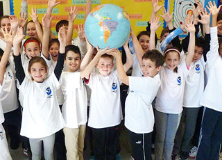
In FY 14, 100 new educators joined the NOAA Planet Stewards Education Project, which provides professional development opportunities and a collaborative online learning community to engage educators in active stewardship projects. Participants represent 43 states, Washington, DC, Guam, the U.S. Virgin Islands, and Panama, and include formal and informal educators from K-12 schools, community colleges, universities, and informal learning institutions including zoos, aquaria, and nature centers.
Project educators completed 2,060 contact hours of professional development through monthly webinars and book discussions, teleconferences, workshops, and online resources. The Project partnered with the U.S. Forest Service, U.S. Ice Core Drilling Program, American Meteorological Society, and National Science Teachers Association (NSTA) to offer participants a variety of experiences.
In cooperation with some of these partners, the NOAA team organized and hosted a climate workshop at the NSTA annual meeting that attracted more than 170 educators.
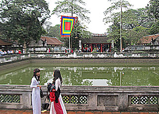
In response to a request for federal science specialists to work with the U.S. Embassy in Hanoi, the education team leader of NOAA's National Ocean Service (NOS) developed training materials about climate science and adaptation for leaders in Vietnam provinces. Vietnam's long coastline, geographic location, diverse topography, and microclimates contribute to its being one of the most hazard-prone countries in the Asia-Pacific region, with storms and flooding causing both economic and human losses.
Tasks included selecting and editing appropriate climate materials, selecting university professors as in-country trainers, and providing training for the trainers. A pilot training for 70 top government officials from Thanh Hoa province incorporated websites, resources, and new simulation strategies from NOAA and NOS, along with relevant local information and climate predictions for Vietnam. Topics included the causes and impacts of regional climate change, adaptation and mitigation strategies, climate vulnerability, disaster risk reduction, coastal resilience, and Green Growth opportunities for economic development.
Evaluation of the training outcomes showed a significant growth in understanding about climate change and a desire for additional training. The trainers will assist with climate training in other provinces and support Vietnam's growth in climate literacy.

The Maui News, the largest newspaper on Maui, Hawaii, honored a coral-reef protection and conservation campaign by the organization West Maui Kumuwai with a “2013 People Who Made a Difference” award. The campaign is part of a partnership between NOAA’s Office for Coastal Management and SeaWeb to save coral reefs, starting in Maui residents’ backyards. Through stories about community members taking action to help corals, the campaign inspired others to get involved. At the kick-off event, 50 volunteers planted more than 1,000 plants to reduce soil runoff. Pledge programs and events taught residents about rain gardens and proper fertilizer use. The campaign got a number of Maui retailers to post labels on fertilizers and pesticides that are less harmful to ocean wildlife. Landscaping companies on Maui also joined the effort by committing to ocean-friendly practices.
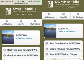
Real-time weather and water quality data are now as close as one’s mobile device. The data originate from NOAA’s National Estuarine Research Reserves, a federal-state partnership that protects 28 designated reserve sites and provides natural areas for scientific research. The SWMP Mobile app provides useful data through any smartphone or tablet. Users can locate monitoring stations, view station locations on Google maps, view near real-time data, and create quick charts. The app also complements the reserves’ other data access resources. The National Estuarine Research Reserve System Centralized Data Management Office, which developed the app, is supported through a cooperative agreement between NOAA's Office for Coastal Management and the University of South Carolina.

NOAA’s Office of Coast Survey developed an online project called Integrated Ocean and Coastal Mapping Sandy Coordination to foster collaboration on Post-tropical Cyclone Sandy data acquisition in FY 14. The goal was to gather as much information as possible about mapping needs and plans to support decision-making and restoration in Sandy-impacted coastal areas, while eliminating overlaps. The site displays federal and state mapping requirements and plans acquired from external partners. The project is part of SeaSketch, a user-friendly GIS developed by the McClintock Laboratory at the University of California Santa Barbara.
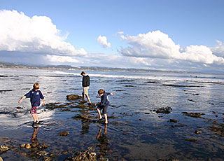
In June 2014, NOAA’s Office of National Marine Sanctuaries published the final rule that reestablished the Sanctuary Nomination Process. The updated process, developed with input from more than 18,000 public comments, allows the American people to nominate nationally significant marine and Great Lakes areas for potential designation as national marine sanctuaries. The final rule addresses growing interest from communities, state and tribal governments, Congress, and nongovernmental organizations. John Podesta, Counselor to the President, announced publication of the final rule at Capitol Hill Oceans Week in June 2014. More information can be found on the Sanctuaries Nomination Process website.

The 170-year-old whaling ship Charles W. Morgan embarked on its 38th voyage in May 2014, departing its home port of Mystic Seaport, Connecticut. The historic vessel returned in August, after spending the summer sailing New England on a mission of whale education and conservation, making stops in Boston, Provincetown, Newport, and other places. In some ports, visitors toured the restored ship and explored the accompanying shore-side attractions, which included a tent staffed by NOAA’s Office of National Marine Sanctuaries, the Sanctuary Advisory Council, and other volunteers. The public learned about local whale populations, whale research, and whale watching in Massachusetts’s Stellwagen Bank National Marine Sanctuary.
From July 11-13, the ship continued its historic 38th voyage with a visit to the Sanctuary. The ship’s three-day journey through the sanctuary was broadcast on OceansLIVE, allowing thousands of viewers to connect to the expedition via exclusive streaming footage. Interviews were broadcast live from the ship’s deck and from the OceansLIVE studio in Provincetown, Massachusetts.
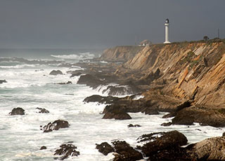
In April 2014, NOAA’s Office of National Marine Sanctuaries announced a proposal to expand the boundaries of California’s Gulf of the Farallones and Cordell Bank National Marine Sanctuaries by a combined 2,775 square miles. The proposed expansion would protect the distinctive marine ecosystems off Marin, Sonoma, and Mendocino Counties to the north and west of current sanctuary boundaries. These areas, including North America’s most intense upwelling site off Point Arena, play a major role in nourishing the sanctuaries’ extremely productive waters, which attract numerous species that travel thousands of miles to feed there. These include endangered blue and humpback whales, sharks, salmon, and seabirds like albatrosses and shearwaters.
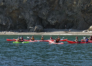
NOAA’s Office of National Marine Sanctuaries (ONMS) convened the inaugural meeting of its Sanctuary System Business Advisory Council in January 2014. Established to help ONMS engage its corporate partners, the council took nearly a year to develop and is the first of its kind. The meeting included representatives from TripAdvisor, Royal Caribbean, Johnson Outdoors, Maersk, Hess, Disney, National Geographic, and the Rockefeller Foundation. Council members were introduced to the sanctuary system through a series of presentations and discussions with ONMS staff, which included what they hoped to gain from participating in the council, ways that ONMS could engage corporations as partners, and how the council should operate in the future. The council will explore new ground in building cooperative and productive relationships between national marine sanctuaries and the corporate sector.
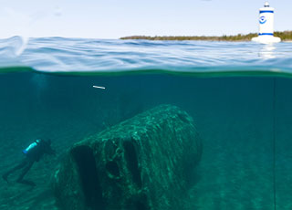
As FY 14 drew to a close, NOAA’s Office of National Marine Sanctuaries (ONMS) published new regulations that will expand the boundaries of the Thunder Bay National Marine Sanctuary in Lake Huron nearly tenfold – from 450 square miles to 4,300 square miles – to protect an additional 100 known and suspected shipwreck sites. The new boundaries include waters adjacent to Alcona and Presque Isle Counties in Northeast Michigan and extend to the international border within Lake Huron. The expansion is based on years of research by NOAA and its scientific partners, as well as public input and widespread support from local and regional interests and elected officials. U.S. Senator Carl Levin (D-MI) championed the expansion, citing scientific, cultural, and economic benefits for Alpena and Northeast Michigan. The goal of the expansion is to increase protection of the nation’s maritime heritage, support the economy, promote tourism, and build technology partnerships with the business community, colleges and universities, and others.
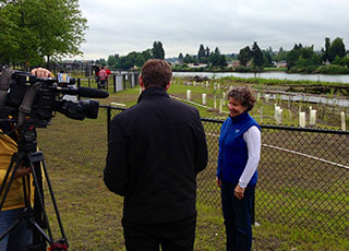
In FY 14, the airplane manufacturer Boeing Company completed a large habitat restoration project just south of Seattle on the Lower Duwamish River. Boeing worked with NOAA and partners under a Natural Resource Damage Assessment to restore habitat for fish, shorebirds, and wildlife harmed by historical hazardous substance releases on the heavily used urban river. Restoration included reshaping the shoreline, planting 170,000 native plants, and adding large woody debris to provide areas where young salmon can seek refuge from predators in the river. Two acres of wetlands were also constructed on the site, which Boeing will maintain to ensure productive habitat for years to come.
 An official website of the United States government.
Here's how you know we're official.


