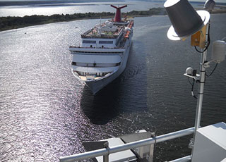
NOAA PORTS® (Physical Oceanographic Real Time System) is an integrated system of oceanographic and meteorological sensors that provides mariners with reliable real-time information about environmental conditions in a seaport, greatly enhancing the safety and efficiency of maritime commerce. On July 23, 2014, NOAA's Center for Operational Oceanographic Products and Services (CO-OPS) inaugurated a new PORTS® – the nation's 23rd and second largest – in the Port of Jacksonville, Florida.
Jacksonville ranks as the number-one vehicle export port in the nation, and is the top container port in Florida. Approximately 65,000 Floridians have jobs directly or indirectly related to the port, which channels around $19 billion into the U.S. economy every year. The new PORTSdirectly benefits commercial and recreational mariners in the dynamic St. John's River. It includes a broad suite of operational sensors that measure water levels, currents, under-bridge clearance, visibility, salinity, and meteorological conditions. Jacksonville PORTS® also supports hurricane response including storm-surge forecasts, real-time storm-surge monitoring, and evacuation planning, as well as studies of river ecology and health.

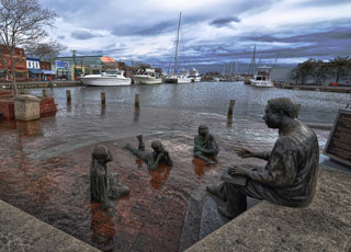
NOAA's Center for Operational Oceanographic Products and Services (CO-OPS) national network of long-term coastal water-level stations collects the highly accurate data required to determine local sea-level trends. A new analysis of the data, released in the report "Sea Level Rise and Nuisance Flood Frequency Changes around the United States," revealed that eight of the top 10 U.S. cities along the East Coast have experienced major increases in nuisance flooding caused by rising sea levels – from 300 percent to 925 percent in the last half-century. Nuisance flooding causes such public inconveniences as frequent road closures, overwhelmed storm drains, and compromised infrastructure from saltwater exposure. The report supports NOAA's coastal resilience priority by providing better understanding of the ongoing impacts of climate change in coastal areas. The report received extensive media attention at the national, regional, and local levels through print, radio, and TV.

NOAA's Center for Operational Oceanographic Products and Services (CO-OPS) maintains a national network of Operational Forecast Systems (OFS) in commercially and recreationally important estuaries around the nation for the purpose of providing science-based predictions about current and future environmental conditions (e.g., water levels, currents, wind speed and direction). These predictions – both 6-hour nowcasts and forecast guidance extending to 48 hours in most cases – support safe commercial navigation, recreational boating, fishing, storm tracking, hazardous materials response, and search-and-rescue operations.
CO-OPS released enhancements to the Northern Gulf OFS by adding two higher-resolution nested models for the northwest and northeast areas of the Gulf of Mexico. The enhancements provide higher-resolution water level, current, temperature, and salinity forecasts for Matagorda Bay, Galveston Bay, Sabine Neches, Calcasieu-Lake Charles, Gulfport, Pascagoula Bay, and Mobile Bay.
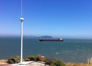
CO-OPS also released a new OFS for the San Francisco Bay region, providing reliable forecast guidance for both San Francisco Bay and the San Francisco Bay Entrance. In direct response to user requests, CO-OPS also upgraded its OFS in New York/New Jersey Harbor and in Florida's St. Johns River, extending their forecast horizons from 24 to 48 hours.

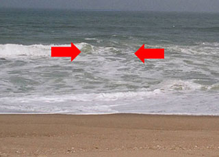
Oceanographers from NOAA's Center for Operational Oceanographic Products and Services (CO-OPS) developed a new rip current forecast model that is now being tested at National Weather Service (NWS) Weather Forecast Offices (WFOs) in Newport/Morehead City, North Carolina, and Miami, Florida. The new model, which improves upon the current one, uses wave field and water-level data to predict the likelihood of hazardous rip currents forming near shore. CO-OPS and NWS are collaborating with local lifeguards in both areas to test and validate the new model. NOAA sees great promise in the new model, which should enable its WFOs to issue more timely and effective beach hazard warnings.

NOAA's Center for Operational Oceanographic Products and Services (CO-OPS), which has a long history of providing tidal current observations and predictions to the maritime community, released two significant enhancements to these products and services in FY 2013. The new web-based NOAA Tidal Current Predictions expands on traditional hard-copy Tidal Current Tables by allowing users to generate customizable predictions on demand in a variety of formats. The product offers daily, weekly, and yearly current predictions for more than 3,000 locations around the nation, as well as six-minute, half-hour, and hourly tidal current predictions for more than 500 locations. These up-to-date predictions incorporate new data as they are collected and analyzed by CO-OPS oceanographers.
The second new product—High Frequency Radar Surface Currents—provides near real-time surface current observations and tidal current predictions in coastal waters. Using data from the NOAA-led U.S. Integrated Ocean Observing System (IOOS®), this web-based product offers broad spatial coverage of surface currents in areas vital to the maritime community. It is currently available for Chesapeake Bay and San Francisco Bay. In addition to supporting safe commercial navigation and recreational activities, the product fosters search-and-rescue operations, hazardous materials spill response, harmful algal bloom monitoring, and fisheries management.
 An official website of the United States government.
Here's how you know we're official.


