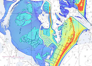
In FY 14, in response to post-tropical cyclone Sandy, NOAA’s National Geodetic Survey collected more than 2,600 square miles of near-shore light detection and ranging (LIDAR) data to improve coastal mapping. The data were acquired through a combination of contract and in-house resources using state-of-the-art topographic bathymetric (topo-bathy) LIDAR sensors. The sensors are able to penetrate the surface to a depth of 10 meters. In addition to being used to update the shoreline on nautical charts in Sandy-impacted areas, the data will also be used by federal and state agencies, universities, and others for coastal zone planning, emergency response, and coastal resilience efforts. Contracts and the new sensor were procured through the Disaster Relief Appropriations Act of 2013 in support of navigation services for coastal states affected by Sandy.
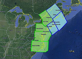
In FY 14, in response to post-tropical cyclone Sandy, the National Geodetic Survey's Gravity for the Redefinition of the American Vertical Datum (GRAV-D) Project collected airborne gravity data covering the East Coast from Maine to North Carolina. The geographically continuous data set collected in the surveys will allow NOAA’s National Geodetic Survey to produce more accurate models of heights above sea level, which is of significant benefit to the East Coast. When complete, the improved elevations from GRAV-D products will provide an estimated $4.8 billion in cost savings to the nation. Much of this work was funded through the Disaster Relief Appropriations Act of 2013.
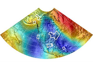
In June 2014, NOAA’s National Geodetic Survey released a new experimental geoid height model called xGEOID14B, which spans one-quarter of the Earth’s surface. The model represents a significant step toward defining a new regional vertical datum and contributing to a worldwide height system. Covering Hawaii, Alaska, Puerto Rico, and the U.S. mainland and incorporating satellite, airborne, and surface gravity data, the new geoid was tested by surveyors, engineers, geographic information specialists, and others interested in defining accurate heights. NOAA collaborated with Canada, Mexico, Central American and Caribbean nations, and Denmark (for Greenland) to provide the unified height model. It has already improved forecasters’ ability to predict the effects of storm surge, and will be used for a variety of scientific, engineering, disaster mitigation, and emergency response purposes.
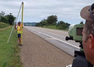
NOAA’s Geoid Slope Validation Survey of 2014 commenced in June 2013 with a National Geodetic Survey field crew setting approximately 200 official survey benchmarks in Iowa along U.S. Route 30. The survey line extended approximately 200 miles, from Denison to Cedar Rapids, Iowa. Field observations, including leveling, GPS, gravity, and astrometric surveys, began in May 2014 and concluded in September 2014.
Data collected from the survey will be used to evaluate the accuracy of a new gravity-based geoid model. The model, which is used to determine mean sea level and the direction of water flow, is an important component in creating the next-generation vertical datum. The survey is the second in a series of three large test projects to validate the new gravity-based geoid model and the new vertical datum, which are scheduled for release in 2022.
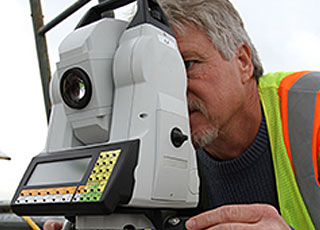
When the Washington Monument sustained damage from a 2011 earthquake in central Virginia, NOAA’s National Geodetic Survey began a project determine the monument’s accurate height. The survey made headlines and several news agencies interviewed the NGS chief geodesist and other surveyors. Final results of the survey are pending final review by the U.S. Park Service.
 An official website of the United States government.
Here's how you know we're official.


