NOAA’s National Centers for Coastal Ocean Science (NCCOS) delivers ecosystem science solutions for stewardship of the nation’s ocean and coastal resources, in direct support of NOS priorities, offices, and customers, and to sustain thriving coastal communities and economies.
Advancing Offshore Wind Energy
SUPPORTS NOS PRIORITIES: NEW BLUE ECONOMY | CONSERVE, RESTORE, AND CONNECT
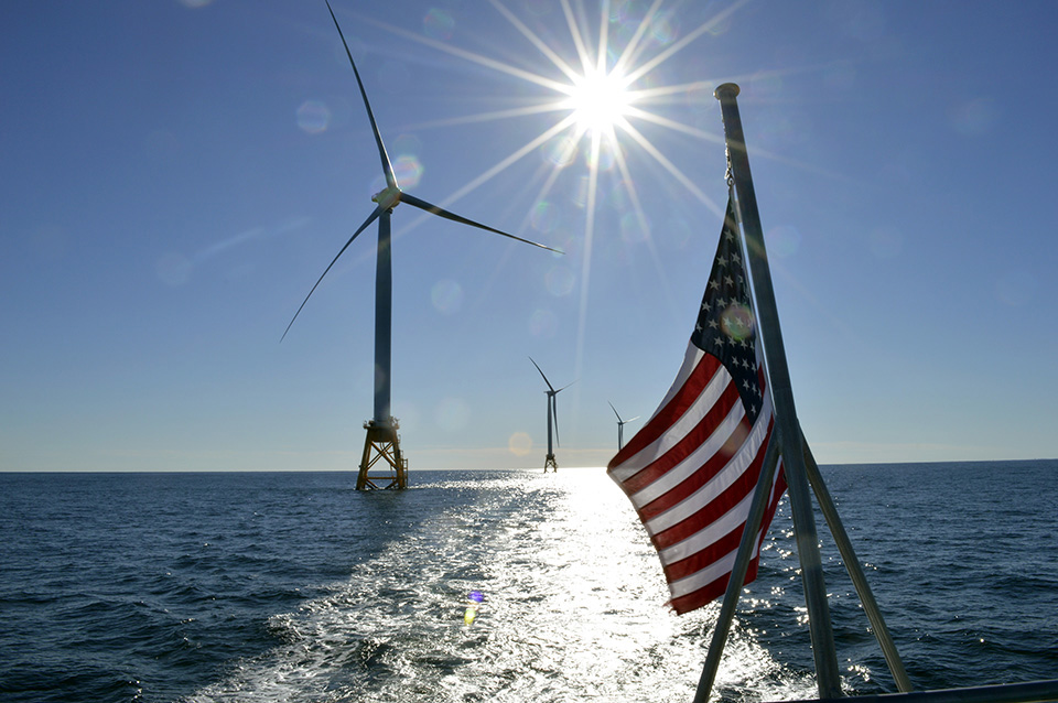
NCCOS data and analyses continue to inform the Bureau of Ocean Energy Management’s offshore wind energy siting decisions. This year, NCCOS built spatial models to identify optimum locations for offshore wind energy in the Gulf of Mexico. The models identified more than 730,000 acres that have the potential to power over three million homes without disrupting fisheries and other ocean industries. On the West Coast, NCCOS and partners published the at sea spatial distributions of 33 species of marine birds for the contiguous U.S. Pacific outer continental shelf to help choose offshore wind farm sites that minimize negative impacts to their populations. In North Carolina and South Carolina, NCCOS researchers found that traditional public engagement activities for offshore wind energy development do not accurately categorize public opinion and developed recommendations to improve civic engagement. These efforts are helping advance the goal of deploying 30 gigawatts of offshore wind energy by 2030, while minimizing the wind industry’s impacts on protected species, habitats, and commercial and recreational fishing.
Wind farm off the coast of Block Island, Rhode Island.
Aerial Drone-based System Aids Marine Debris Cleanup
SUPPORTS NOS PRIORITY: COASTAL RESILIENCE | CONSERVE, RESTORE, AND CONNECT
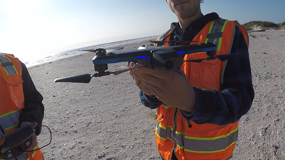
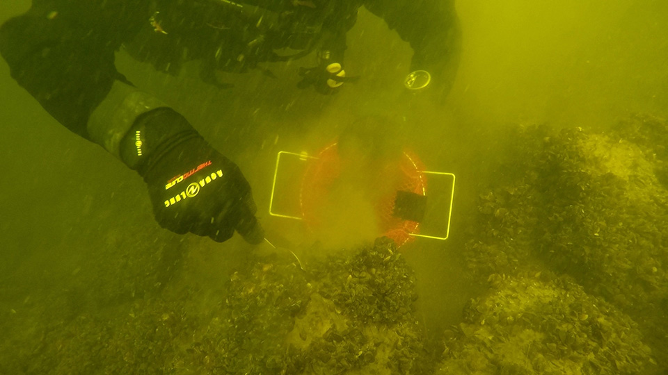
NCCOS and partners are developing an aerial drone-based, machine-learning system to detect and identify marine debris along the coast. This year, the team used beaches near Corpus Christi, Texas, to evaluate a polarimetric camera for potential installation on a drone to improve debris detection. Polarized light reflected from human-made objects often differs from natural objects. Next, the team trained a machine-learning computer program to find and classify the debris in the imagery collected. Once fully operational, the system and its data will be used to make maps that show where marine debris is concentrated along the coast to guide rapid response and removal efforts. The researchers will provide NOAA Marine Debris Program staff with training in the use of the new system.
NCCOS partners test the drone on a beach near Corpus Christi, Texas.
Improving HAB Monitoring and Management
SUPPORTS NOS PRIORITY: COASTAL RESILIENCE | CONSERVE, RESTORE, AND CONNECT
NCCOS awarded $12.4 million this year for harmful algal bloom (HAB) research projects in U.S. coastal and Great Lakes waters. HABs threaten human and animal health, seafood supplies, and local economies. HAB-related beach and fishery closures, reductions in tourism, and medical interventions result in the loss of millions of dollars per outbreak. New projects will investigate the effectiveness of clay dispersal as a technology to control algal blooms in southwest Florida; enhance the freshwater HAB toxin detection capabilities of autonomous underwater vehicles operating in Lake Erie; and optimize an early warning system to support mitigation of shellfish-killing HAB toxins in the Pacific Northwest.
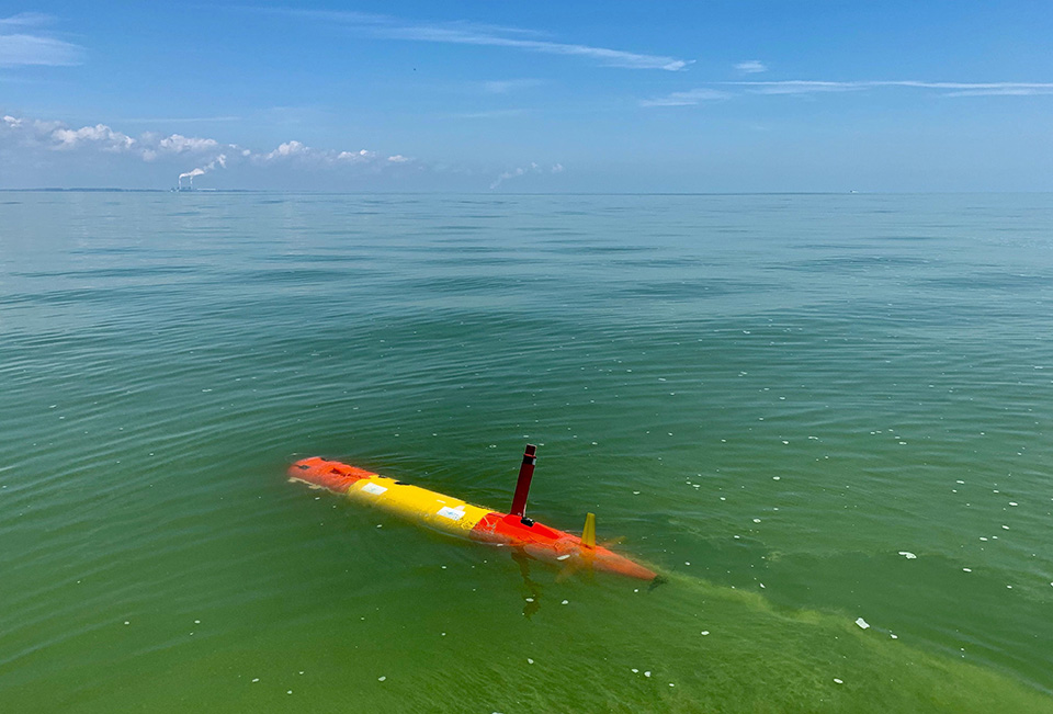
A long-range autonomous underwater vehicle glides through a Lake Erie algal bloom, using sensors developed by NCCOS scientists to assess the bloom’s toxicity. Credit: Monterey Bay Aquarium Research Institute.
Coastal communities are increasingly vulnerable to the effects of climate change, such as sea level rise and coastal erosion. To support sea level rise planning in the Puget Sound region of Washington, NCCOS scientists and partners categorized social vulnerability using ZIP code by analyzing 36 socioeconomic variables, including age, income, and housing occupancy. Full study results are available in a technical report. Local planners will use the social vulnerability indices provided in the report to better protect, plan for, and manage sea level rise impacts within their communities.
Approximately 40% of Americans in coastal counties are categorized as having an elevated risk for coastal hazards. Understanding social vulnerability is critical to coastal resilience for everyone.
Using Machine Learning to Predict Coastal Contamination
SUPPORTS NOS PRIORITY: COASTAL RESILIENCE
NCCOS scientists developed Machine Learning models to predict contamination along the coast based on patterns of humans in the landscape. The NCCOS Mussel Watch Program is using the new models to link chemical contaminants detected in bivalves, such as mussels and oysters, and seafloor sediments to potential sources of contamination. The project analyzes NCCOS bivalve monitoring data along with land-use and demographics data to identify patterns in coastal contamination. The results will help prioritize testing in areas where human activities indicate there might be reason for concern about contaminants.
Since 1986, the NCCOS Mussel Watch Program has monitored U.S. coastal waters at roughly 300 coastal sites nationwide for chemical contaminants and biological indicators of water quality.
 An official website of the United States government.
Social