U.S. Integrated Ocean Observing System (IOOS®) produces, integrates, and communicates high-quality ocean, coastal, and Great Lakes information that meets the nation's safety, economic, and stewardship needs.
High-Frequency Radars Licensed For New Radio Bands
SUPPORTS NOS PRIORITIES: NEW BLUE ECONOMY
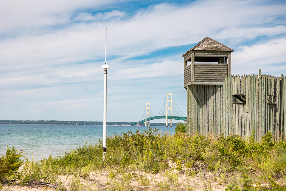
IOOS’s Surface Currents Program worked with other NOAA offices, IOOS regional associations, and the Federal Communications Commission to license all of the high-frequency radars (HFRs) in the IOOS national network to use eight new radio frequency bands allocated specifically for oceanographic radars. This allows the network to continue growing and providing high-quality, near-real-time surface current velocity and wave measurements without interfering with other businesses and government users of this radio frequency spectrum. The IOOS HFR network consists of approximately 160 radars in nearly every oceanic coastal state, the Great Lakes, and Puerto Rico, providing data to support search and rescue operations, oil spill response, marine shipping navigation, tracking harmful algal blooms, and coastal water quality monitoring.
High-frequency radar stations, like this one at Fort Michilimackinac State Park in Michigan, are now licensed to use eight new radio frequency bands. Licensing for this station required international coordination with Canadian authorities.(Credit: Michigan Technological University.)
Second U.S. IOOS Code Sprint a Success
SUPPORTS NOS PRIORITIES: NEW BLUE ECONOMY
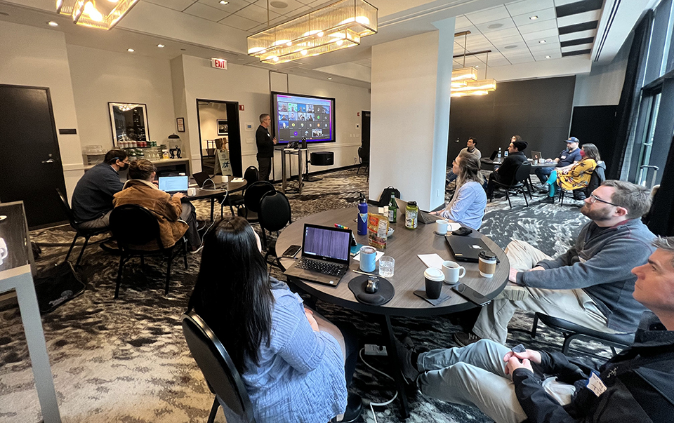
In April, some 40 coders, programmers, researchers, and developers gathered in person and virtually to tackle emerging themes in ocean observing data management. The second U.S. IOOS Code Sprint, hosted by the Great Lakes Observing System, drew participants from all over the globe. Results from the code sprint included new processes and tools that support our ability to produce, integrate, and communicate high-quality ocean, coastal, and Great Lakes information. During the sprint, the cohort split into smaller groups to tackle topics like compliance checkers, user documentation, and open-source biodiversity data. The event combined in-person collaboration with online collaboration tools to create a dynamic environment for development, and this year’s sprint not only resulted in several ready-to-use tools and products, but also spurred continued virtual collaborations. A full list of outcomes can be found here.
Participants listen to remarks at the second U.S. IOOS Code Sprint in Chicago, Illinois. (Credit: Great Lakes Observing System)
New SanctSound Portal Available
SUPPORTS NOS PRIORITIES: COASTAL RESILIENCE | CONSERVE, RESTORE, AND CONNECT
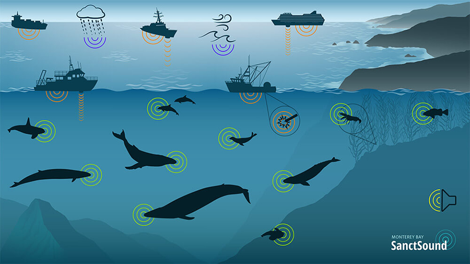
IOOS supported a cross-NOAA initiative led by the Office of National Marine Sanctuaries, in partnership with the U.S. Navy and others, to launch a new Sanctuary Soundscape Monitoring Project (SanctSound) web portal.. This portal allows the public to learn about the importance of sound in the marine environment. Visitors can listen to natural marine sounds as well as sounds from other marine activity. In addition, it shows how underwater sound monitoring is helping resource managers better understand the special places in the National Marine Sanctuary System. SanctSound generated 300 terabytes of data, all of which are accessible to download from the NOAA National Centers for Environmental Information (NCEI) Passive Acoustic Archive, and standard measurements from these recordings are also archived at NCEI and made accessible through the web portal hosted by U.S. IOOS.
In the SanctSound web portal, sounds recorded in each sanctuary’s soundscape can be explored through interactive underwater scenes that allow users to hear marine sounds and understand when and where they were recorded.
IOOS Mentors During 2022 Summer of Code
SUPPORTS NOS PRIORITIES: NEW BLUE ECONOMY
Google’s Summer of Code invites students to pursue coding projects with mentor organizations.
For the second year, U.S. IOOS served as a mentoring organization for Google’s Summer of Code. A global, sponsored program funded by Google, the Summer of Code selects mentoring organizations from a pool of applicants. The program then invites postsecondary students to approach their preferred mentors with projects of their own design that contribute to active development of open-source software packages. Once selected for funding, the students work closely with their mentors for 10 weeks in the summer, delivering final results in early fall. This year, three projects have been completed and another extended into FY 23, thanks to the Summer of Code’s new flexible timeline.
New Marine Life Projects Support Healthy Ecosystems
SUPPORTS NOS PRIORITIES: COASTAL RESILIENCE | CONSERVE, RESTORE, AND CONNECT
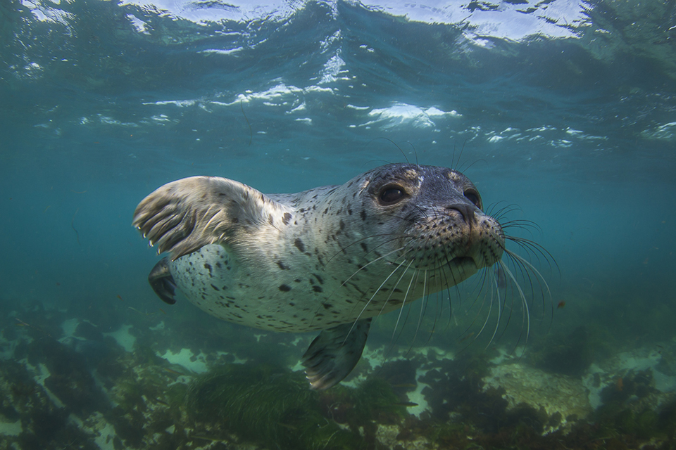
NOAA and partner agencies awarded five-year cooperative agreements for new marine life observation and biodiversity data projects. The projects will build on the foundation established by the U.S. Marine Biodiversity Observation Network, the U.S. Animal Telemetry Network, and the U.S. IOOS regional associations to work across sectors and disciplines towards an integrated, sustained marine life observing capability for the U.S. ocean, coasts and Great Lakes. The projects will also advance technologies for efficient and/or automated collection of species and habitat observations. They should also enable open access to biodiversity data and information and utilize observations, technologies, and data to address place-based management, conservation, and restoration needs. A full list of the projects can be found here. The projects were funded on behalf of the National Oceanographic Partnership Program, in cooperation with National Aeronautics and Space Administration, the Bureau of Ocean Energy Management, and the Office of Naval Research.
Marine observation and animal telemetry networks provide vital information on marine life and habitats. (Credit: Jeff Hester / Ocean Image Bank)
 An official website of the United States government.
Social