At its most basic level of definition, the horizontal datum is a collection of specific points on the Earth that have been identified according to their precise northerly or southerly location (latitude) and easterly or westerly location (longitude).
To create the horizontal datum, or network of horizontal positions, surveyors marked each of the positions they had identified, typically with a brass, bronze, or aluminum disk or monument. These markers were placed so that surveyors could see one marked position from another. To maximize the line-of-sight between markers, they were usually set on mountaintops or at high elevations. When markers were set on flat land, towers were built above them to aid surveyors in locating them.
To "connect" the horizontal markers into a unified network, or datum, surveyors have used a variety of methods, including triangulation. As technology has improved, surveyors now rely almost exclusively on the Global Positioning System (GPS) to identify locations on the Earth and incorporate them into existing datums.
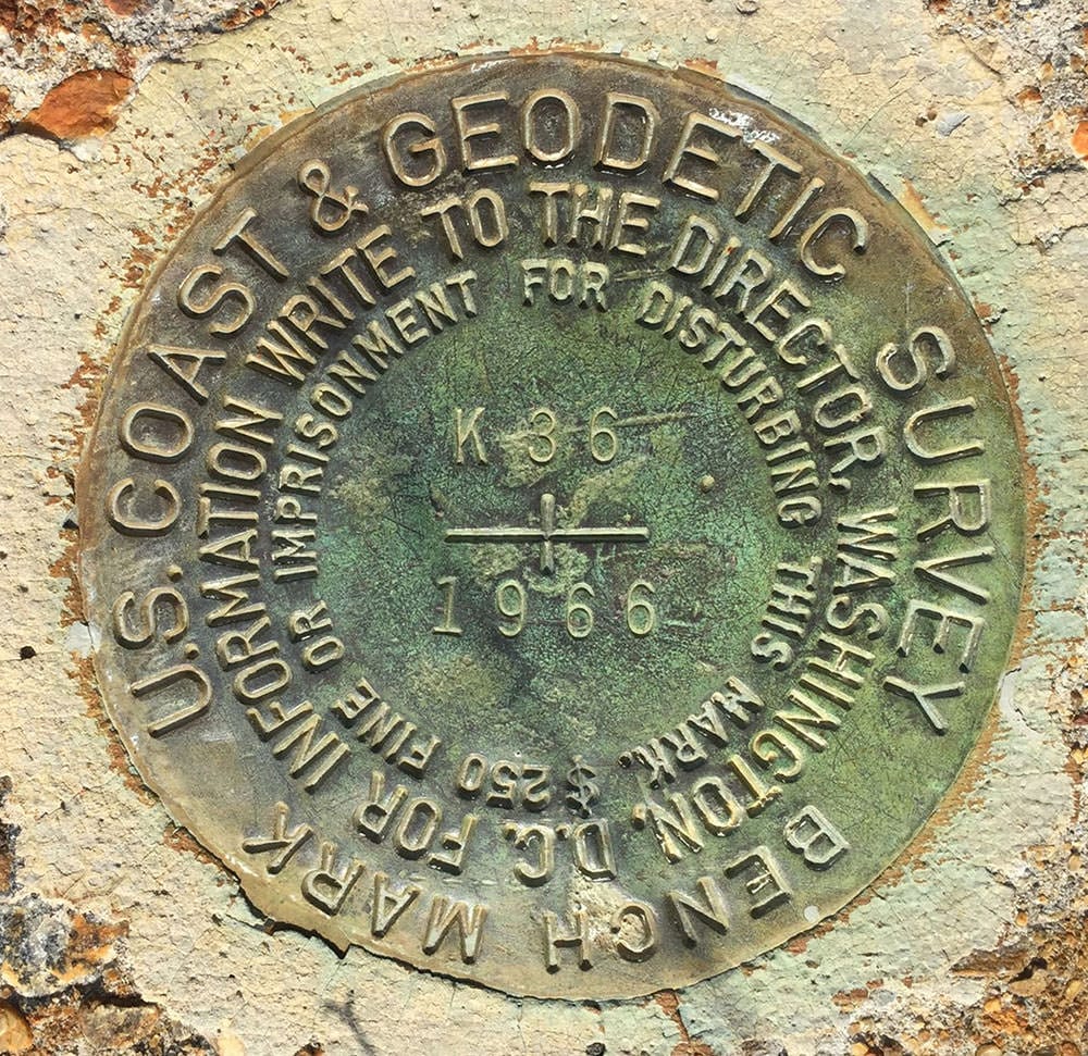
Brass markers permanently affixed in concrete or surrounding bedrock indicate accurate geodetic reference positions within the National Geodetic Survey's horizontal and/or vertical datums.
When positioning markers are located on flat ground, large towers such as this were often erected above them allowing geodesists to observe the monument's accurate position over large distances. Learn more and view a larger version of this image.
In 1927 the U.S. Coast and Geodetic Survey, the predecessor of the National Geodetic Survey, "connected" all of the existing horizontal markers together and created the North American Datum of 1927 (NAD 27). This datum was used extensively during the next 60 years as the primary reference for horizontal positioning. In 1983, NAD 27 was adjusted to remove inaccuracies and to correct distortions. The new datum, called NAD 83, is the most commonly used horizontal positioning datum today in the United States.
One application of the horizontal datum is monitoring the movement of the Earth's crust. This type of monitoring is often used in places like the San Andreas Fault in California where many earthquakes occur. Extending from northern California south to San Bernardino, the San Andreas Fault is where two plates of the Earth's crust meet. The fault is approximately 800 miles long and extends 10 miles below the Earth's surface. By looking at the movement of markers in the horizontal datum, geodesists can determine just how much the surface of the Earth has moved after an earthquake.
Heard of geodesy? These videos from NOAA's National Geodetic Survey offer a deep dive into the science of knowing where you – and everything else is in the world!
The National Science Teaching Association (NSTA) includes this resource in its database. NSTA provides educators and students access to Web-based, educationally appropriate science content that has been formally evaluated by master teachers.
 An official website of the United States government.


Social