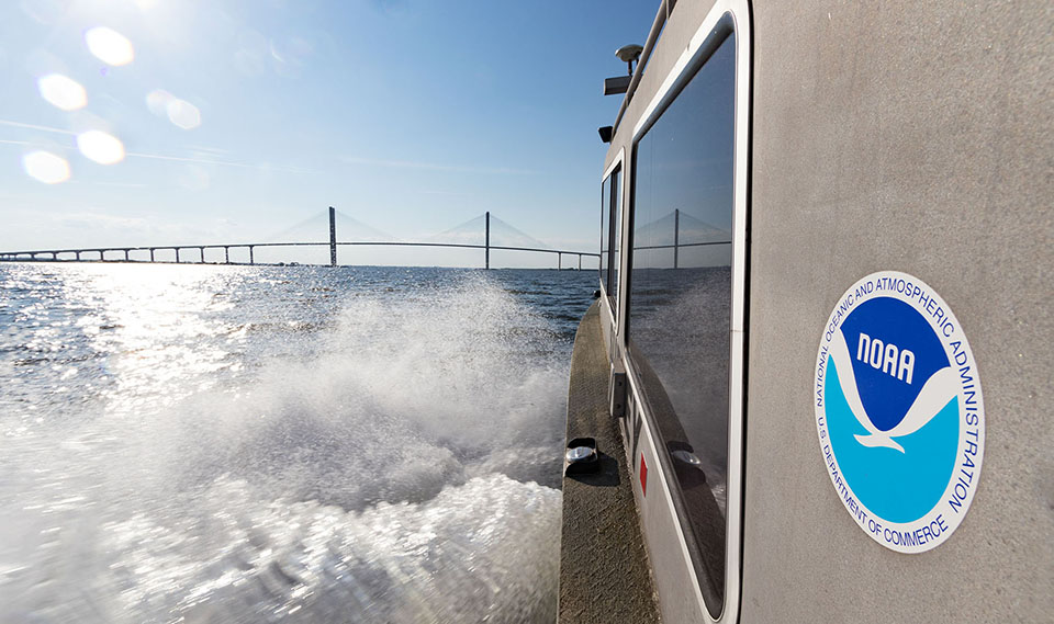
NOAA navigation response team vessel on the Brunswick River, Georgia, en route to the Sidney Lanier Bridge. Credit: Lt. John Kidd.
OCS Searches for Dangers to Navigation Following Hurricane Dorian
SUPPORTS NOS PRIORITY: SAFE AND EFFICIENT TRANSPORTATION AND COMMERCE
In anticipation of Hurricane Dorian making landfall, the Office of Coast Survey (OCS) pre-staged personnel and assets in locations outside of the hurricane’s impact zone. Once Dorian reached the Southeast U.S., OCS teams mobilized to the affected areas. NOAA’s regional navigation managers continued coordinated operations with the U.S. Coast Guard (USCG) and U.S. Army Corps of Engineers to evaluate and prioritize hydrographic survey requests from ports. The mobile integrated survey team surveyed Little River Inlet, South Carolina, and navigation response teams surveyed the St. Mary’s River near Fernandina Beach, Florida, and Brunswick, Georgia. One of OCS’s hydrographic survey contractors, eTrac, surveyed Beaufort and Morehead cities in North Carolina, and the approaches to Wilmington, North Carolina. OCS developed and delivered preliminary survey products identifying dangers to navigation to aid the USCG in their decision-making to reopen ports. Read more about these efforts in OCS’s blog.
OCS Accepts Two Autonomous Launch Conversions
SUPPORTS NOS PRIORITY: SAFE AND EFFICIENT TRANSPORTATION AND COMMERCE
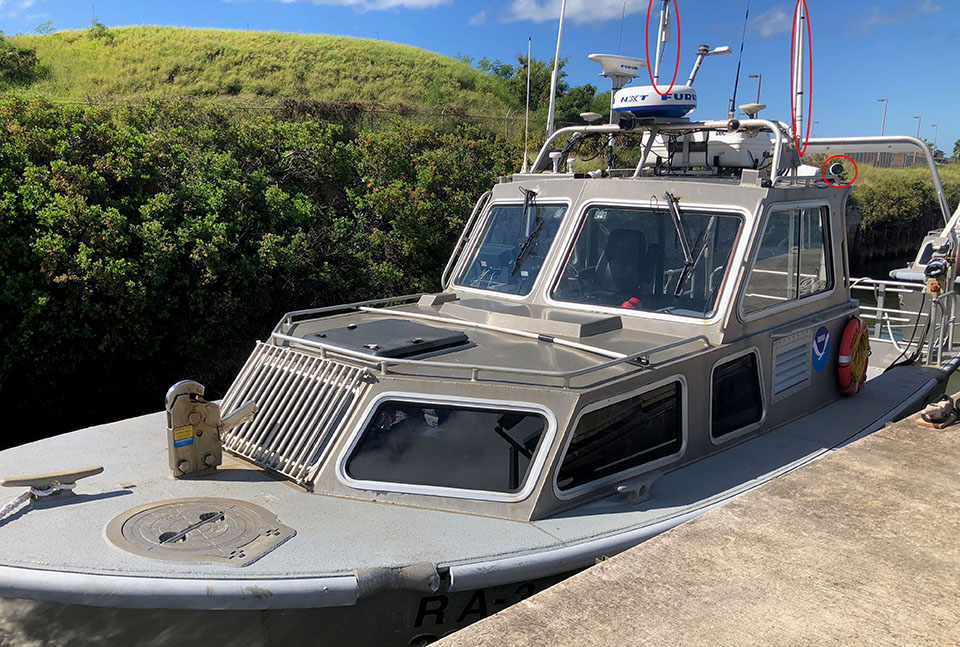
OCS and NOAA's Office of Marine and Aviation Operations integrated autonomous control systems in two existing hydrographic survey launches assigned to NOAA Ship Rainier. The launches provide NOAA ships with built-in autonomous vessels capable of deployment at sea to perform hydrographic survey data acquisition, among other tasks. The ability to operate a launch either with crew or autonomously makes the most efficient use of existing shipboard infrastructure, and provides the flexibility to acquire data efficiently in varied project areas. OCS successfully converted two launches in 2019 and expect to convert an additional launch on NOAA Ship Thomas Jefferson in 2020. Read the related blog story here.
Autonomous survey launch (RA-3). Red circles in top right of image identify newly installed radios and cameras for autonomous operation. Credit: Lt. (j.g.) Airlie Pickett.
OCS Improves Alaska Data with New NOAA ENC® Layout
SUPPORTS NOS PRIORITY: SAFE AND EFFICIENT TRANSPORTATION AND COMMERCE
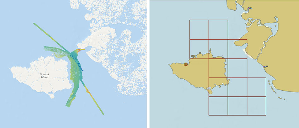
OCS released 13 new large-scale electronic navigational charts (NOAA ENC®) of Etolin Strait, Alaska. These charts provide a nearly twenty-fold increase in scale over the previous ENC coverage. New Etolin Strait hydrographic surveys and the resulting ENCs served as a pilot project for the overall re-scheming of the entire NOAA ENC suite with a regular, gridded layout for ENC charts, as outlined in NOAA’s National Charting Plan. No corresponding NOAA raster nautical chart products in Etolin Strait were produced. This is in keeping with OCS’s “ENC-only” production concept, which generally maintains the current raster chart product coverage, but only creates new larger-scale coverage in the ENC product line. To learn more about these updates, read the OCS blog story.
Left - Survey work in 2016 provided additional detail that was applied to the new ENCs. Right - The outlines of the thirteen new large scale (1:80,000) ENCs of Etolin Strait available from NOAA’s Chart Locator.
OCS Releases New Edition of Nautical Chart Symbol Guide
SUPPORTS NOS PRIORITY: SAFE AND EFFICIENT TRANSPORTATION AND COMMERCE
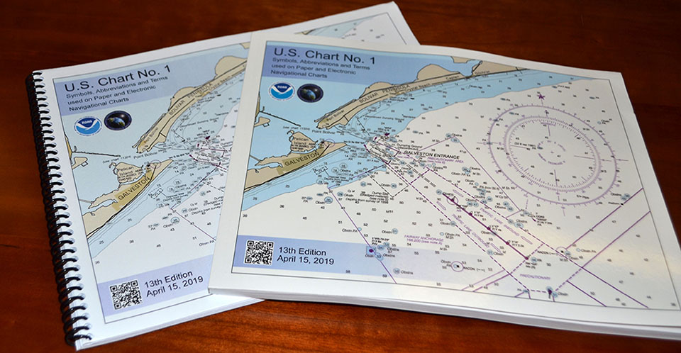
The latest edition of the nautical chart symbol guide, U.S. Chart No. 1, is available to download for free on OCS's website. Paper copies may also be purchased from any of four NOAA Chart No. 1 publishing agents. This 130-page book describes the symbols, abbreviations, and terms used on paper NOAA nautical charts and for displaying NOAA electronic navigational chart (NOAA ENC®) data on Electronic Chart Display and Information Systems. The document also shows paper chart symbols used by the National Geospatial-Intelligence Agency and symbols specified by the International Hydrographic Organization. To learn more, read the OCS blog story.
Printed booklet versions of U.S. Chart No. 1.
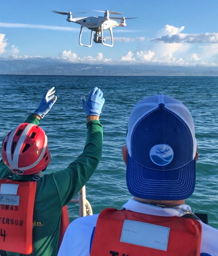
NOAA Ship Thomas Jefferson Tests Drone Use for Shoreline Mapping
SUPPORTS NOS PRIORITY: SAFE AND EFFICIENT TRANSPORTATION AND COMMERCE
Matt Sharr (left) and Capt. Brian Taggart (NOAA, ret., right) deploy the DJI Phantom 4 drone from one of NOAA Ship Thomas Jefferson’s survey launches.
OCS and the National Geodetic Survey (NGS) conducted operational tests of small unmanned aerial systems — or drones — aboard NOAA Ship Thomas Jefferson in support of survey operations conducted along the south coast of Puerto Rico. The tests showed the potential of imagery from low-cost, off-the-shelf drones to meet NOAA survey specifications for near-shore and shoreline feature mapping. This method could replace traditional shoreline verification and mapping techniques used by NOAA hydrographic survey field units. Potential benefits of using drones for shoreline mapping include: improved data collection efficiency compared to data collection from small skiffs; more accurate feature investigation than traditional techniques; and, most importantly, removal of personnel from potentially dangerous situations. Read more in the OCS blog story.
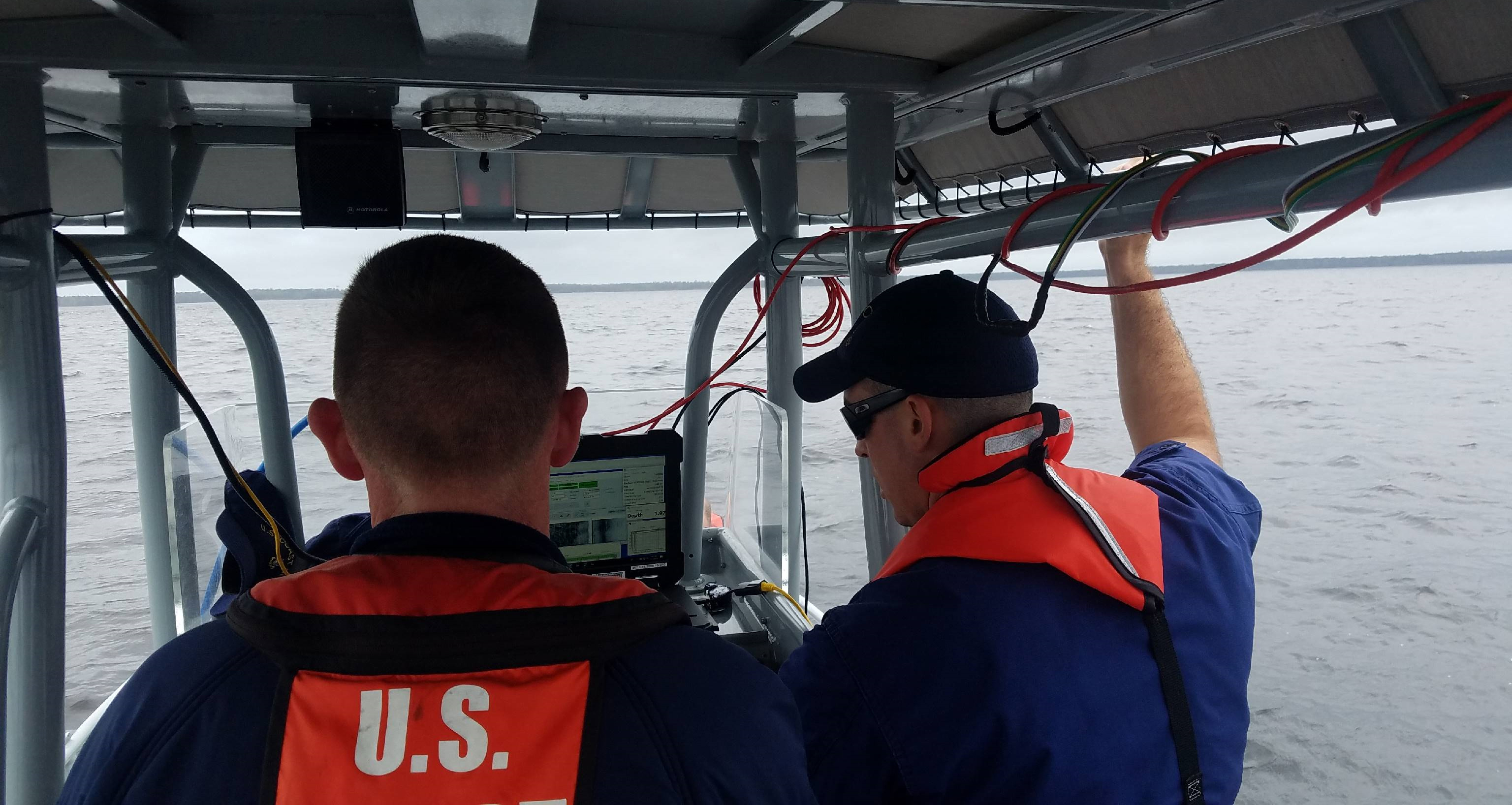
NOAA Supports USCG, and USMC Resumes Training, Following Hurricane Florence
SUPPORTS NOS PRIORITIES: SAFE AND EFFICIENT TRANSPORTATION AND COMMERCE • PREPAREDNESS AND RISK REDUCTION
The United States Marine Corp’s (USMC) Camp Lejeune suffered infrastructure and waterway damage after Hurricane Florence. Camp Lejeune is home to the Second Marine Division, multiple training commands, and the U.S. Coast Guard’s (USCG) Special Missions Training Center. The training center submitted a request to OCS in late October, 2018, to investigate their training area for hazards to navigation. The team used mobile integrated survey team equipment and conducted the survey from USCG training vessels. This survey will not only increase USMC and USCG confidence to conduct training in these areas, but will also serve to update the nautical charts for military assets and local fishermen using these waters. Read more in the OCS blog story.
Lt. Debroisse and BMC Rootz collect and access data in the U.S. Coast Guard’s training area at Camp Lejeune.
OCS Mobilizes in Response to Hurricane Dorian
SUPPORTS NOS PRIORITY: PREPAREDNESS AND RISK REDUCTION
OCS, in anticipation of Hurricane Dorian making landfall, pre-staged personnel and assets in locations outside of the hurricane impact zone so that they would be ready to respond upon request. Once Dorian reached the Southeast U.S., OCS teams mobilized to the affected areas. NOAA’s regional navigation managers continued to coordinate with the U.S. Coast Guard (USCG) and U.S. Army Corps of Engineers to evaluate and prioritize hydrographic survey requests from ports. The mobile integrated survey team surveyed Little River Inlet, South Carolina, and navigation response teams surveyed St. Mary’s River near Fernandina Beach, Florida, and Brunswick, Georgia. One of OCS’s hydrographic survey contractors, eTrac, surveyed Beaufort/Morehead City, North Carolina, and the approaches to Wilmington, North Carolina. Preliminary survey products identifying dangers to navigation were developed and delivered to the USCG to aid in decision-making in reopening ports.
 An official website of the United States government.
Social