NOAA's National Centers for Coastal Ocean Science (NCCOS) continue to improve the nation's ability to forecast, detect, and mitigate the impacts of harmful algal blooms (HABs). The forecasts are part of a NOAA ecological forecasting initiative that aims to deliver accurate, relevant, timely and reliable ecological forecasts directly to coastal resource managers and the public as part of its stewardship and scientific mandates for coastal, marine and Great Lakes resources. NOAA and its partners provide HAB forecasts for Lake Erie, the Gulf of Maine, and the Gulf of Mexico. In FY15, NCCOS issued a new early seasonal projection of bloom severity in western Lake Erie, helped the California Water Board evaluate the state of HABs in waterbodies in California, and funded and participated in event response and monitoring related to a bloom of Pseudo-nitzschia that stretched from southern California to Alaska. As part of the HAB toxin detection program, NCCOS delivered toxin sensors for deployment on autonomous environmental sample processors (ESPs) that can now report toxin levels in real time. Also in 2015, NCCOS engaged citizens in science to expand the Phytoplankton Monitoring Network to provide early warning for cyanobacteria in Lake Erie and for paralytic shellfish toxin with the Sitka tribes of Alaska.

In FY15, NCCOS Ecological Effects of Sea Level Rise (EESLR) program funded research to assess the vulnerabilities of coastal communities and ecosystems to sea level rise, coastal erosion, and severe storms. This research improved two models and initiated three partnerships to apply improved models in land planning and flood preparedness efforts in Central Florida, Virginia and the Northeast region of the U.S.These models illustrate the need to incorporate sea level rise, storm surge, and landscape change in future assessments of coastal infrastructure.
NCCOS also awarded $1.2M for coastal resilience research in FY15, including a socioeconomic analysis of the benefits of natural infrastructure, modeling the ability of marshes to attenuate high tides and storm surge in North Carolina, beach and dune modeling in North Carolina, advancing marsh modeling in San Francisco Bay, and improved modeling to guide conservation planning along the coast of Hawai'i.

Social scientists are now studying how people use, and depend on, special and protected coastal areas - to reduce potential conflicts between user groups, and plan for sustainable use by constituents.
In FY15, NOAA's National Centers for Coastal Ocean Science (NCCOS) scientists surveyed the adult population in Puerto Rico and Hawaii to assess their use of coral reef resources, knowledge of threats to coral reefs, and support for management strategies used to protect reef ecosystems. In the U.S. Virgin Islands, occupational divers shared their expert knowledge of coral reefs in the region as part of an online, map-based survey conducted by NCCOS. The information the divers provided is being incorporated into a decision-support tool that will help natural resource managers identify priority reefs for management actions.
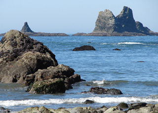
Additionally, NCCOS provided managers of the Mission Aransas National Estuarine Research Reserve in Texas with a report that identifies what the reserve's visitors and other stakeholders value about the reserve. They assessed the perceived value of the Olympic Coast National Marine Sanctuary in Washington, addressing how values might change if sanctuary resources were degraded by stressors like coastal development and climate change.

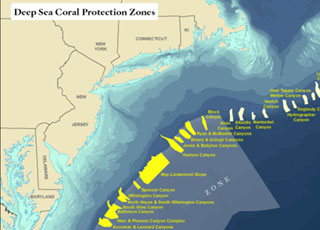
In 2015, NOAA's National Centers for Coastal Ocean Science (NCCOS) models, mapping products, and spatial analyses of deep-sea coral ecosystems informed a near-unanimous vote by the Mid-Atlantic Fishery Management Council (MAFMC) to protect more than 38,000 square miles of seafloor, stretching from New York to Virginia, from bottom fishing activities. The detailed spatial and scientific information provided by NOAA scientists enabled stakeholders to reach a broad consensus on proposed boundaries, leading to an outcome that both protects deep-sea corals and minimizes potential impacts to fisheries.
Also in 2015, in the Florida Keys National Marine Sanctuary, NCCOS scientists assessed the ecological impacts of management alternatives proposed by the Florida Keys National Marine Sanctuary Advisory Council. The assessment, along with related mapping products and human-use information developed by NCCOS, will support zoning and conservation decisions based on the best-available and most comprehensive science.

NCCOS continues to support the Natural Resource Damage Assessment (NRDA) of the Deep Water Horizon (DWH) oil spill by quantifying the spill's impacts to bottlenose dolphins, benthic organisms and sediment quality, and is improving NOAA's oil spill mitigation capabilities by examining the effects of oil dispersants on estuarine animals.
In FY15, NCCOS scientists reported that persistent organic pollutants were likely not a contributing factor to the poor health and increased mortality seen in some populations of bottlenose dolphins following the oil spill. NCCOS worked with other NOAA offices to develop guidelines for assessing injury to marine mammals from oil spills. These studies documented spill-related effects on benthic invertebrate communities and sediment quality in the vicinity of the DWH wellhead, which included a decline in the condition of soft corals. Results of these studies are supporting the development of a Damage Assessment and Recovery Plan (DARP) as part of the ongoing DWH NRDA process.
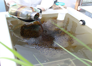
Additionally in 2015, using a simulated saltmarsh, NCCOS determined dispersant and dispersed oil toxicity thresholds in six estuarine species. Results are being used to predict the impacts of dispersants, to support recovery assessments, and to support decisions on dispersant use in future oil spill events.
 An official website of the United States government.
Here's how you know we're official.


