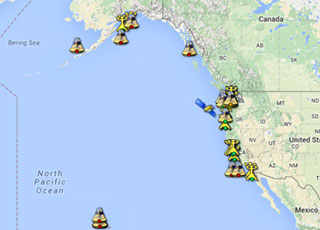
The IOOS® Pacific Region Ocean Acidification Portal was launched in October 2014. Funded through a grant award from U.S. IOOS' Ocean Technology Transfer Project in collaboration with NOAA's Ocean Acidification (OA) Program, this portal provides shellfish growers, researchers and others interested in ocean acidification with access to comprehensive, real-time ocean acidification data from Alaska, Hawaii, Oregon, California and Washington State.
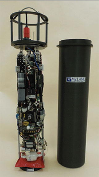
This grant award also expanded monitoring of ocean acidification in the Pacific Ocean region. Alaska, Pacific Northwest, Central and Northern California, and Southern California IOOS regions deployed ocean acidification monitoring sensors, developed by Dr. Burke Hales at Oregon State University, at five oyster farms and hatcheries in California, Oregon, Washington, and Alaska. Data from monitoring equipment enables shellfish growers to assess how the chemical make-up of the water will affect shellfish productivity and adapt their aquaculture practices to minimize impacts from ocean acidification to their operations.

In FY 2015, the U.S. IOOS Program (IOOS®), in partnership with NOAA's Ocean Acidification (OA) Program, continued its multi-year Ocean Technology Transition project to transition innovative marine observing technologies to improve the Nation's understanding of coastal stressors and ecological change. Three projects totaling $1.2 million were awarded in 2015:
The first of these is a two year project with the University Of Hawaii Institute Of Marine Biology (UH) to deploy an operational Shark Telemetry System for the Hawaiian Islands. The project will attach environmental sensor tags on tiger sharks, six gill, and hammerhead sharks in this region. Data from the sharks will be acquired via the Argos satellite system and through land-based relay receivers installed on several islands as part of this project.
The second of these awards went to the Woods Hole Oceanographic Institution (WHOI) to expand the Imaging Flow CytoBot's (IFCB) potential for operational use by deploying it on autonomous vehicles in the Gulf of Maine and in the Gulf of Mexico. These deployments will enable high resolution plankton studies with both long duration and spatial coverage. Expected benefits from the proposed work are improved early warning of Harmful Algal Blooms (HAB) in the Gulf of Maine and the Gulf of Mexico
The third award was granted to the University of New Hampshire (UNH) to expand the quantity and quality of ocean acidification (OA) monitoring across Northeastern U.S. coastal waters. In all, five different deployment platforms will be used to enhance ocean acidification monitoring within the Northeast Coastal Acidification Network (NE-CAN) with significant improvement in temporal and spatial coverage.

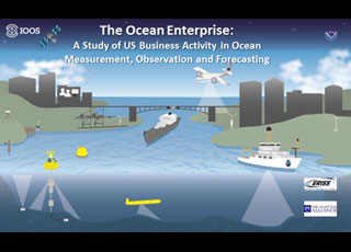
The U.S. IOOS® Program recently sponsored The Ocean Enterprise: A Study of U.S. Business Activity in Ocean Measurement, Observation and Forecasting. This a first of its kind study to identify and dissect the scale and scope of the United States private sector activity in support of ocean measurement, observation and forecasting, and the use of ocean information to deliver safety, economic and environmental benefits.
Ocean information is important for delivering a range of safety, economic and environmental benefits, underpinning the blue economy. The means to collect and use ocean data constitutes a significant business enterprise and one in which the United State is an acknowledged world leader.

Using data from the U.S. IOOS® Program, the Office of Coast Survey added New York Harbor as the third site for the High Frequency (HF) Radar web product, joining lower Chesapeake Bay and San Francisco Bay. HF Radar provides near-real time surface current observations and tidal current predictions in estuarine and coastal locations.The product offers broad spatial coverage of surface currents in areas vital for marine navigation. The HF Radar web product also supports NOAA's Physical Oceanographic Real-Time System (PORTS®), a system that provides real-time water level, currents and meteorological observations for safe navigation.
IOOS also published the sixth and seventh Quality Assurance of Real Time Ocean Data (QARTOD) manuals addressing standard quality assurance practices for oceanographic data variables. One of the manuals published this year provides guidance to the U.S. IOOS Regional Associations and the wind community at large for the real-time quality control of wind speed, direction, and gust measurements using a standard process. The other provides guidance to the U.S. IOOS Regional Associations and the water-quality community at large for the real-time quality control of ocean optics measurements using an agreed-upon, documented, and implemented standard process. A third manual, providing guidance on real-time quality control of dissolved oxygen measurements was also updated.

The U.S. IOOS® Program and The Office of Naval Research (ONR) working with Stanford University, University of California (UC) and the NOAA Southwest Fisheries Science Center Environmental Research Division launched the national Animal Telemetry Network Data Assembly Center to provide reliable and accurate biological and physical observation data provided tagged animals from nearly 50 different species.
The network provides data that can be used in modeling ocean dynamics, defining critical ocean habitats, and forecasting marine ecosystem features to support U.S. IOOS societal benefits needs. These needs include improving predictions of climate change, more effective protection and restoration of healthy coastal ecosystems and enabling the sustained use of ocean and coastal resources.
 An official website of the United States government.
Here's how you know we're official.


