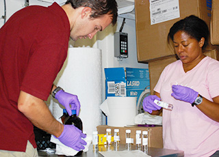
A flexible new data management tool known as DIVER was developed by NOAA to support the Natural Resource Damage Assessment for the 2010 Deepwater Horizon oil spill. DIVER stands for "Data Integration, Visualization, Exploration and Reporting," and provides unprecedented flexibility for filtering and downloading validated data collected as part of the damage assessment efforts for the Gulf of Mexico.
DIVER was developed as a digital data warehouse during the Deepwater Horizon oil spill response effort and related damage assessment process, which has required collecting and organizing massive amounts of scientific data on the environmental impacts of the spill.
The tool serves as a centralized data repository that integrates diverse environmental data sets collected from across the Gulf of Mexico ecosystem. It allows scientists from different organizations and laboratories located across the country to upload field data, analyses, photographs, and other key information related to their studies in a standardized format. DIVER thus brings together all of that validated information into a single, web-based tool.
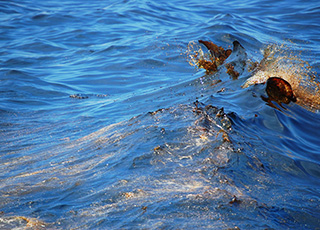
On July 2, 2015, BP reached an agreement in principle with the United States and the five Gulf states to settle the civil claims against the company arising out of the Deepwater Horizon oil spill tragedy. Although the terms are not final or binding until a consent decree is negotiated, undergoes public comment, and secures court approval, BP has announced the value of the settlement to be approximately $20.8 billion. Of this proposed settlement up to $8.8 billion will go to natural resource damages and fund Gulf restoration projects as designated by the trustees.
The agreement in principle led to the October 2015 release of the draft comprehensive restoration plan for the Gulf of Mexico. The draft plan would allocate funds to meet five restoration goals and 13 restoration types designed to meet these goals. Together, these efforts will restore wildlife and habitat and increase recreational opportunities in the Gulf.
Scientific data for the Deepwater Horizon oil spill can be accessed on the public data warehouse and query tool DIVERExplorer, as well as our online mapping tool ERMA®Deepwater Gulf Response.
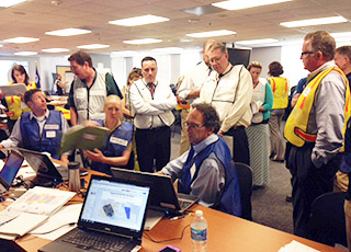
The National Ocean Service enhanced its response and recovery posture for future all-hazards events in a major drill involving more than 60 staff and coordinated by NOAA’s Office of Response and Restoration and NOAA’s Homeland Security Program Office.
Code named "The Little Splash," this training event exercised NOS’ capability to establish incident coordination as described in the 2014 updated Concept of Operation (CONOPS) Plan. The event simulated a response to a small tsunami wave impacting the East Coast, which resulted from a major landslide in the Canary Islands off Africa. Through the exercise which was carried out in Silver Spring, MD, Chesapeake, VA, and Charleston, SC, NOAA staff, facilities, and missions were challenged to respond to the drill as though it were a real emergency, providing a consistent visualization for everyone involved. Among the activities, field staff provided real-time situational reports to the NOS Incident Management Team about impacts and response activities, Environmental Response Management Application (ERMA®) served as the common operational picture, and NOAA’s communications team simulated a press conference.
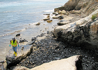
In May of 2015, a 24-inch pipeline rupture released approximately 100,000 gallons of crude oil near Refugio State Beach in Santa Barbara County, California, with a reported 21,000 gallons flowed into the Pacific Ocean.
NOAA’s Office of Response and Restoration provided overflight observation of the spill, information on fate and effects of the crude oil, potential environmental impacts both in the water and on the shore, and observational and data management support for the Natural Resource Damage Assessment. The spill closed down multiple beaches and fisheries and caused harm to birds, marine mammals, fish, and marine invertebrates. NOAA and our state and federal partners are investigating these impacts.
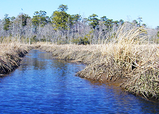
NOAA, U.S. Fish and Wildlife Service, and the State of North Carolina will receive more than $22 million for natural resource damages from the Kerr-McGee Superfund site in Navassa, North Carolina.
The settlement was part of a larger $5.15 billion Department of Justice settlement with Anadarko Petroleum Corporation. Damages to natural resources were the result of creosote-wood treating that took place on the site from the 1930s until the mid-1970s. Polycyclic aromatic hydrocarbons (PAHs) from the wood treating have been found at elevated levels in on-site soils, groundwater, and Sturgeon Creek sediments.
 An official website of the United States government.
Here's how you know we're official.


