NOAA’s Office for Coastal Management has developed three new green infrastructure products are helping coastal communities use natural and nature-based systems to absorb and filter excess water and reduce flooding. These new offerings include an interactive animation that illustrates how green infrastructure can help protect communities from storm impacts; a guide for spatial analysts who want to incorporate green infrastructure into mapping efforts; and a cost-benefits process that people are using to determine what green infrastructure strategies make the most sense for their community. These additions join other products featured on the green infrastructure section of the Digital Coast website.

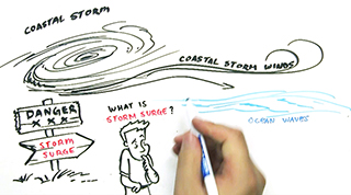
Using eye-catching graphics, the new Storm Surge Fast Draw (also available in Spanish) animation explains the dangers that storm surge can pose to people and their property. Social science research indicates residents in coastal areas many miles inland might not realize they live in a storm surge-affected area and might not leave if an evacuation is issued. With storm surge posing a year-round threat, this fast-draw video (also availablecan be used for outreach during tropical or winter storm season to help people understand when preparation and evacuation is critical. The video was created by the Office for Coastal Management in collaboration with the National Weather Service.

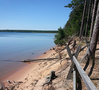
Fluctuating levels in the U.S. Great Lakes are resulting in renewed community interest in topics such as encouraging sustainability, planning for infrastructure, conserving habitat, and zoning restrictions. Helpful in these discussions is a new NOAA tool developed for this purpose, the Lake Level Viewer. This tool portrays the impacts of lake level change on coastal areas and resources. Tool users download the data and access services within the tool for more in-depth analysis. This easy-to-use tool was designed and tested with input from Great Lakes stakeholders. It was selected as a Site of the Month by the Great Lakes information Network, which averages 4.5 million monthly hits. Designed by the Office for Coastal Management and funded by President Obama’s Great Lakes Restoration Initiative, the viewer complements the Great Lakes Environmental Research Lab’s Water Level Dashboard.

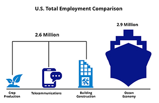
Understanding the value of the ocean is a crucial component of community decision making, yet the economic data we need are not always readily available or easy to understand. NOAA’s ENOW (Economics: National Ocean Watch) data were developed in response to this need. A 2012 fact pulled from the website, for instance, says the U.S. ocean and Great Lakes economy grew by 10.5 percent in real gross domestic product (GDP)—more than four times as fast as the U.S. economy as a whole. More facts, as well as the latest data and trends, soon will be online in the NOAA Report on the U.S. Ocean and Great Lakes Economy. These and other economic-centered products are available from NOAA’s Digital Coast, which is provided by the NOAA Office for Coastal Management.
During the past year more than 10,000 acres of coastal lands were acquired or designated for long-term protection through the Coastal Zone Management Program. State partners executed these actions, in many cases by creating a conservation easement. These same programs also constructed or enhanced 385 public access points. Giving people access to the nation's natural resources is an important and popular part of the local and national coastal management effort.
 An official website of the United States government.
Here's how you know we're official.


