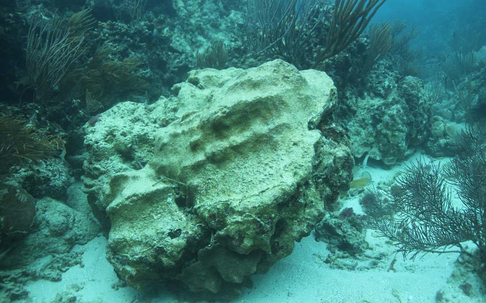
Intense wave action in Puerto Rico detached this colony of star coral. (Credit: Michael Nemeth, NOAA Restoration Center.)
NOAA Rehabilitates Puerto Rico Reefs, Trails, and Flood Maps
SUPPORTS NOS PRIORITIES: STEWARDSHIP, RECREATION, AND TOURISM • PREPAREDNESS AND RISK REDUCTION
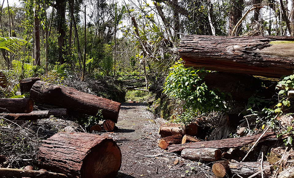
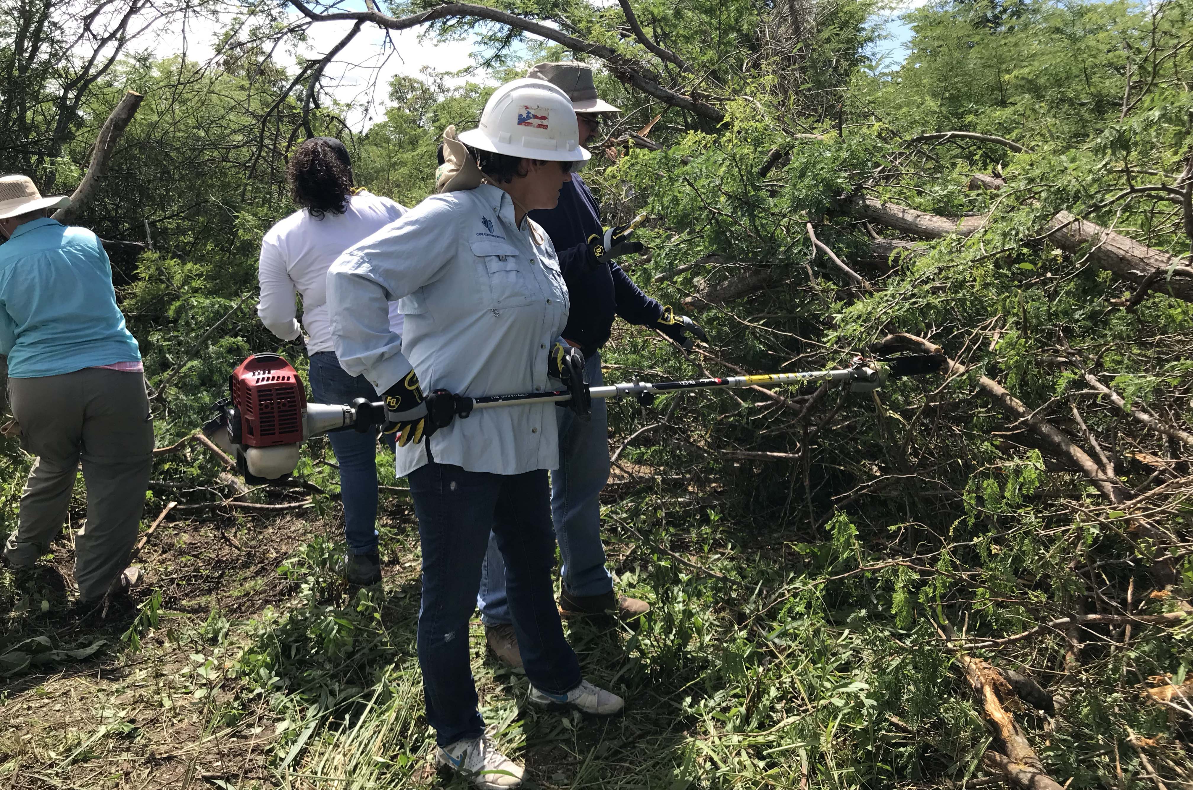
Following Hurricane Maria and a devastating winter storm, NOAA and partners helped salvage and re-attach more than 15,000 coral fragments to re-grow Puerto Rico’s reefs; restored all trails at Jobos Bay National Estuarine Research Reserve; and provided fine-scaled flood maps and training to aid recovery and protect residents from future hazards. Research reserve staffers nationwide — with funds from the National Estuarine Research Reserve Association — joined volunteers to log 3,293 hours restoring trails, saving an estimated $73,554 in labor costs. Coral reefs and reserve trails are essential to the tourism and recreation sector, which account for 87 percent of Puerto Rico’s ocean economy. Hikers once again can view the unspoiled mangroves and lagoons that shelter the endangered yellow-shouldered blackbird, hawksbill sea turtle, and West Indian manatee.
Volunteers removed fallen trees along trails in the Jobos Bay National Estuarine Research Reserve. (Credit: Miguel Figuerola Hernandez.)
Research Reserves Advance Blue Carbon Approach to Conserving Wetlands
SUPPORTS NOS PRIORITY: STEWARDSHIP, RECREATION, AND TOURISM
NOAA’s National Estuarine Research Reserves and their partners are using blue carbon financial markets to make wetlands conservation and restoration profitable, while at the same time lessening greenhouse gas emissions. Since its inception in 2016, the effort has resulted in the first-ever U.S. guide that makes salt marsh restoration eligible for international carbon markets; research that documents carbon storage capabilities in marshlands; and workshops and school curricula on the topic. 2018 accomplishments include the addition of a blue carbon curriculum to the “Teachers on the Estuary” program in six states — reaching more than 100 teachers and 2,000 students; the formation of the Pacific Northwest Coastal Blue Carbon Working Group; and the creation of tools, guides, and workshops in numerous cities and research reserves around the country.
Volunteers in Jobos Bay National Estuarine Research Reserve helped restore trails to enable access. (Credit: Milton Muñoz.)
NOAA Data and Expertise are Applied to Address Ocean Use Conflicts
SUPPORTS NOS PRIORITIES: PREPAREDNESS AND RISK REDUCTION • SAFE AND EFFICIENT TRANSPORTATION AND COMMERCE
NOAA Digital Coast products and the Marine Cadastre, in combination with NOAA’s geospatial expertise, were used to develop ocean information hubs to inform discussions about using the ocean waters off of the North Atlantic for a variety of activities. The Mid-Atlantic Ocean Data Portal and the Northeast Ocean Data Portal allow users to access thousands of data layers and easily detect potential ocean use conflicts that might arise from increased offshore energy, aquaculture, tourism, undersea cables, marine traffic, and other uses. These mapping tools have been extensively used by industry, government agencies, and ocean stakeholders to inform discussions about using offshore waters. The data portals were also foundational to the development of Northeast and Mid-Atlantic Regional ocean plans, which provided a roadmap for proactive thinking among federal, state, and tribal partners about ocean uses.
NOAA Provides Capacity and Technical Support for Lake Superior Tribal Communities
SUPPORTS NOS PRIORITY: STEWARDSHIP, RECREATION, AND TOURISM
Lake Superior contains some of the highest water levels on record, while coastal development and contaminants continue to threaten area waters. Adjacent tribal communities are concerned about the viability and health of nearshore coastal wetlands and sacred wild rice fields. To address these concerns, the Office for Coastal Management (OCM) held a well-attended second annual workshop to discuss these topics. Over 70 participants shared their concerns and priorities, which included coastal wetland monitoring, restoration, education, and outreach. With funding from the Great Lakes Restoration Initiative, OCM is providing geospatial contract support to identify suitable habitats for restoration purposes, and pursuing new education and outreach partnerships with NOAA Sea Grant.
NOAA Awarded for Providing Access to LIDAR Data
SUPPORTS NOS PRIORITY: PREPAREDNESS AND RISK REDUCTION
The Office for Coastal Management (OCM) was awarded second place in the Outstanding Team Achievement category of the International LIDAR Mapping Forum’s LIDAR Leader Awards. The NOAA team enables agencies and groups to access data at no cost through the Digital Coast website. The team has been on the forefront of data distribution since the earliest days of LIDAR technology, providing an inventory of collections and distributing the data in an efficient, user-friendly way. The team's efforts helped to multiply the value of all LIDAR collections to date, thereby maximizing the cost-effectiveness of the technology.
 An official website of the United States government.