Jacob Heck, Great Lakes Regional Geodetic Advisor.
As a geodesist with the National Geodetic Survey (NGS), Jacob is a scientist who studies the size and shape of the earth. Have you ever wondered how the global positioning system, or GPS, determines where you are in the world? Geodesy is the science that does that.
What are your basic job duties?
In my role as regional geodetic advisor, I engage in positioning activities throughout the Great Lakes region and work with a variety of public, academic, and private-sector partners in Michigan, Indiana, Illinois, and Wisconsin. I provide expert guidance and assistance to the constituents who manage the geodetic component of geospatial activities tied to the National Spatial Reference System, or NSRS, the nation’s coordinate system for latitude, longitude, height, shoreline, and gravity measurements. One of my major regional activities is to support the International Great Lakes Datum, which is a reference for comparing water levels across the Great Lakes basin. This project is a joint effort between the U.S. and Canadian governments.
How did you get to where you are now in your career?
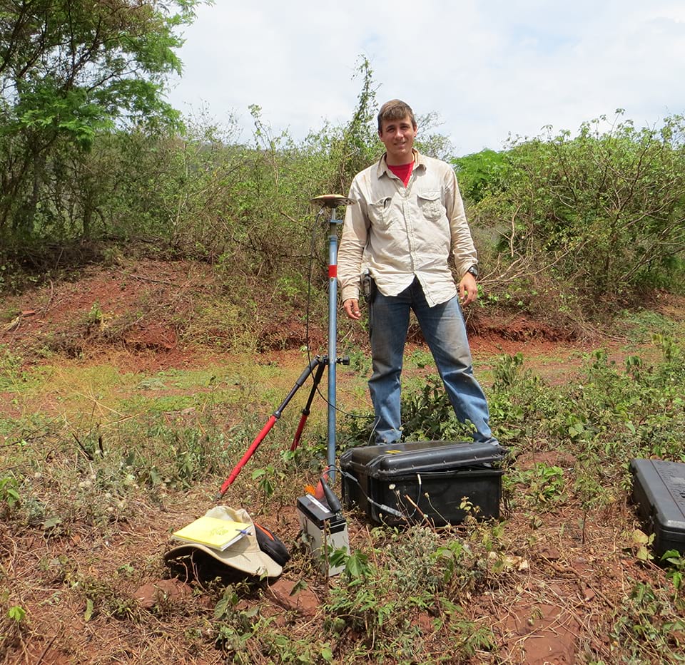
I studied surveying in college and explored different areas of surveying, including geodesy, during summer internships. One summer, I worked for the Michigan Department of Transportation on the statewide geodetic crew, and that exposed me to a different level of surveying. I thought that was pretty cool, and the experience led me to pursue an advanced degree in geodesy. During my Ph.D. studies, I worked in project locations so remote they were more than a day’s drive from the nearest town. One such assignment was in Bolivia, where I took gravity and long-session GPS measurements. There were many nights of sleeping in tents in those days. For a small-town farm kid from a flat area of the country, working in the Andes Mountains was an amazing experience. After completing graduate school, I went to work for the Geosciences Research Division of the National Ocean Service’s National Geodetic Survey in Silver Spring, Maryland. When the regional job became available in the area where I grew up, I jumped on the opportunity and have been growing in that role ever since.
What NOAA project have you enjoyed working on the most?
NGS works with partner agencies across the country to maintain the NOAA Continuously Operating Reference Stations, or CORS, Network, a multi-purpose cooperative network of Global Navigation Satellite System stations from over 200 government, academic, and private organizations to support three-dimensional positioning activities. In recent years, I have helped with the installation of some of these stations, including one in partnership with the National Park Service and the Michigan Department of Transportation at Isle Royale National Park. Isle Royale is an incredible place — it’s a cluster of islands in the middle of Lake Superior near the Canadian border, and it’s very remote. I’ve helped install CORS monuments in other places as well, and I really enjoy the experience of working with a wide variety of people on something as important as geodetic infrastructure.
Name: Jacob Heck
Location:Ann Arbor, Michigan
Education: B.S. in Surveying Engineering, Michigan Technological University; Ph.D. in Geodetic Science, The Ohio State University
National Ocean Service Program Office:National Geodetic Survey (NGS)
 An official website of the United States government.
Social