Donut chart showing how Ryan Hardy, geodesist, spends his time.
50% Data analysis and modeling, hardware assembly, and software development
20% Preparing presentations and writing
10% Field work, data collection, and instrument testing
10% Meetings
10% Conferences and research community activities
Ryan measures and models the geoid — a representation of the Earth’s shape that corresponds to global mean sea level. While we think of the Earth as a sphere, the planet is actually bumpy and irregular. If we were to remove the tides and currents from the ocean, the water would settle into a smoothly undulating shape (rising where gravity is high, sinking where gravity is low). This irregular shape is called the geoid. The geoid is an ideal basis for heights, because it tells us which way water flows.
What are your basic job duties?
I measure and model Earth’s changing gravity field to establish an accurate height system for the nation. I develop models of the geoid, and research how it changes over time and how it compares with real-world measurements. I work on modeling gravity change in Alaska and developed a new system to measure changes in height and gravity there.
How did you know you wanted to pursue this line of work?
I studied physics and astronomy as an undergraduate. Gravity and orbits fascinated me the most, and those topics are critical in geodesy. During an internship at NASA’s Goddard Space Flight Center, I got a close-up view of the precision instrumentation used at their Geophysical and Astronomical Observatory. Enamored by both spacecraft navigation and geodesy, I applied to an aerospace engineering sciences graduate program. After graduate school, I started at NOAA on a postdoctoral fellowship to predict and model gravity change in Alaska at a higher resolution than satellites can provide.
When has your work felt most exciting or rewarding?
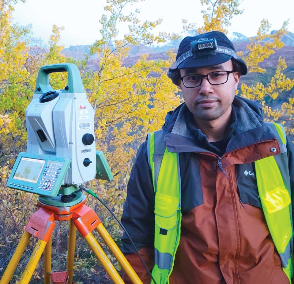
I developed something called the Total Station Astrogeodetic Control System. It’s a hardware and software kit for automated surveying equipment, allowing the equipment to measure the direction of local gravity astronomically (by using the position of stars). The direction of gravity changes with the curvature of the Earth and local geological factors. These astronomical measurements supplement other techniques that help us model the geoid. I built the first kit while working from home in 2020, and the system recorded its first measurement from the roof of my apartment’s parking garage. After some fine tuning, I was able to deploy it in Alaska, where it helped collect data on changes in height and gravity from plate tectonics and loss of glacial ice. It’s satisfying to know my work has meaningfully expanded the observational capabilities of the agency and told us something new about the shape of our planet.
What NOAA project have you enjoyed working on the most?
I joined the Geoid Monitoring Service project as an expert in satellite geodesy, but the work has pulled me far beyond my core skills. I developed mathematical models of geoid change in Alaska, and these models generated predictions that we could then validate in the field. I sharpened my electronics skills to develop new hardware and software equipment. I also reviewed historical geodetic records to look at what changes we could measure across the decades. This project has taken me from the reading rooms of the National Archives to the boreal forests of Alaska.
Name: Ryan Hardy
Location:Silver Spring, Maryland
Education:Ph.D. and M.S. in Aerospace Engineering Sciences; B.S. in Physics
National Ocean Service Program Office:National Geodetic Survey
 An official website of the United States government.
Social