Precision Marine Navigation
NOAA Ocean Podcast: Episode 41
NOAA's Precision Marine Navigation team is creating new online services to enable more efficient access to the NOAA data that powers private-sector marine navigation products. In this episode, Julia Powell and John Kelley from the Office of Coast Survey share how the team is working to foster innovation, improve navigation safety, aid in more efficient coastal route planning, and help mariners make informed decisions as they navigate our nation's waterways.

Container ships at the Port of Oakland.
Transcript
HOST: This is the NOAA Ocean podcast. I’m Abby Reid. What’s good for the ocean economy, saves money, and helps keep people safe? The answer is Precision Marine Navigation, or PMN, as we call it here at NOAA.
PMN gives mariners the information that they need to operate safely and efficiently within U.S. waters. Picture a massive cargo ship carrying tons of goods passing through hazardous conditions. The ship’s captain and crew need the most accurate navigational products and tools possible in order to make critical decisions about safety and efficiency. That’s where PMN comes in.
PMN is truly a team effort, with different parts of NOAA working together to get the job done. NOAA’s Office of Coast Survey, the Center for Operational Oceanographic Products and Services, the National Geodetic Survey, the U.S. Integrated Ocean Observing System, and the National Weather Service’s Ocean Prediction Center are all working together to create an efficient and accurate Precision Marine Navigation Program.
Today you’ll hear parts of a conversation that I had with two experts from NOAA’s Office of Coast Survey, Julia Powell and John Kelley, to talk about what PMN is, how it works, its history, and where this critical field is heading.
Julia is Chief of the Navigation Services Division in NOAA’s Office of Coast Survey. The Navigation Services Division handles navigation response, outreach activities, nautical publications, and the management of the Precision Marine Navigation Program.
John is a meteorologist and Lake Modeler in the Office of Coast Survey’s development lab. He’s also the project manager for developing and implementing NOAA’s PMN Data Processing and Dissemination System.
We spoke using a chart service on our laptops, so the audio might be a bit spotty at times.
To start, I was curious who, exactly, might benefit from Precision Marine Navigation? Here’s what Julia had to say.
JULIA POWELL: So our user base is actually very broad. We’ve got what we call the “Safety of Life at Sea Class Mariner.” Which is the big ships. They have to have and carry navigation systems that are standardized.
And so the main thrust of our products tends to be for that customer. However, all of these products actually help the entire user community of mariners. So these products will actually get into sort of fish-finding applications for the fishermen, they can use the high resolution bathymetry and find their fishing holes. For ferry operators, for charter vessels. And it’s really about who uses our traditional products. These products will morph into, into the systems that these stakeholders use, and they’ll be able to have access to it.
So it’s not really just for the big ships, but we want these products to trickle all the way down into sort of the recreational market.
HOST: Julia went on to talk about the history of Precision Marine Navigation at NOAA, and how accurate navigation can save millions of dollars every year.
JULIA POWELL: So historically, we often trace the roots of this program to a pilot project that we conducted in the port of Long Beach, California, about six or seven years ago. And in that port vicinity the wave swell conditions outside the port caused restrictions on the maximum allowed draft. And the maximum allowed draft is the amount of water depth a ship needs in order to float and not touch the bottom.
HOST: Often, large drafts required large vessels to offload some of their cargo offshore, which is a process known as “lightering.” In this particular case, the ship’s pilots hired a private company that used NOAA data to create a model to help determine when it would be safe to bring ships into port when there were deeper drafts. After a few years of testing, they determined that the port should increase the maximum draft by four feet.
‘But how could four feet make a difference?,’ I wondered. ‘That doesn’t sound like much.’
JULIA POWELL: So while four feet doesn’t actually sound like a lot in the real world, each extra foot of draft represents an additional two million dollars of cargo per vessel transit.
So if you think of a super tanker coming into a port and if you can add four feet of draft to that transit, that equals 8 million dollars of additional cargo that can come into that port. And so this project demonstrated how valuable integrating NOAA data is, and invigorated an initiative to make NOAA marine navigation data easily discoverable and machine-to-machine readable.
Because it’s not just about getting data out to the mariner, you know, cause that data can equate into sort of economics, or it does.
And if we look at shipping as a whole, shipping is an economically important industry within the United States. And U.S. seaports have an economic impact in the U.S. of over 5 trillion dollars in 2018, and it supports nearly 31 million jobs.
HOST: The world is becoming increasingly connected, and the shipping industry is no exception. That’s why NOAA has been working with federal agencies in other countries to develop international standards on how we format marine navigation information. These new international standards, which are currently in development, are called S-100. S-100 will help ensure that information for electronic navigational charts, water levels, high resolution charts of the seafloor, surface currents, and more, are standardized, and easily understood throughout the world.
JULIA POWELL: So when you want to think about what S-100 does, is you think about S-100 as the grocery store, where it has everything that you need for your recipe, and a product specification is the recipe.
So you just collect everything you need from the framework standard of S-100, and you put it in your product specification, and then you sort of build your apple pie.
We live in a data-driven world, and really, shipping is no different. They rely on navigation data to safely operate in a wide variety of conditions. And many types of data that they rely on have unique formats or actually are based on paper, and is difficult to intake and display on navigation systems.
So for example, there used to be sort of a traditional book of tide tables, and, you know, and trying to get that information and adjust your water levels within your navigation system, you couldn’t really do it in an efficient manner.
In addition, the problem is, is that there’s a potential for different countries around the world to produce the same type of data using a different format. And what this does, is it actually makes the cost of implementation high, which then is passed on to the customer. And that actually makes international shipping more challenging.
HOST: Julia shared that the S-100 standards will make it much easier for mariners to use their shipboard computers and software to download relevant navigation data, because they will all be in the same format, no matter what country the data comes from.
JULIA POWELL: So for example, you know, one of the key things I can talk about is that these standards actually restrict how large the data files can be, which is actually really important for a mariner trying to download data at sea, where he or she doesn’t actually have a 5G wifi connection. A lot of us forget — we’re on our phones so often, and we have high speed and high broadband, you know, connections at home, but when you’re at sea you’re relying on satellite connections, which actually is very costly and very slow, so the key is to try and deliver data that’s essential for navigation, but in small, bit-sized packets.
And then one final way that these standards are really important for safe marine navigation is that they dictate how different types of data interact with each other on the navigation screen.
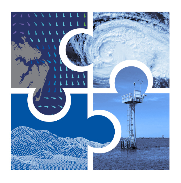
So for example, you don’t want surface current data, which is a bunch of arrows that shows the speed and direction of the current, to cover up important information on the chart so that a mariner can’t actually see where a navigational hazard is.
HOST: In an effort to safely respond to hazards that these mariners may face, NOAA is working to build what’s called a “dissemination system.” This system collects information about the waters where a mariner is travelling, and shares, or “disseminates” it, to mariners’ navigation systems. Julia said that you can think of a dissemination system as being similar to your grocery delivery service, where you have a standing order, and it’s automatically delivered to your door.
One key way that information is disseminated is through “the cloud.” “The cloud” is a term that’s used a lot, but not everyone knows what it really means. John said that cloud technology is usually defined as the use of remote and computing resources, such as computer servers, storage, and network services, in applications that can be quickly accessed, used, and then taken down when the information isn't needed. Using the cloud will allow NOAA to tap into the abundance of pre-built cloud services and tools to build NOAA’s data processing dissemination system, and to continuously improve it, to meet the growing needs that mariners have for NOAA’s data.
John emphasized that getting information out to mariners isn’t just essential for efficient shipping - it’s essential during an emergency response, such as a landfalling hurricane, when NOAA’s websites and services start to slow down due to very high web traffic.
He also emphasized that knowing what’s going on underneath the water is just as important as knowing what’s going on above it.
JOHN KELLEY: Bathymetry, essentially, the ocean bottom. And we need to know how much water is under the keel of a ship, so how much the ship is riding on the ocean and the bay. How much water is underneath that ship. Cuz they don’t want to run aground.
You know, that could cause a HAZMAT incident.
HOST: HAZMAT stands for “hazards materials,” like toxic chemicals, or fuels.
JOHN KELLEY: It could delay them getting to the port or out of port. So it’s critical to know what’s happening on the surface in terms of the winds, the currents, but also, how much water is underneath that ship. And that’s why we map the bathymetry with our NOAA ships to determine what the ocean bottom actually looks like, and we need to do that frequently because sometimes in different areas the bottom changes, and so we need to know how the bottom has changed over the last few years.
HOST: So what’s in store for the future of PMN?
JULIA POWELL: Really the Precision Marine Navigation Dissemination System was built to be scalable. So which means we start small, but we built it in such a way that we can scale it up and have lots more different types of data streams feeding into the system.
JOHN KELLEY: And some of these uh future datasets that we plan to make available via the dissemination system, includes water level forecast guidance from the National Ocean Service’s real-time, computer-based ocean forecast models for estuaries, coastal waters in the United States and the Great Lakes, as well as the latest weather observations from buoys, and lighthouses, and ships, marine weather forecasts, and marine alerts, such as small craft advisories, gale warnings from the National Weather Service.
So the mariner will have a complete picture of what’s happening both oceanographically, and also weather-wise, in the area that they’re uh operating.
JULIA POWELL: Yeah, and so really what it is, it’s our hope that we can actually successfully transition this program from a developmental prototype into a new way of disseminating data specifically for navigation. So what we’re able to do with this program, is we’re able to take different types of NOAA data that haven’t been traditionally formatted for navigation systems, and format it into, for navigation systems, and allow mariners access to even more types of data than they’ve had before in order to put it all together and have a bigger picture on how to navigate safely.
HOST: Thanks to Julia and John for sharing their insights about Precision Marine Navigation, and thanks to you for listening.
For more information about PMN, visit oceanservice.noaa.gov.

From corals to coastal science, connect with ocean experts to explore questions about the ocean environment.
Social