Surveying in the Great Lakes
NOAA Ocean Podcast: Episode 56
Keeping our marine transportation system functioning in a way that is safe and efficient requires information about water depth; mapping the shape of the seafloor, lakebed, or coastline; pinpointing the location of possible obstructions; and understanding many other physical features of water bodies. Hydrography is the science behind this information, and surveying is a primary method of obtaining hydrographic data. In this episode, we learn about surveying and NOAA Ship Thomas Jefferson's survey missions in the Great Lakes.
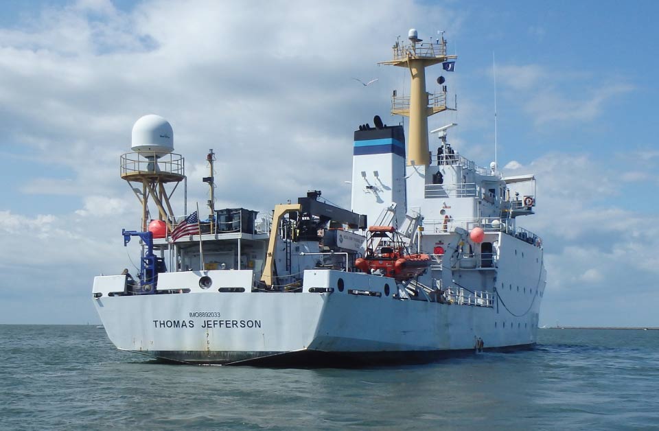
NOAA and NOAA contractors will conduct multiple hydrographic mapping missions in the Great Lakes in 2022 aboard NOAA Ship Thomas Jefferson.
Listen here:
Or listen in your favorite podcast player:
Transcript
HOST: This is the NOAA Ocean Podcast. I’m Marissa Anderson. When people drive their car and need directions to their destination, they usually use a map application with GPS to help guide them. This can provide them with directions, help them avoid traffic jams, and alert them to any dangers on the road.
Boaters, sailors, and people who rely on marine transportation also need critical information to safely travel on the water. They need to know about the depth of the water, the shape of the sea or lakebed floor, and possible underwater obstructions. Nautical charts provide this information. They are maps for navigating a waterway.
NOAA’s Office of Coast Survey conducts missions to map out the nation’s coastal waters for the maritime community for safe passage into American ports and along 95,000 miles of U.S. coastline.
In this episode, we talk about the NOAA survey mission in the Great Lakes which runs from May through September of 2022. Today, we are joined by NOAA Corps Cmdr. Matthew Jaskoski, Commanding Officer of NOAA Ship Thomas Jefferson. We are also joined by Tom Loeper, Office of Coast Survey’s Great Lakes Navigation Manager.
HOST: Let’s dive right in and start with the basics of these mapping missions. Cmdr. Jaskoski provides us with a brief overview on hydrography.
CMDR. JASKOSKI: Hydrography is the science of ocean mapping. It’s a branch of oceanography that deals with understanding the nature of the topography of the seafloor. It’s a very old branch of science. For centuries the technology that was involved in hydrography remained relatively unchanged. It was a weighted line that had some level of measurement on it and some way to position yourself. Those basics have not really changed a whole lot in our modern surveying, but the tools with which we use to gather those data have changed significantly, whereas before we would use a weighted line, now we use a multibeam echo sounder which gives us a digital, three-dimensional view of what the bottom looks like. And the positioning, instead of using terrestrial or celestial navigation, we have very precise GPS.
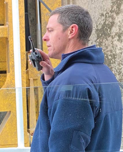
NOAA Corps Cmdr. Matthew Jaskoski, Commanding Officer of the NOAA Ship Thomas Jefferson
HOST: Tom described another type of sounding equipment that is used during the mission.
LOEPER: There’s another system that they use to really characterize objects on the bottom and it’s called side scan sonar. The beams of sound actually go down into the side and it really gives a great black and white image of things that are on the bottom, say a geographic feature or a wreck, or some other kind of obstruction.
HOST: Now that we know about the science of ocean mapping, Cmdr. Jaskoski explains what a hydrographic survey mission is.
CMDR. JASKOSKI: A hydrographic survey mission is when we send a field unit, in this case a ship, NOAA Ship Thomas Jefferson, to cover an area of interest for updated ocean mapping data. Typically, the main product from those data is an updated nautical chart which is a map which mariners use to travel from one place to the other. The bulk of our missions tend to be in areas that are high commerce, where there’s a lot of commercial traffic, and they tend to be in areas that need updating, either due to the age of the data that’s currently on the charts, the nature of the sea bed being highly changeable or the nature of the traffic, as the traffic increased or changed significantly. The areas we’re working in the Great Lakes are right around Cleveland. I think it’s one of the biggest ports in the Great Lakes and it’s one of the top 50 biggest ports in the United States. So it’s a very highly trafficked area that has a high level of consumers of our nautical chart products.
HOST: The goals of the survey mission are really to paint a picture or a map of the bottom of the lakebed floor. Cmdr. Jaskoski talks about the importance of mapping using modern surveying tools.
CMDR. JASKOSKI: Only about five to 15 percent of the mapped data in the Great Lakes is to modern standards. That modern standards being that three-dimensional bathymetric sonar and high resolution imaging sonar. Most of the data that’s portrayed on our nautical chart products are not to that standard. The main intent is for the safety of navigation, to improve the nautical chart products so that commerce can flow from port to port safely so that mariners can use a product that they have a high degree of faith and confidence in.
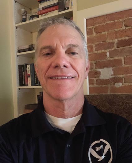
Tom Loeper, Great Lakes Navigation Manager, NOAA’s National Ocean Service, Office of Coast Survey
HOST: Tom provided some examples of how surveys in the Great Lakes were conducted in the past.
LOEPER: Most of the soundings that they got were done with a lead line or they were done with a single beam echo sounder so that was just one, like a flashlight going down and coming back with a return and you’d have really good depth information at that point, but not across the whole bottom. And actually, another way that they used to survey in the winter when the lakes froze solid, they would send teams out with horses and a tent and they would drill holes in the ice and sound that way. So they were very accurate for that point, but again they didn’t have full bottom coverage which is what we’re trying to shoot for now.
HOST: Cmdr. Jaskoski discusses the importance of finding things that were not previously known.
CMDR. JASKOSKI: Nearly every hydrographic survey that I’ve been a part of for the last 18 years or so, we’ve found something that we did not expect to find. That can be something as interesting as a brand new wreck, or something as benign as a rock that was incorrectly positioned, but a significant enough rock that it needed to be positioned in a more accurate way. Or just the natural shifting of the lakebed, and the changing of shoals, the changing of where sand deposits move with currents and with storm activity. Nearly every survey that we have, there’s something new that we find, something significant that needs to be added to the chart or to be removed from the chart. As a mariner myself, when I look at the chart and I don’t see anything there that would lead me to believe that there was something dangerous there, I wouldn’t question it. So finding those things that can be dangerous to surface navigation are incredibly important for us.
HOST: And by wreck, the commander is referring to “shipwreck.” Tom elaborated on this.
LOEPER: The Great Lakes, especially Lake Erie it mostly runs east-west, you know, 100 years ago, when there were mostly sailing ships out there, if there was a storm coming from the north, north west, it would tend to blow the ships down to the southern shore of Ohio, Pennsylvania, and to a lesser extent, New York. So all those ships got blown down there to the shallowest part of the lake, and they ran aground. Most of the wrecks are known, but there’s always some that turn up and maybe this survey will actually turn up a few more.
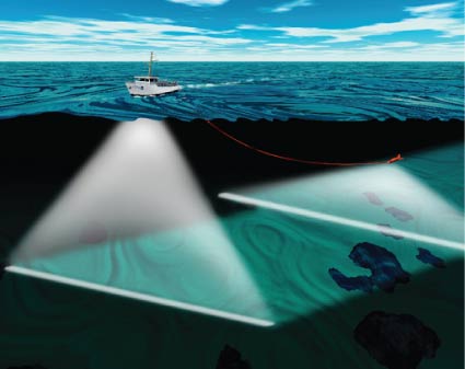
Hydrographic survey vessels use both a multibeam sonar and towed side scan sonar to map the seafloor.
HOST: I asked Cmdr. Jaskoski to talk about NOAA Ship Thomas Jefferson.
CMDR. JASKOSKI: It was built in 1991 as a Naval Oceanographic ship. It transferred to NOAA in 2003 and commissioned as Thomas Jefferson. We carry about 35 people aboard, of those 35 people around eight to 12 will be commissioned officers. The balance will be civilian mariners; mariner engineers, deck hands, survey technicians, and stewards. It’s 208 feet long, and 45 feet in the beam. It carries two hydrographic survey launches, which are small boats that we carry on the back of the ship that have the same capabilities as the ship and we can send into kinda shallower water or areas we may not want to send the ship. But the ship has a full suite of modern ocean mapping sonars. Both the launches have modern ocean mapping sonars.We have the ability to tow sonars as well.
HOST: I asked Tom if there will be any new technologies used during this mission.
LOEPER: Later in the summer, the University of New Hampshire will be bringing over what is called a DriX unit. It's a surface autonomous vehicle. Really they’ll be testing, to do some further testing, but eventually, they’d like to use that as a force multiplier. So Jefferson’s out there working, you have two survey launches working closer to the shore, and then you have this autonomous vehicle just driving back and forth for a week collecting data. That’s a whole lot of work that's being done that you are not devoting a whole ship and a crew too. So it's small, it's trailerable, and I think it can be completely operated from Jefferson. But it's a lot cheaper, a lot easier to have this autonomous unit survey instead of devoting all that ship time and personnel, and fuel, too. It's really there to just add to the capabilities of Jefferson.
HOST: Cmdr. Jaskoski shares how the data collected from these survey missions can be used for many different purposes.
CMDR. JASKOSKI: There’s lots of uses for ocean mapping data. They can be used for benthic mapping, for habitat mapping, for natural resources like fish, groundfish. There can be marine archaeological implications for some of the things that we find. Any data that we collect of a shipwreck is sent to the state historic preservation office to determine whether or not it's a historically significant wreck. The data we collect represents baseline, fundamental knowledge of the ocean and lakes. We also take bottom sample measurements to get kind of an idea, not only what the shape of the bottom is, but what the bottom is made out of. Some of our high resolution sonars can give us that acoustically as well. We get different shades for different types of bottom. There’s a lot of different information that's gathered from these hydrographic surveys aside from just the depth of the water and whether something is or is not a danger to surface navigation.
HOST: If you’d like to learn more about this survey mission, be sure to check out our show notes. Subscribe to us in your podcast player of choice, and dive into our episodes! This is the NOAA Ocean Podcast, thanks for listening.
From corals to coastal science, connect with ocean experts to explore questions about the ocean environment.
Social