Crew from the NOAA Ship Rainier assists in a current survey of waters near Sitka, Alaska. Results from current surveys are used to improve tidal current predictions and to support new operational forecast models.
Our planet is constantly changing in ways that impact every facet of our society. To keep coastal communities, economies, and ecosystems healthy requires keeping track of ocean and coastal areas—monitoring and assessing how these areas are changing.
From tracking contaminants in the water, assessing environmental change, monitoring sea-level rise, or surveying the coastline and coastal sea floor, NOS physical, chemical, and biological observations help coastal communities make the best decisions for them and for the environment.
An integrated system
Scientists all over the globe are monitoring how our planet is changing. They use tools, such as satellites, thermometers, and tide gauges, to collect observations. However, not all collected observations are in the same format, meaning they cannot be easily used together. Also, there are gaps in the information that is collected. Enter the U.S. Integrated Ocean Observing System, or IOOS®. Led by NOAA, IOOS brings together federal and non-federal people and technology, building a network to fill observing gaps. IOOS is also establishing standards for data collection, so that data can be used together and be more accessible to users. All of this means more information, which means a more comprehensive understanding of our planet.
Changing landscapes
Development, erosion, and other forces can alter the face of the coastal landscape. These changes can have implications for conservation, recreation, development, planning, and even safety. NOS uses a range of tools to monitor changes in the shape of the coast. For example, NOS uses Light Detection and Ranging (or LIDAR) technology to determine changes in coastal elevations. Satellite imagery and aerial photography are tools used by the Office for Coastal Management and the National Geodetic Survey to survey and create maps of our nation's shoreline and track land cover change over time.
Rising sea level
Sea level rise and other flood-related hazards can have potentially severe impacts. NOS helps coastal communities move beyond a "one size fits all" approach when analyzing and planning for these threats. For a start, NOS has been measuring sea level for over 150 years, with tide stations operating on all U.S. coasts. NOS also offers the Coastal Inundation Toolkit, which helps users of any technical skill level understand the causes of inundation, identify local vulnerabilities, and communicate risks. Another helpful tool is the Sea Level Rise and Coastal Flooding Impacts Viewer, which shows how various levels of sea level rise are likely to impact coastal communities.
Estuarine habitats
Estuaries are some of the most diverse and productive ecosystems in the world, supporting everything from fish, birds, and otters to mussels and plants. To monitor the health of these important habitats, NOS partners with 28 state-managed National Estuarine Research Reserves, which serve as living laboratories. One NERRS program is the System-Wide Monitoring Program. As part of this program, scientists collect information such as temperature, salinity, pH, biodiversity, and population characteristics at reserves across the country. Collected information helps changing reserve conditions in both the short and long terms and provide an important baseline for evaluating similar habitats outside reserve boundaries.
Oil spill response
Thousands of incidents occur each year in which oil or chemicals are released into the coastal environment. Spills into our coastal waters, whether accidental or intentional, can harm people, the environment, and the economy. To help, the Office of Response and Restoration has developed more than 3,300 Environmental Sensitivity Index (ESI) maps. These maps cover the majority of the U.S. coastline and include information on shoreline shape and biological and socioeconomic resources. The maps are used to rank sensitivity to oil impact, but can also be used in evaluating coastal-erosion potential and coastal-storm vulnerability and in monitoring coastal change.
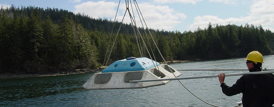
Safe navigation
America's ports are our lifelines for maritime commerce and the national economy. Inadequate or outdated navigational information would pose unacceptable risks to life, property, and coastal environments. To produce accurate charts for safe travels - for commercial and recreational vessels alike - the Office of Coast Survey conducts hydrographic surveys to measure water depths and locate elements that affect navigation. NOS also provides environmental observations and forecasts through programs such as the Physical Oceanographic Real-Time System to help mariners safely navigate in to port.
Benthic habitats
Benthic habitats support a wide variety of marine life, from corals and fish to clams, plants, and bacteria. The organisms in benthic habitats play important roles in ecosystem health by functioning as part of the ocean food web and helping to filter pollutants out of the water. Healthy habitats also play an important economic role by providing food, protecting areas from erosion, and sustaining tourism-related jobs. To map these habitats and assess how they are changing, NOS uses satellite and airborne sensors, acoustic imaging, photography, and benthic community analysis. Aerial photographs are also used to create maps of coral reefs and other habitats. And the Coastal and Marine Ecological Classification Standard provides a unifying framework allowing assessment of habitats on both a local and regional basis.
Protecting health
Our health is intricately connected to the health of the ocean. When water quality is poor, beaches dirty, or seafood tainted, communities, economies, and ecosystems all suffer. The National Centers for Coastal Ocean Science (NCCOS) monitors coastal contaminants and their effects on the local marine environment to identify problem areas that need attention. NOS also produces advance warnings of harmful algal blooms (HABs) and then provides science to monitor bloom development. HABs produce potent toxins, which can cause illness or death in humans and marine organisms.
Tide stations use advanced acoustics and electronics to monitor tides. Part of each station is a recorder which sends an audio signal down a half-inch-wide sounding tube and measures the time it takes for the reflected signal to travel back from the water's surface.
 An official website of the United States government.
Here's how you know we're official.
An official website of the United States government.
Here's how you know we're official.