How do we monitor tides?
Tide stations use advanced acoustics and electronics to monitor tides.

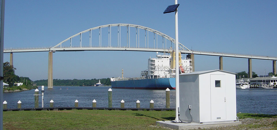
This image shows the Chesapeake City tide station, an active water level gauge that is part of NOAA's National Water Level Observation Network, located in Chesapeake City, Md.
The Center for Operational Oceanographic Products and Services maintains a total of 210 permanent, continuously operating water level stations throughout the U.S., including the Great Lakes.
Part of each station is a recorder which sends an audio signal down a half-inch-wide sounding tube and measures the time it takes for the reflected signal to travel back from the water's surface.
In addition to measuring tidal heights, these stations also record up to 11 different oceanographic and meteorological parameters including wind speed and direction, water current speed and direction, air and water temperature, and barometric pressure.
The stations collect data every six minutes with timing controlled by a Geostationary Operational Environmental Satellite (GOES). The stations also use these satellites to transmit their data every six minutes to NOAA headquarters. Field teams can quickly check and maintain the systems using laptop computers. In addition, all of the raw and processed data are available over the Internet.