Ocean Gliders Listen for Reef Fish Activity
Spawning activities in the western North Atlantic are the target of the latest ocean glider mission.

Listen up!
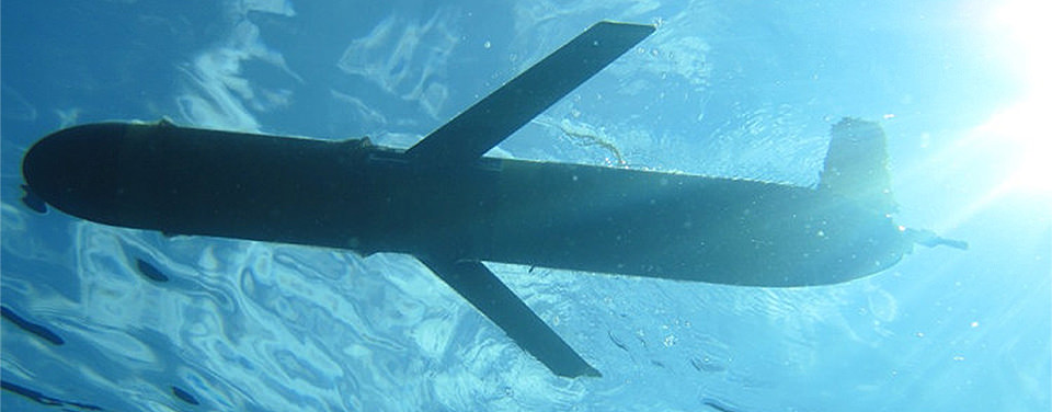
Slocum ocean gliders en route to collect sound and oceanographic data. Credit: C. Lembke, University of South Florida
This month, two autonomous ocean gliders are travelling the waters along the southeast U.S. coast and U.S. Caribbean to detect concentrations of reef fish activity around marine protected areas. The gliders collect sounds produced by several types of reef fish while they are aggregating and reproducing. Once these gliders are retrieved at the end of the month, NOAA scientists and partners will analyze the sound recordings and combine them with water temperature and current information to better understand reef fish spawning aggregations and habitat.
These buoyancy-based gliders travel through the ocean, undulating from the surface to the bottom collecting not only these sounds, but also water temperature, water quality, and currents information continuously for 30 days. The additional oceanographic data collected by the gliders will be used to validate regional ocean current models developed for the Gulf Stream and coastal currents along the U.S. Atlantic coast, Puerto Rico, and the U.S. Caribbean.
NOAA's National Centers for Coastal Ocean Science, NOAA's Integrated Ocean Observing Systems Program, and their partners are using glider missions to explore large areas of the ocean more efficiently and safely than operating large research vessels. As a low-risk method of collecting marine data at various depths, gliders are revolutionizing ocean observations.
Get Social
More Information
Did you know?
Ocean gliders also collect data on ocean conditions to help improve scientists’ understanding of hurricanes and pave the way for future improvements in hurricane intensity forecasts.
