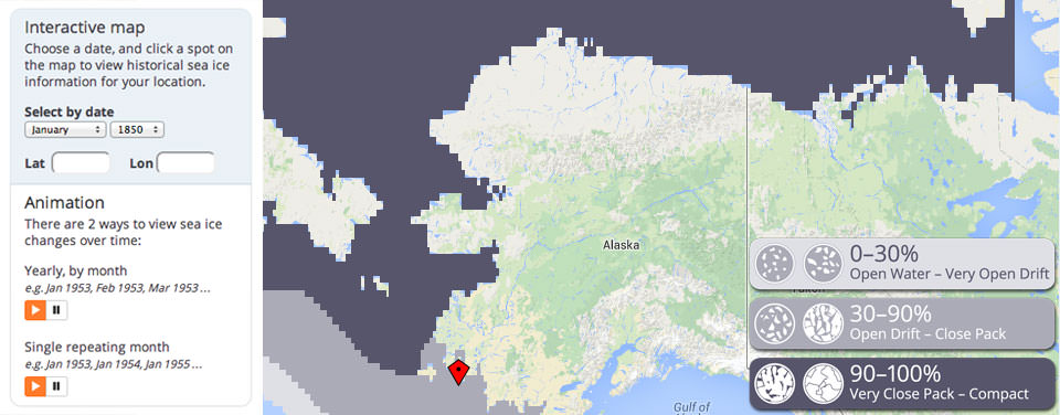
Digital Atlas Shows Alaska Sea Ice History Since 1850
New online atlas combines ten historical data sets into one user-friendly web location.

Shifting Patterns
For the first time, you can simultaneously view multiple sources of historical sea ice data from the oceans surrounding northern Alaska. Choose a region and time of interest and inspect a map of data collected between the mid-1800s and today to discover how ice extent and concentration have changed over time.
Want to know how much of the Beaufort Sea was covered in ice in January 1850? You can now do so, thanks to a new website developed with support from the Alaska Ocean Observing System (AOOS), a region of the NOAA-led U.S. Integrated Ocean Observing System (IOOS®).
The new portal is a result of a collaboration with the Alaska Center for Climate Assessment and Policy (ACCAP), the Scenarios Network for Alaska and Arctic Planning (SNAP) and AOOS . It is the first digital atlas of historical sea ice concentration for Alaska's Beaufort, Chukchi, and Bering seas, and allows users to view and download sea ice concentration data from 1850 to the present. This objective, historical record of sea ice conditions spans nearly two centuries and provides researchers with a reliable tool to evaluate climate change impacts.
A Visualization Tool
The data powering the tool comes from more than ten different sources, including the satellite record (1979-present), various U.S. Naval and National Ice Center compilations (1950s to 1990s), Canadian records (1950s to 1980s), Danish and Norwegian ship records (mid-1800s to 1970s), and whaling ship reports (1850-1900).
Users can select particular dates and locations, and watch animations of how open water seasons have varied in time and space. Requests for data can also be processed in graphic or map formats. Additionally, the atlas includes a detailed glossary on types of sea ice and information on original data sources and how the data were compiled.
Times Scales of Variability
One of the objectives of the project is to offer researchers a reliable tool to find time scales of variability, such as whether there is a 20-year cycle in sea ice. "That is a research question. Researchers want to know about it scientifically," said project lead John Walsh, University of Alaska Fairbanks. "If you only have 30 years of data, it's really hard to say there is a 20-year cycle. But when you get to 160 years, you can start to see if any cycles hold up over time, whether they are reliable, robust enough to be considered real."
Walsh points out, however, that the data represents "snapshots" in time, as well as historical trends in arctic sea ice cover and extent. They are not projections or predictions of future conditions, nor is the atlas designed for forecasting or prediction, but it can provide useful historical context for future planning efforts.
"This is an excellent example of bringing together, in one location and in a common format, data that can inform not only researchers and coastal resource managers, but the general public as well," said Zdenka Willis, director of the NOAA-led U.S. IOOS Program.
Users of the site could range from coastal community residents, fishermen and hunters; the oil and gas energy industries; military and maritime shipping agencies; and scientists. It can be a powerful educational classroom tool as well. AOOS will soon be integrating these data layers into their statewide portal so users can view them alongside real-time conditions, forecast models, and a variety of GIS data.
Get Social
More Information
Did you know?
The sea ice atlas supports NOAA's efforts to develop a national Integrated Ocean Observing System for tracking, predicting, managing, and adapting to changes in the marine environment. IOOS delivers data and information needed to increase understanding of the nation's waters to improve safety, enhance the economy, and protect our environment. Learn more about IOOS
