Are we cleared to land?
How the Wright Brothers influenced NOAA's mission.

First Flight
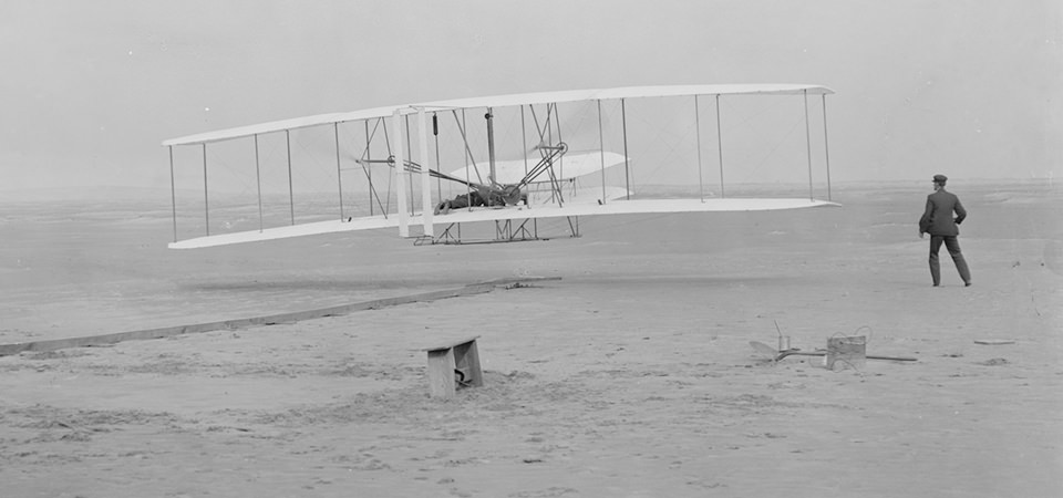
This photograph shows the first powered, controlled, sustained flight. Orville Wright at the controls of the machine, lying prone on the lower wing with hips in the cradle which operated the wing-warping mechanism. Wilbur Wright running alongside to balance the machine, has just released his hold on the forward upright of the right wing. Today, we fly using technological advances that the Wright Brothers only could have imagined. Millions of people board airplanes, confident that pilots will guide them safely to their destinations. But safe navigation begins well before the pilot even touches the plane's controls; it begins with the runway. That's where NOAA comes in.
In a span of 12 seconds on December 17, 1903, two men near the town of Kitty Hawk, North Carolina, changed the course of history. It was there that Wilbur Wright ran alongside a huge flying machine—using his bare hands to stabilize the craft—while his brother Orville wrestled with the plane's primitive controls. Finally, with chilly winds blowing, their invention took flight from Kill Devil Hills amid swirling sand and cheers from the crowd.
The first flight covered 120 feet (39 meters). By the fourth flight of the day, Wilbur flew 852 feet (279 meters) in 59 seconds. All four flights reached an altitude of about 10 feet (3.04 meters) above the ground.
Those fleeting flights were the first of many by the famous Wright Brothers. In the two years after these historic flights, the brothers developed their flying machine into the world's first practical fixed-wing aircraft.
Today, we fly using technological advances that the Wright Brothers only could have imagined. Millions of people board airplanes, confident that pilots will guide them safely to their destinations. But safe navigation begins well before the pilot even touches the plane's controls; it begins with the runway.
Airport runways play a major role in safe navigation. Pilots and air traffic controllers use the runway to guide planes for safe departures and arrivals, but few people realize how much work and preparation it takes to ensure passenger safety.
The Aeronautical Survey Program administered through NOAA provides the highly accurate position, height, and orientation information needed for safe air navigation. NOAA's National Geodetic Survey has performed aeronautical surveys since the 1920s. The surveys provide critical information about airport features, obstructions, and aids to navigation.
The Federal Aviation Administration uses this information to establish airport approach and departure procedures, determine maximum takeoff weights, update aeronautical publications, and for airport planning and construction studies.
Get Social
More Information
It's a fact!
The National Geodetic Survey's Aeronautical Survey Program, part of the National Ocean Service, provides highly accurate position, height, and orientation data needed for safe air navigation.
