U.S. flag An official website of the United States government.

dot gov icon Official websites use .gov

A .gov website belongs to an official government organization in the United States.

https icon Secure websites use HTTPS

A small lock or https:// means you’ve safely connected to a .gov website. Share sensitive information only on official, secure websites.

Port of Corpus Christi Channel Improvement

Case Study: Improving maritime commerce in a changing climate.

Port of Corpus Christi in Texas

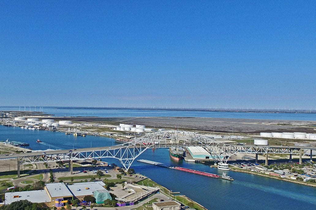
The inner harbor of the Port of Corpus Christi, Texas. Credit: Port of Corpus Christi

The Port of Corpus Christi Ship Channel Improvement Project, slated for final completion in early 2025, caps a 30-year effort to improve the largest gateway in the nation for U.S. energy exports. Here are a few examples highlighting NOAA's roles in helping to make the Port of Corpus Christi, Texas, a more efficient shipping hub. However, the success of this multi-decade effort depended upon and continues to rely on the work of many federal, state, and commercial partners.

  • Establishing a new PORTS. In Corpus Christi, strong currents in Corpus Christi Bay make it difficult for vessels to navigate. A majority of the vessels coming into the port are carrying hazardous materials, such as liquid natural gas, crude oil and other chemicals. Based on these challenges,the port authority partnered with NOAA to establish a requested Physical Oceanographic Real Time System, or PORTS®. This system offers mariners the opportunity to add other real-time oceanographic and meteorological observations with real-time current meters to safely reach and depart the seaport. This Corpus Christi PORTS, NOAA’s 32nd such system, was established in 2018 through a partnership with the Port of Corpus Christi Authority (PCCA). Knowing the currents, water levels, and winds can enable shippers to optimize cargo loads so that vessel captains and pilots are using every inch of available channel depth safely, maximizing profits and efficiency. Just one additional inch of usable draft can translate into millions of dollars of additional cargo per vessel transit.
  • Building a better PORTS to account for channel improvements. The Port of Corpus Christi’s channel improvement project created additional capacity for the increased frequency of the Very Large Crude Carrier ships calling on the port. The port expansion also included the construction of a new oil terminal. As the port grew, so did concerns about navigational safety, and the port deemed necessary an expansion of the NOAA Corpus Christi PORTS system. In 2019, the Port of Corpus Christi Commission approved funding for the expansion of the Corpus Christi PORTS system and funded the procurement, installation, operations, and maintenance of an additional 10 new observing stations to its PORTS network. This expansion built out the existing Corpus Christi PORTS. In 2022, CO-OPS signed an additional five-year Memorandum of Agreement with PCCA, and partnered with the Coastal Bend Bays & Estuarine Program to integrate one water level and meteorological station at the south end of Nueces Bay in the Corpus Christi PORTS. As of late 2022, all enhanced stations were declared operational and are publicly accessible online. These additional real-time oceanographic and meteorological collection data systems provide users with real-time information necessary for the safe and efficient transit of vessels into and out of the Port of Corpus Christi.
  • Maximizing the use of deeper, wider channels with NOAA's marine navigation infrastructure. In addition to the expanded PORTS at this location, NOAA’s marine navigation information infrastructure allows mariners to maximize the use of newly deepened and widened navigation channels and harbors. NOAA’s National Water Level Observation Network (NWLON) delivers real-time water level observations and allows for the provision of updated tidal datums and tide predictions. NOAA’s National Current Observation Program updates tidal current predictions for harbors affected by new dredging. And NOAA’s Operational Forecast Systems offer nowcast and forecast model guidance critical for planning safe and efficient marine navigation.
  • Updated Electronic Navigational Charts delivered in three weeks. Upon completion of the most recent portion of the channel improvement project, the Office of Coast Survey expedited review and application of the U.S. Army Corps of Engineers (USACE) bathymetric data. As a result, NOAA’s official nautical charts for the port were updated in only three weeks. This update to NOAA’s electronic navigational charts allowed the U.S. Coast Guard to permit deeper draft vessels through the port and realized the full value of the taxpayers’ investment in this project. With NOAA’s updated charts aboard, the first U.S. export of crude carrier at 47’ draft sailed Friday, July 21st, 2023. The four feet of additional draft corresponded to about 50,000 barrels of additional oil aboard, worth approximately $3.9 million.