Infographic Transcripts
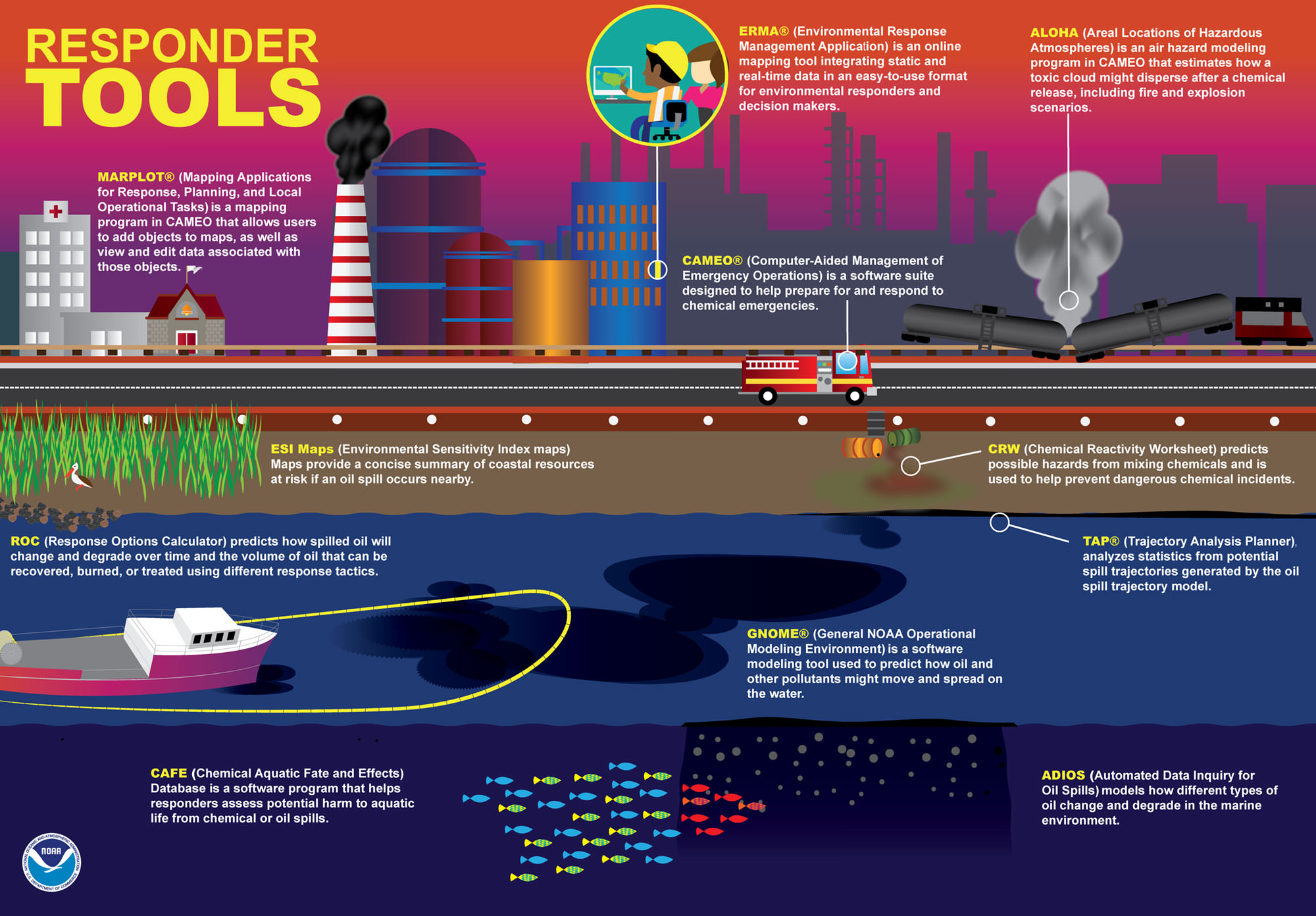
Since the 1988 debut of CAMEO — software that NOAA developed in partnership with the U.S. Environmental Protection Agency — NOAA established itself as the go-to agency for HAZMAT modeling and simulations. This graphic illustrates the variety of tools used by NOAA and partners for hazardous material modeling and simulations.
- CAMEO® (Computer-Aided Management of Emergency Operations) is a software
- MARPLOT® (Mapping Applications for Response, Planning, and Local Operational Tasks) is a mapping program in CAMEO that allows users to add objects to maps, as well as view and edit data associated with those objects.
- ERMA® (Environmental Response Management Application) is an online mapping tool integrating static and real-time data in an easy-to-use format for environmental responders and decision makers.
- ALOHA (Areal Locations of Hazardous Atmospheres) is an air hazard modeling program in CAMEO that estimates how a toxic cloud might disperse after a chemical release, including fire and explosion scenarios.
- ESI Maps (Environmental Sensitivity Index maps) provide a concise summary of coastal resources at risk if an oil spill occurs nearby.
- CRW (Chemical Reactivity Worksheet) predicts possible hazards from mixing chemicals and is used to help prevent dangerous chemical incidents.
- ROC (Response Options Calculator) predicts how spilled oil will change and degrade over time and the volume of oil that can be recovered, burned, or treated using different response tactics.
- GNOME® (General NOAA Operational Modeling Environment) is a software modeling tool used to predict how oil and other pollutants might move and spread on the water.
- CAFE (Chemical Aquatic Fate and Effects) database is a software program that helps responders assess potential harm to aquatic life from chemical or oil spills.
- ADIOS (Automated Data Inquiry for Oil Spills) models how different types of oil change and degrade in the marine environment.
Responding to Oil Spills on Shore
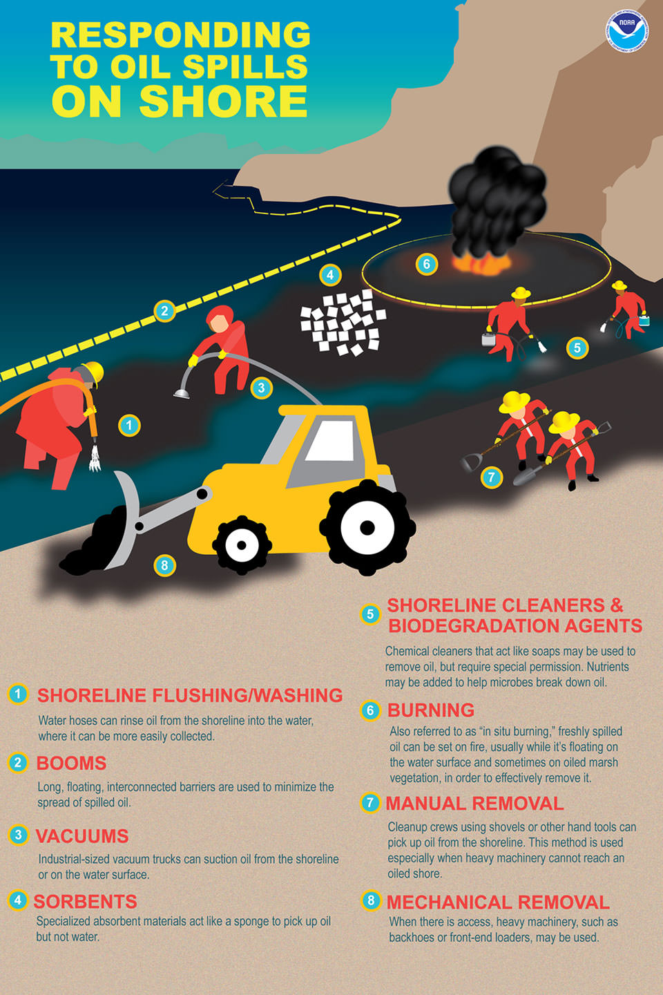
This graphic depicts workers responding to an oil spill along the coast using various tools. The following are different tools used for shoreline spill cleanup:
- 1. Shoreline Flushing/Washing: Water hoses can rinse oil from the shoreline into the water, where it can be more easily collected.
- 2. Booms: Long, floating, interconnected barriers are used to minimize the spread of spilled oil.
- 3. Vacuums: Industrial-sized vacuum trucks can suction oil from the shoreline or on the water surface.
- 4. Sorbents: Specialized absorbent materials act like a sponge to pick up oil but not water.
- 5. Shoreline Cleaners & Biodegradation Agents: Chemical cleaners that act like soaps may be used to remove oil, but require special permission. Nutrients may be added to help microbes break down oil.
- 6. Burning: Also referred to as "in situ burning," freshly spilled oil can be set on fire, usually when it's floating on the water surface and sometimes on oiled marsh vegetation, in order to effectively remove it.
- 7. Manual Removal: Cleanup crews using shovels or other hand tools can pick up oil from the shoreline. This method is used especially when heavy machinery cannot reach an oiled shore.
- 8. Mechanical Removal: When there is access, heavy machinery, such as backhoes or front-end loaders, may be used.
Responding to Oil Spills at Sea
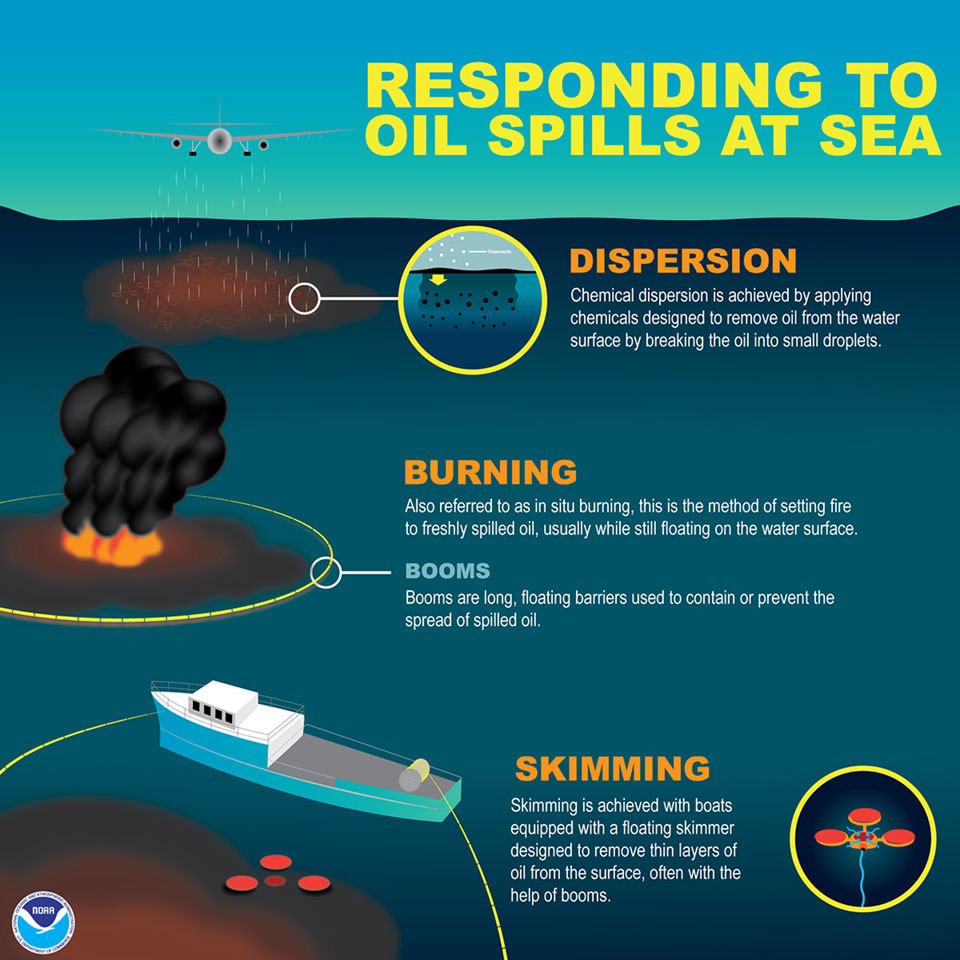
The following graphic describes a few methods used to respond to oil spills that occur in the open ocean:
- 1. Dispersion: Chemical dispersion is achieved by applying chemicals designed to remove oil from the water surface by breaking the oil into small droplets.
- 2. Burning: Also referred to as "in situ burning," this is the method of setting fire to freshly spilled oil, usually while still floating on the water surface.
- 3. Booms: Booms are long, floating barriers used to contain or prevent the spread of spilled oil.
- 4. Skimming: Skimming is achieved with boats equipped with a floating skimmer designed to remove thin layers of oil from the surface, often with the help of booms.
 An official website of the United States government.


Social