Where do I get real-time and forecast coastal conditions?
National coastal conditions are available online with NOAA's nowCOAST™

Heading out on the water? Visit nowCOAST to view real-time and forecast tides, winds, currents, and much more.
Did you know?
There are two versions of nowCOAST: one version is for use by the general public and one version is enhanced for mariners. The map for mariners adds many additional features, such as raster and electronic nautical chart (RNC/ENC) underlays, National Weather Service coastal marine zone forecasts, and offshore weather observations from ships and buoys. Look for the button in the upper right corner of the application to choose which version you would like to view.
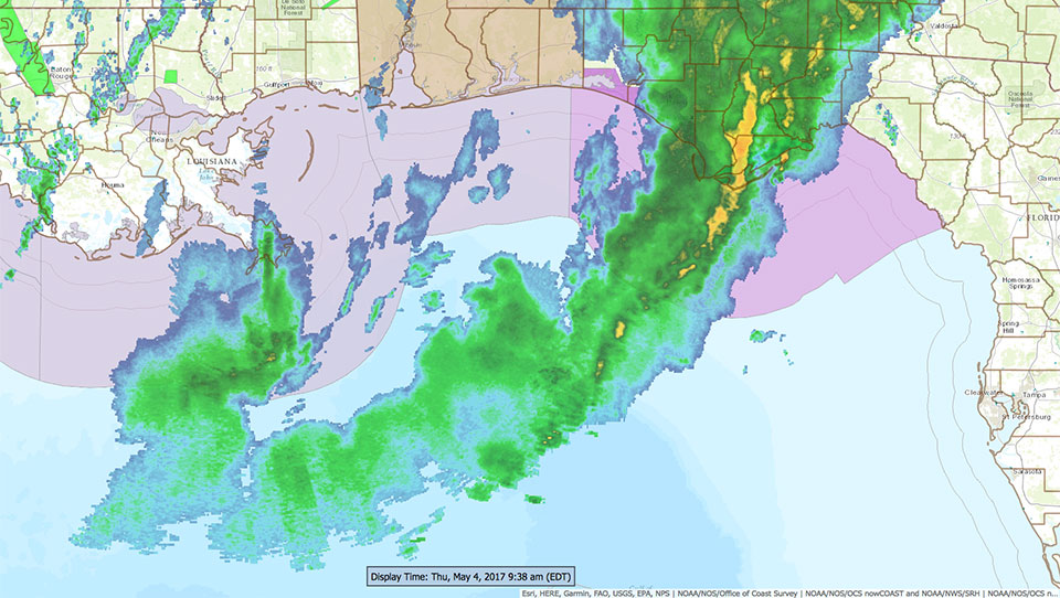
NOAA's nowCOAST is a GIS-based webmap service that provides frequently updated weather and ocean observations along with coastal and marine weather forecasts 24 hours a day. The free online map viewer offers point-and-click access to 60 NOAA data products and services all in one place. With nowCOAST, you can get a one-stop-shop look at coastal conditions — real-time and forecast — before you do or plan anything on the water.
The nowCOAST map viewer displays animated observations for the past four hours and forecasts for the next seven days. The map incorporates data from NOAA's National Ocean Service; National Weather Service; and National Environmental Satellite, Data, and Information Service. Data includes watches, warnings, and advisories for hazardous weather and marine weather conditions such as special marine warnings and gale warnings — even far offshore. It also provides near-real-time weather radar data, weather satellite imagery, and lightning strike density data for both land and overwater areas, sea surface temperature analyses, and predictions from NOAA’s ocean forecast models. Advanced users may also ingest maps of NOAA data and predictions directly into third-party applications using nowCOAST web map services.
NowCOAST is an ArcGIS-based web mapping application developed by NOAA's Coast Survey Development Laboratory and hosted in NOAA's Integrated Dissemination Program Infrastructure operated by the National Weather Service's National Centers for Environmental Prediction.
Social