What is geocaching?
Geocaching is an outdoor treasure-hunting activity that uses GPS-enabled devices.
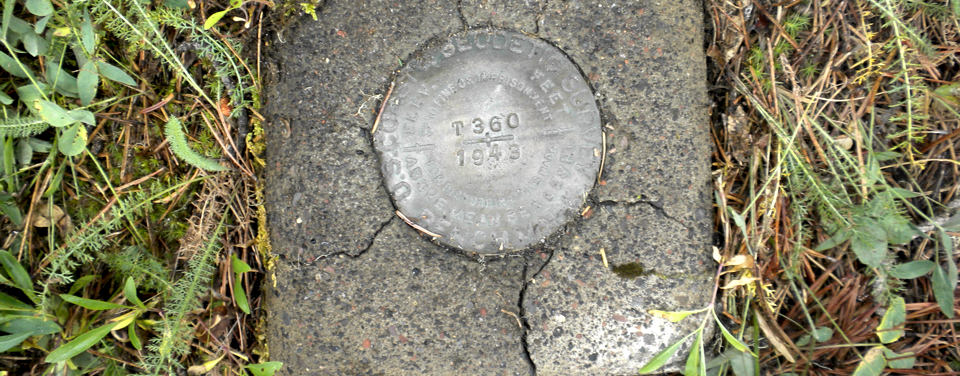
In geocaching, participants navigate to a specific set of GPS coordinates and then attempt to find the "geocache," (usually a container or marker) at that location. The survey mark shown here illustrates how some caches may be hard to spot, even if you have the coordinates!
Geocaching is an outdoor treasure-hunting activity that uses Global Positioning System (GPS)-enabled devices. It can also be a valuable public service.
Geocachers often look for benchmarks—a type of survey mark—that make up the National Spatial Reference System (NSRS), the foundation for all mapping and surveying activities in the United States. NOAA’s National Geodetic Survey (NGS) defines and maintains the NSRS. For more than 200 years, NGS and its predecessor agencies have collaborated with surveyors in both the public and private sectors to place benchmarks across the nation. More than 1.5 million of them were placed from the 1920s to the 1980s!
A benchmark is a brass, bronze, or aluminum disk set in bedrock or concrete. This collection of markers forms a network that surveyors use to accurately position other geographic points of interest. This ensures that everything “matches up” when people produce maps, mark off property boundaries, and plan, design, and build structures, roads, and bridges.
Since many NSRS benchmarks are nearly a century old, NGS wants to know when geocachers find a benchmark. Many have been disturbed and reset through the years, and as many as half of them may have been destroyed by construction projects. A geocacher who finds a benchmark, measures its coordinates with a handheld GPS device, and reports the find to the National Geodetic Survey is performing a valuable public service.
Search Our Facts
Get Social
More Information
Did you know?
You can help keep the National Spatial Reference System up to date! If you find a survey marker during your travels, let us know about the markers' condition using our online form.

Last updated: 06/16/24
Author: NOAA
How to cite this article