What is the difference between a hurricane and a typhoon?
The only difference between a hurricane and a typhoon is the location where the storm occurs.

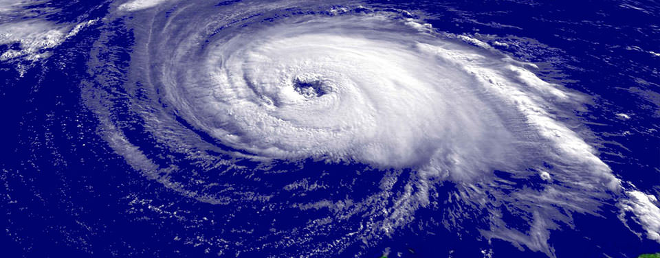
A close-up satellite image of Hurricane Isabel taken on Sept. 15, 2003. The National Ocean Service helps coastal communities prepare for and recover from major coastal storms such as hurricanes.
Hurricanes and typhoons are the same weather phenomenon: tropical cyclones. A tropical cyclone is a generic term used by meteorologists to describe a rotating, organized system of clouds and thunderstorms that originates over tropical or subtropical waters and has closed, low-level circulation.
The weakest tropical cyclones are called tropical depressions. If a depression intensifies such that its maximum sustained winds reach 39 miles per hour, the tropical cyclone becomes a tropical storm. Once a tropical cyclone reaches maximum sustained winds of 74 miles per hour or higher, it is then classified as a hurricane, typhoon, or tropical cyclone, depending upon where the storm originates in the world. In the North Atlantic, central North Pacific, and eastern North Pacific, the term hurricane is used. The same type of disturbance in the Northwest Pacific is called a typhoon. Meanwhile, in the South Pacific and Indian Ocean, the generic term tropical cyclone is used, regardless of the strength of the wind associated with the weather system.
The ingredients for tropical cyclones include a pre-existing weather disturbance, warm tropical oceans, moisture, and relatively light winds. If the right conditions persist long enough, they can combine to produce the violent winds, large waves, torrential rains, and floods we associate with this phenomenon. At times, when a weather system does not meet all of these conditions, but is forecast to bring tropical storm or hurricane force winds to land in the next day or two, it is called a potential tropical cyclone in the Atlantic basin and the central and eastern North Pacific basins.
In the Atlantic, hurricane season officially runs from June 1 to November 30. Ninety-seven percent of tropical cyclone activity occurs during this time period. However, there is nothing magical about these dates. Hurricanes can and do occur outside of this six month period.
Learn moreGet Social
More Information
Did you know?
The main parts of a tropical cyclone are the rainbands, the eye, and the eyewall. Air spirals in toward the center in a counter-clockwise pattern in the northern hemisphere (clockwise in the southern hemisphere), and out the top in the opposite direction. In the very center of the storm, air sinks, forming an "eye" that is mostly cloud-free.

Last updated: 06/16/24
Author: NOAA
How to cite this article