November is National American Indian Heritage Month, a time set aside to pay tribute to the rich ancestry and traditions of Native Americans. The Library of Congress, National Endowment for the Humanities, National Gallery of Art, National Park Service, and Smithsonian Institution are just a few of the many organizations participating with special programs.
NOAA’s support happens on a daily basis, as the agency is responsible for enforcing the Coastal Zone Management Act, legislation that dictates national standards for the stewardship and conservation of coastal resources. NOAA partners with state agencies and tribes to protect the natural resources that often represent the foundation of tribal communities and their traditions. Some examples are provided below.
Wild Rice Initiative
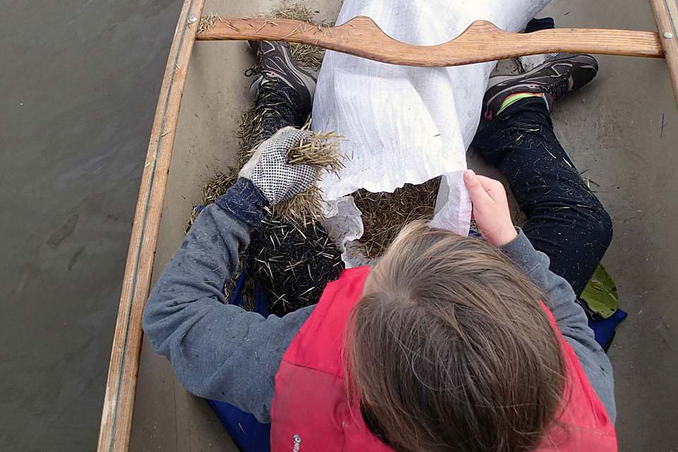
A student helps plant manoomin (wild rice) at Lake Superior National Estuarine Research Reserve. Credit: Lake Superior Reserve
Oral tradition says a prophecy was fulfilled when the Anishinaabeg — also known as Chippewa and Ojibwe people — left their East Coast home and found abundant wild rice growing in Lake Superior’s wetlands. Wild rice, known as manoomin, is one of the first foods the Anishinaabeg feed their babies and a traditional dish for funeral mourners. Many factors have disrupted tribal harvests, but the tribes and NOAA’s Great Lakes state coastal management programs and research reserves are working with a large group of partners to preserve and restore wild rice through workshops, data mapping, funding, and education.
Projects are ongoing in Minnesota, Wisconsin, and Michigan’s Upper Peninsula. Efforts include participatory mapping exercises that combine tribal knowledge of wild rice locations with NOAA’s satellite and aerial-based land cover data; wild rice camps led by tribal groups to educate people on harvesting, cooking tips, and regulations; and potential funding for tribal agencies and communities to uncover new findings on procuring and restoring wild rice, understanding its cyclical seasons, and making it more resilient.
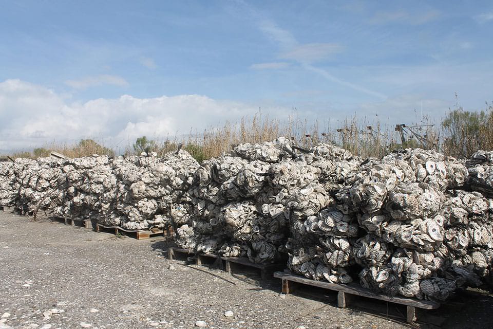
Near Pointe-aux-Chenes, Louisiania, community members and volunteers built a 400-foot reef of recycled oyster shells to protect against erosion and rising waters. Credit: Coalition to Restore Coastal Louisiana
For centuries along Louisiana’s Gulf Coast, Pointe-au-Chien tribal members cultivated livestock, family fisheries, and lands rich in fruit trees and vegetable gardens. Waterlogged properties and a vanishing shoreline are jeopardizing the community’s culture and economy. Striving to reverse this trend, remaining community members and volunteers built a 400-foot reef of recycled oyster shells to protect against erosion and rising waters.
This multi-partner project was made possible by a NOAA grant. As oyster larvae and other types of marine life attach to shells, the reef will grow in both height and protective strength. Water quality will rise, too, as one oyster can filter up to 75 gallons of water daily. The shells also help protect sacred tribal mounds that date back to 900 B.C.E.
Disaster Prevention and Response
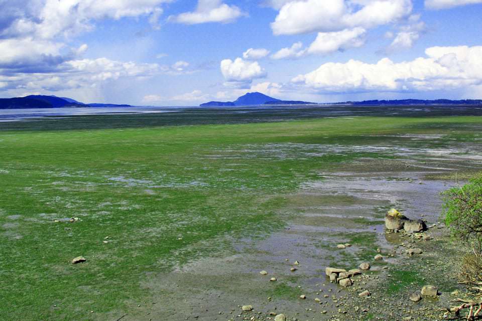
Padilla Bay National Estuarine Research Reserve is home to an 8,000 acre eelgrass meadow, an area of significance to local tribes. Credit: Padilla Bay Reserve
Sitting on two sides of Washington State’s Padilla Bay are oil refineries, oil and natural gas pipelines, a railroad that transports oil, and a highway that carries trucks loaded with refinery products. Coordinated oil-spill prevention and response is vital to protect the area’s natural resources. A recent disaster-response initiative that included the local Samish Indian Nation and the Swinomish Tribe is making a difference.
Through the initiative a digitized navigation map that helps responders wind their way through the bay’s sinuous channels was developed. A land-based tour of all places where oil-spill equipment, collection, and strategizing occur will occur to help responders and partners understand how different times of year, tides, wind directions, and water-level conditions can affect spill-response.
Oil-industry experts led group role-played disaster scenarios to allow people to practiced using a data system for reporting and documenting emergency incidents. NOAA also provided information about damage assessments and oil-spill protocols.
The Padilla Bay region features the second-largest eelgrass meadow on North America’s Pacific Coast, and tribal fishing and hunting areas depend upon its health. NOAA and the state partner coastal management program, the Washington Department of Ecology, participated.
 An official website of the United States government.
Social