Dedicated to the
memory of NOAA Corps Rear Adm. Richard T. Brennan, a passionate hydrographer, deeply committed to understanding and
limiting the environmental impacts of NOAA’s ocean and coastal mapping mission.Learn
More
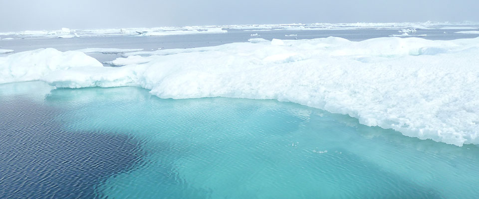
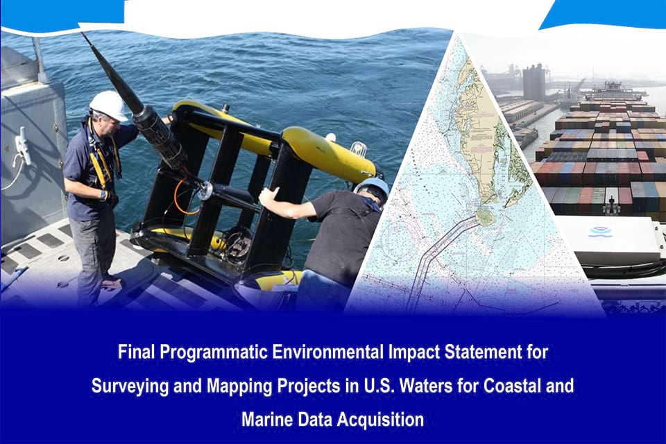
Surveying and Mapping Projects in U.S. Waters for Coastal and Marine Data Acquisition
Welcome to the National Ocean Service website for the Final
Programmatic Environmental Impact Statement for Surveying and Mapping Activities in U.S.
Waters for Coastal and Marine Data Acquisition.
The National Oceanic and Atmospheric Administration (NOAA) National Ocean
Service (NOS) is the country’s leading authority on a wide
variety of marine sciences, including hydrography; shoreline mapping; nautical charting; and water
level, tides, and currents measurement.
Learn more about the NOS NEPA process for surveying and mapping
activities, including compliance with other environmental regulations and executive
orders.
NOS has prepared a Final Programmatic Environmental Impact
Statement (PEIS), in accordance with the National
Environmental Policy Act (NEPA), to analyze the potential environmental impacts associated
with NOS recurring surveys and other related data collection throughout the U.S. and its
territories. Data obtained from these projects are needed to produce charts and maps that are relied
upon by mariners, scientists, shipping and fishing industries, and countless other users in the U.S.
and beyond. The Proposed Action for the Final PEIS is to perform a wide variety of data collection
field
activities, including hydrographic surveys and habitat surveys (performed from crewed vessels or
remotely-operated or autonomous vehicles), and to install tide gauges and other instruments and
equipment. Field work may be performed by field crews from NOS program offices, other NOAA personnel on behalf of NOS, contractors, grantees, or permit/authorization holders.
Purpose and Need
The purpose of the Proposed Action is to gather accurate and timely data on the marine and coastal
environment. The need for the Proposed Action is to provide the public and private sectors with
nautical charts, benthic habitat condition maps, current and tide charts, and other products
necessary to ensure safe navigation, economic security, and environmental sustainability. Select a
topic below to learn more about each of these key components.
NOAA has identified 500,000 square nautical miles as “navigationally-significant waters”
which are in
greatest need of modern surveying. NOS uses survey data to create products that support
safe
navigation for commercial shipping, the fishing industry, recreational boaters, and
military and
government functions such as law enforcement.
Shipping on the nation’s network of coastal waterways, navigable channels, ports, and
marine terminals is a primary mode of moving goods around the country and connects the
U.S. to the global marketplace. Port authorities, mariners, and coastal communities
depend on accurate navigational information provided by NOS to make informed decisions
that support the U.S. economy.
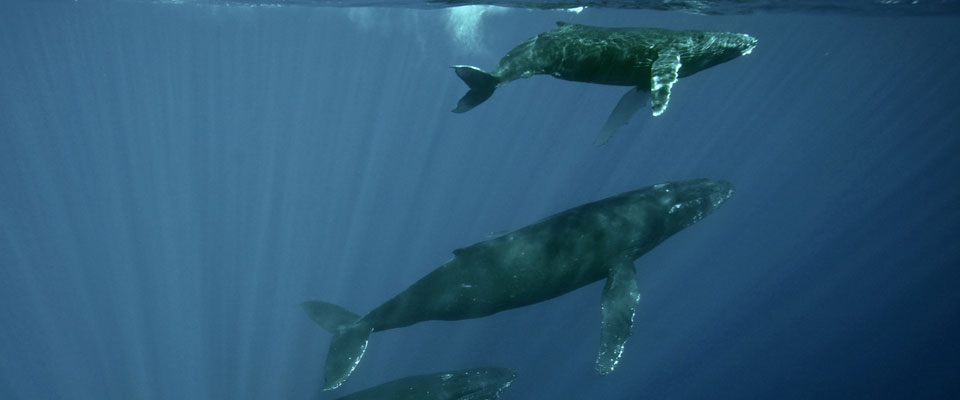
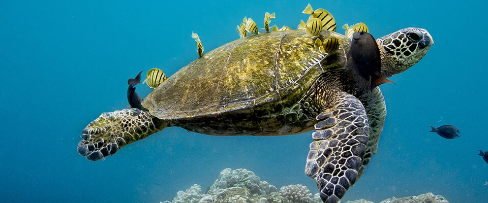
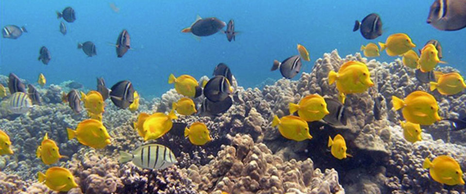
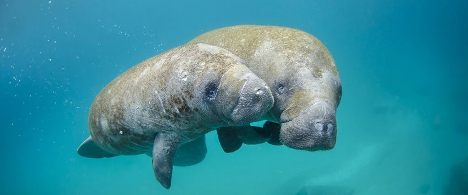
NOS coastal and marine data also support ecosystem stewardship. Survey data enable
marine resource managers to conserve, preserve, and restore ecological resources,
including critical habitat for endangered seabirds, coral, fish, sea turtle,
and marine mammal species.
Scope
Scope refers to both the geographic and temporal range of the Proposed Action. Geographic scope is
the spatial extent of the areas potentially affected by the Proposed Action. Temporal scope is the
timeframe over which the Proposed Action is evaluated. NOS determined the scope of this document on
the basis of the current extent of NOS project work and the ability of NOS program offices to
reliably predict their future level of activity.
The geographic scope is the “action area” for this Final PEIS. The “action area”
encompasses the U.S. territorial sea; the contiguous zone; the U.S. Exclusive Economic Zone; rivers; states’ offshore waters; and coastal and riparian lands for projects such as the installation,
maintenance, and removal of tide gauges. This includes the U.S. portions of the Great Lakes and
internal waters such as Lakes Tahoe, Mead, Champlain, Okeechobee, and parts of major rivers. The
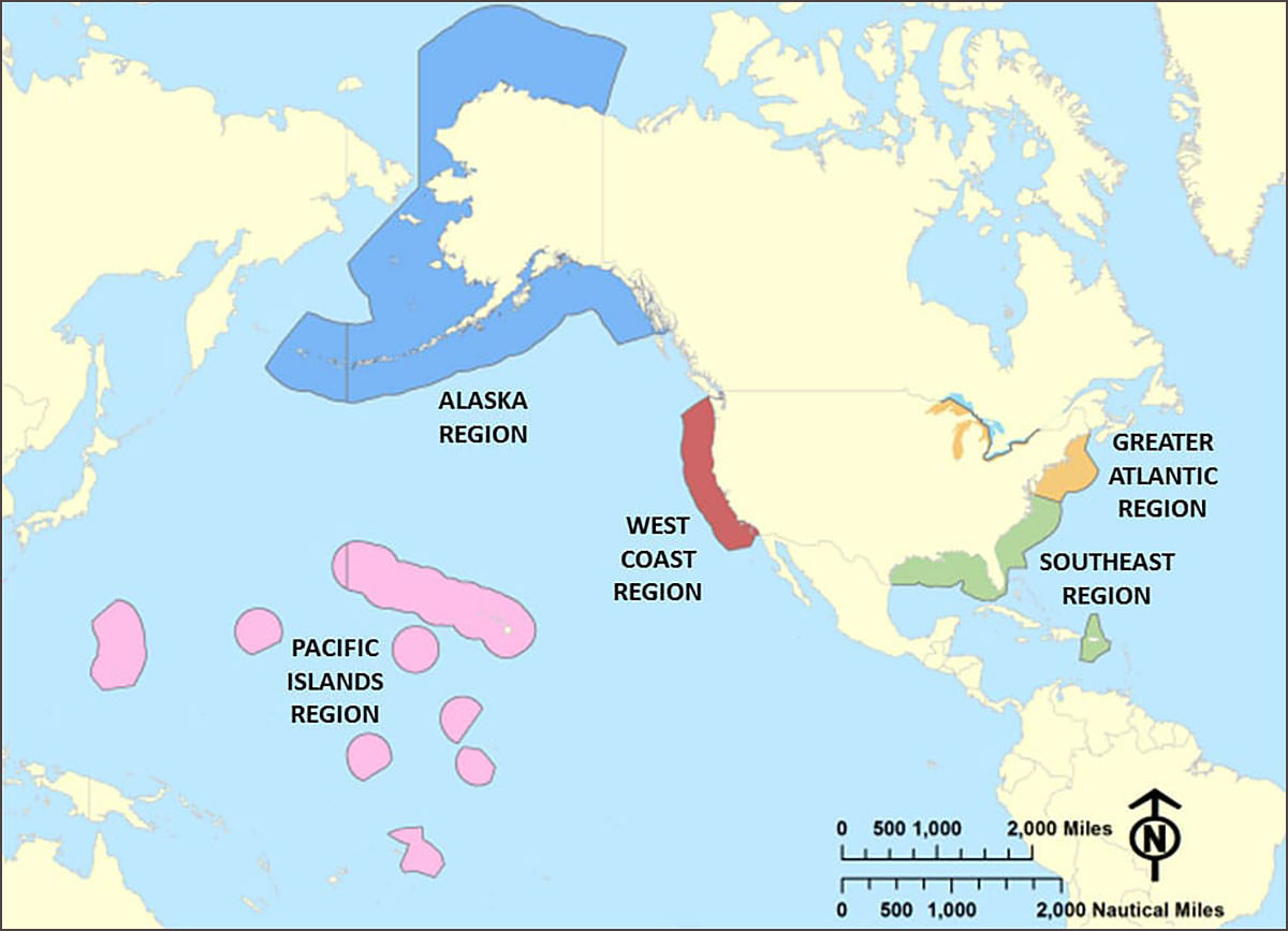
action area is organized into five regions: Greater Atlantic Region, Southeast Region, West Coast
Region, Alaska Region, and Pacific Islands Region.
This illustration shows the five regions of U.S. waters that make up the "action area"
for
this proposed action.
The temporal scope of the Proposed Action covers a time period of five years, 2023
through 2027. As with any planning process, the confidence with which an agency can foresee and
evaluate its actions, and the environmental effects of those actions, decreases at longer time
intervals. Changes in spending levels, the environment, the data needs of the public, and
technologies and field methods available to NOS can all change how surveying projects are executed.
For the purposes of this Final PEIS, a specific project could take place at any time of year.
Consistent with Council on Environmental Quality (CEQ) guidance that “[NEPA documents] that are more
than five years old should be carefully reexamined to determine if the criteria in Section 1502.9
compel preparation of a [NEPA] supplement.” NOS intends to reevaluate the Final PEIS to
determine if the analysis contained within remains sufficient, or if new analysis is required. If
necessary, this new analysis may take the form of a supplemental PEIS, a new PEIS, or more extensive
project-level analysis.
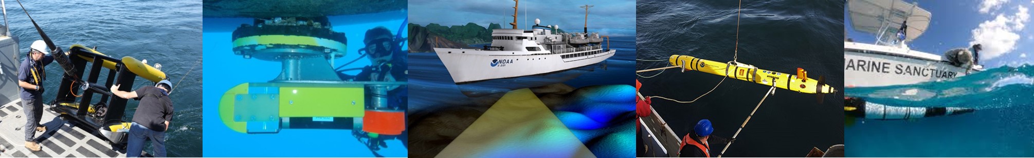
NOS Surveying and Mapping Activities
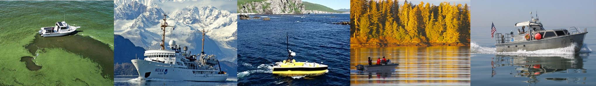
NOS surveying and mapping activities use a variety of equipment and technologies to
gather accurate and timely data on the nature and condition of the marine and coastal environment,
including:
Crewed Vessel Operations
Anchoring
Operation of Remotely Operated Vehicles (ROVs), Uncrewed Surface Vehicles
(USVs), and Autonomous Underwater Vehicles (AUVs)
Use of Echo Sounders
Use of Acoustic Doppler Current Profilers (ADCPs)
Use of Acoustic Communication Systems
Use of Sound Speed Data Collection Equipment
Operation of Drop/Towed Cameras and Magnetometers
Collection of Bottom Grab Samples
Use of Passive Listening Systems
SCUBA Operations
Installation, Maintenance, and Removal of Tide Gauges
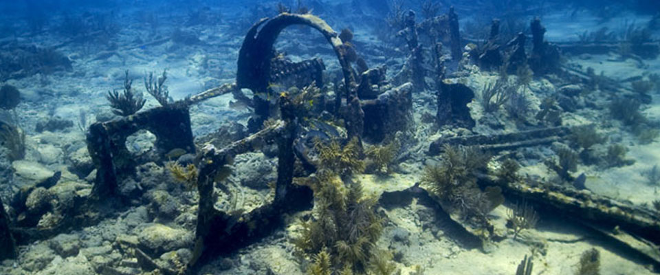
Many of the NOS projects addressed in the Final PEIS include the use of underwater acoustic sound sources to
perform surveys for nautical charts, underwater obstruction detection, marine debris identification
and
location, and benthic (sea floor) habitat characterization. Below is a short video that explains how
a
multibeam echo sounder and side scan sonar are used to perform a hydroacoustic survey.
A three-minute video about multibeam and side scan sonar, including a visualization that
shows
how sonar data is used to make products like nautical charts. | Download: Soundscapes
Fact Sheets
Learn more about the resources and impacts analyzed in the Final PEIS:
Frequently Asked Questions
NOS is organized into eight program offices. Of the eight programs listed below, all but
one (the National Geodetic Survey) perform activities that are addressed in the Final
PEIS. Their responsibilities are as follows:
Office of Coast Survey (OCS) carries out NOAA’s
surveying and charting responsibility in over 3 million square nautical miles
(nm2) of U.S. waters. The program collects hydrographic data and creates and
maintains nautical charts and other products to support safe navigation for
commercial shipping, fishing, recreational boaters, and state and local
governments.
Center for Operational Oceanographic Products and Services
(CO-OPS) provides accurate, reliable, and timely water level,
current, and other oceanographic measurements that support safe and efficient
maritime commerce, sound coastal management, and recreation.
National Centers for Coastal Ocean Science (NCCOS) conducts and funds research in support of NOS core priorities of coastal change
vulnerability, mitigation, and restoration; marine spatial ecology; stressor
impacts and mitigation; and social science.
Office for Coastal Management (OCM) implements the
Coastal Zone Management Act, the nation’s guiding legislation for keeping the
natural environment, built environment, quality of life, and economic prosperity
of our coastal areas in balance.
Office of National Marine Sanctuaries (ONMS) oversees the National Marine Sanctuary System, comprising 14 national marine
sanctuaries and two marine national monuments. Together, these protected areas
encompass more than 600,000 square miles of marine, riverine, and Great Lakes
waters.
Office of Response and Restoration (ORR) provides
expertise in preparing for, evaluating, and responding to threats to coastal
environments, including oil and chemical spills, hazardous waste releases, and
marine debris.
Integrated Ocean Observing System (IOOS) a
national-regional partnership that provides observational coastal data,
forecasts, and new tools to improve safety, enhance the economy, and protect the
environment. IOOS provides integrated ocean information in near real time, as
well as retrospectively, which improves NOAA’s ability to understand and predict
coastal storms, wave heights, and sea level change.
Office of National Geodetic Survey (NGS) provides
the nation with geodetic and geographic positioning services through a common
reference framework, the National Spatial Reference System, for establishing the
coordinate positions of all geographic and geospatial data.
Given the timing of the publication of the Final PEIS, the temporal scope has been reduced from six years (2022 to 2027) to five years (2023 to 2027); therefore, although the annual projections of survey efforts have not changed, the total survey effort was reduced. Projects undertaken by NOS in 2022 relied on existing NOS procedures.
The Final PEIS has been updated to include additional mitigation measures that NOS has developed to be implemented on each project as appropriate to minimize the impacts of project activities, including reducing impacts on sensitive species and subsistence hunting and fishing. The additional mitigation measures in the Final PEIS were developed with subject matter experts and in coordination with field crews and with the National Marine Fisheries Service (NMFS), U.S. Fish and Wildlife Service (USFWS), and the Office of National Marine Sanctuaries (ONMS). This list of mitigation measures is included as an appendix to the Final PEIS.
Additionally, NOS is committed to incorporating the best available information into the Final PEIS. The PEIS has been revised since the draft version was published in June 2021 to reflect feedback received through interagency coordination and consultation, stakeholder input, and public comments. A description of stakeholder input and public comments can be found in Section 1.5, Public Involvement, of the Final PEIS. NOS has included responses to all public comments in Appendix C.
This Final PEIS satisfies NOS requirements for transparent and informed decision making under the National Environmental Policy Act (NEPA). The Final PEIS covers NOS mapping and surveying projects operated by NOS field crews, other NOAA personnel on behalf of NOS and NOS contractors, grantees, or permit/authorization holders. Ocean mapping activities conducted by NOAA programs outside of NOS are covered under a separate NEPA process. Although other NOAA surveying and mapping projects are not evaluated in this Final PEIS, this document may serve as a useful reference for other NOAA Line Offices analyzing activities similar to those covered by the Final PEIS.
Federally recognized tribes have a critical role in helping NOS understand the unique aspects of subsistence hunting and fishing and cultural resources. NOS will initiate project-specific consultations under Section 106 of the National Historic Preservation Act (16 U.S.C. § 470(f)) before commencing any activity with the potential to affect cultural or historic resources and will contact tribes before undertaking projects in areas of interest to the tribe.
NOS is committed to ensuring the concerns raised by federally recognized tribes regarding NOS surveying and mapping activities during this process are heard, understood, and considered.
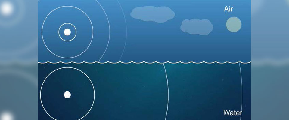
The term “sound” refers to vibrations which cause pressure changes that travel as a
wave through a medium, such as air or water. Physical differences between air and
water result in the same sound having different speed, pitch, and intensity.
In general, sound travels much faster and farther in water than in air. Sound travels
faster in denser mediums; however, the density of seawater varies with the water’s
salinity (salt concentration), temperature, and pressure (depth). On average, sound
travels at about 1,500 meters per second (m/s) (3,500 miles per hour [mph]) in
seawater compared to 340 m/s (760 mph) in air. The frequency, or pitch, of a sound
impacts the distance the sound travels. In general, low frequency sounds travel
farther than high frequency sounds. Some sounds, particularly low-frequency ones,
can travel hundreds of kilometers underwater.
The intensity, or loudness, of a sound depends on both the sound and the medium in
which the sound is traveling. Intensity is typically measured in decibels (dB), a
relative unit on a logarithmic scale that compares the sound pressure to a reference
pressure. The reference pressure is different for different mediums. In air,
decibels use a reference pressure of 20 microPascals (μPa) such that they are scaled
to the range of human hearing, so by definition, a 0 dB sound in air is the lowest
limit of human hearing. Humans perceive a 10 dB increase as a doubling of loudness.
In water, decibels are scaled using a reference pressure of 1 μPa. Since dB in air
and dB in water use different reference pressures, sound intensity reported in dB in
air is not the same as sound intensity reported in underwater dB (DOSITS, 2019). (Discovery of Sound in the Sea. 2019. University of Rhode Island and Inner Space Center, in partnership with the National Science Foundation, Office of Naval Research Science and Technology, National Oceanic and Atmospheric Administration, URI Graduate School of Oceanography, and Marine Acoustics, Inc. Available online at: https://dosits.org.)
The ocean floor changes over time; therefore, accurate and updated survey data are
critical to providing products that support safe navigation for commercial shipping,
the fishing industry, recreational boaters, and military and government functions
such as law enforcement.
As of 2020, only 43 percent of U.S. underwater territory had been mapped to modern
standards. Coordination within the ocean and coastal mapping community is
facilitated through the Interagency Working Group on Ocean and Coastal Mapping
(IWG-OCM) under the National Ocean Council. In addition to NOAA, other federal
agencies undertake or permit surveying and mapping projects for navigation,
conservation, resource exploration, and other purposes, including the Bureau of
Ocean Energy Management (BOEM), Federal Emergency Management Agency (FEMA), National
Park Service (NPS), Naval Oceanographic Office (NAVO), United States Army Corps of
Engineers (USACE), and United States Geological Survey (USGS).
Only 43 percent of U.S. oceans, coasts, and Great Lakes waters extending from shore
to the U.S. Exclusive Economic Zone limits have been mapped to modern standards. The
depth, shape, and composition of the sea floor are foundational data elements that we
need to understand in order to explore, sustainably develop, conserve, and manage
our coastal and offshore ocean resources. NOS ocean mapping and surveying provides
the public and private sectors with nautical charts, benthic habitat condition maps,
current and tide charts, and other products necessary for safe navigation, economic
security, and environmental sustainability.
The National Strategy for Mapping, Exploring and Characterizing the U.S. EEZ calls for interagency coordination for mapping, and developing and maturing science
and technology for mapping. The PEIS satisfies NOS’s requirement to assess the
environmental effects of its proposed actions prior to making decisions under NEPA.
Additionally, the PEIS establishes an informed decision making process that will
support streamlined compliance for NOS ocean mapping projects with other statutes
protecting natural resources such as the Endangered Species Act (ESA) and the Marine
Mammal Protection Act (MMPA). Because the PEIS provides analysis of the potential
environmental impacts of a more widespread adoption of new techniques and
technologies to more efficiently perform surveying, mapping, charting and related
data gathering, NOS will be able to support the implementation strategy for
exploration and characterization activities.
The eight NOS program officse plan surveying and mapping projects well in
advance and inform the public through publications on their own websites. For
example, each year OCS summarizes the coming year’s survey projects in an
interactive story map.
Yes, NOS underwater active acoustic equipment is different from military sonar or seismic airguns.
Military sonar is primarily used for communication and detecting objects in the water requiring higher power acoustic equipment and at a variety of frequencies depending on the communication, detection, or imaging needs. The higher power increases the communication and detection range as well as improves signal processing. Low frequency may be used for long-range communication while higher frequency sonars may be used for better resolution in detection or imaging. Seismic airguns produce low-frequency, impulsive sounds (typically ~100 Hz) used to image geological strata beneath the seabed. Airguns are typically used in arrays to increase the overall sound energy to provide greater penetration and resolving power in seismic surveys. In contrast, NOS uses active acoustic equipment to generate images of underwater features such as the sea floor, benthic habitat, and marine debris. Most of the active acoustic equipment used by NOS operates at frequencies above 200 kHz, which is above the hearing frequency range of most marine species (e.g., marine mammals, sea turtles, fish, and aquatic macroinvertebrates). NOS acoustic equipment that operates below 200 kHz is lower power than military sonar. NOS uses this acoustic equipment to direct the sound energy downward using a narrow beam width to map the sea floor and sediment layers. The low frequency acoustic equipment used by NOS produces non-impulsive sounds of lower sound energy than seismic airgun arrays.
Therefore, NOS active acoustic equipment is considered less harmful to marine species
than military sonar and seismic airguns because of the differences in equipment and
uses.
The Final Programmatic Environmental Impact Statement (PEIS)
The National Environmental Policy Act (NEPA) requires federal agencies to consider the environmental
impacts of their proposed actions. To meet this requirement, federal agencies prepare a document
analyzing the possible impacts of their proposed action and reasonable alternatives.
In December 2016, NOS published a Notice of Intent (NOI) to prepare a Programmatic Environmental Assessment
(PEA). During preparation of the PEA, NOS decided the scope of the surveying and mapping
program and the complexities of the analysis warranted a Programmatic Environmental Impact Statement
(PEIS). A PEIS evaluates the consequences of broad proposals or planning-level decisions on the
environment. An EIS is the most comprehensive of NEPA documents. A PEIS may include a wide range of
individual projects, implementation over a long timeframe, and/or execution over a wide geographic
area. The purpose of the NOS PEIS is to:
Inform NOS and the public on the physical, biological, economic, and social impacts of NOS
mapping and surveying projects; and
Assist NOS in deciding how to execute its mapping and surveying program over the next five
years.
A Notice of Availability (NOA) for the Draft PEIS was published in the Federal Register on June 25, 2021 to announce its publication for public review and comment. An extension of the public comment period was published in the Federal Register on August 24, 2021 to announce an additional 90-day public review and comment period, ending on November 22, 2021.
The PEIS evaluates three alternatives:
The No Action Alternative (Alternative A), under which NOS would continue to gather accurate and timely data on the nature and condition of the marine and coastal environment, reflecting the technology, equipment, scope, and methods currently in use by NOS at the current level of effort (i.e., the status quo);
Alternative B, under which NOS would increase the adoption of new technologies to more efficiently perform surveying, mapping, charting and related data gathering; and
Alternative C, which also includes the adoption of new techniques and technologies and includes an overall funding increase of 20 percent.
Alternative B was selected as the “preferred alternative” because it reflects the most likely scenario for the level of activity needed to meet NOS mission requirements. Alternative B most accurately aligns with anticipated technological needs over the five-year time span based on current and anticipated agency priorities. NOS will make an official decision when the agency signs a Record of Decision (30 days after publication of the Final PEIS).
All environmental consequences from each of the alternatives are anticipated to be adverse, minor to
moderate, and insignificant, except for the environmental consequences to socioeconomic resources
which are expected to be indirect, beneficial, and moderate . The primary difference of impacts
among the alternatives is one of scale, with the impacts from Alternative C the same or slightly,
but not appreciably, larger than those under Alternatives A and B for each impact causing factor.
Among these impacts, NOS identified the potential for acoustic disturbance to marine mammals as an
area warranting detailed analysis. In the Final PEIS, NOS finds that, after conducting quantitative
acoustic impacts modelling, that impacts on marine mammals under all alternatives are expected to be
limited to minor behavioral disturbances that would be temporary or short-term and would not be
considered outside the natural range of variability of species’ populations, their habitats, or the
natural processes sustaining them.
The Summary Comparison of Impacts includes a comparison of the assessed
environmental consequences associated with alternatives for the Proposed Action for resources
analyzed in the Final PEIS.
The Record of Decision (ROD) for the Final PEIS was signed by the NOS Assistant Administrator on January 9, 2023 to conclude the NEPA process for this program. NOS selected Alternative B because it takes advantage of newer, more efficient technology, responds to the needs of anticipated new marine sanctuaries, and most efficiently addresses the nation’s needs for coastal and marine data, while reflecting a reasonably-foreseeable level of funding.
Other Compliance Requirements
Pursuant to 40 CFR 1502.24, NOS invited several agencies to participate as consulting agencies, including the National Marine Fisheries Service (NMFS) and the U.S. Fish and Wildlife Service (USFWS). Both agencies agreed to provide a comprehensive technical assistance review prior to publication of the Draft PEIS. In coordinating with NOS, NMFS and USFWS participated in multiple meetings and reviews during the development of the Draft PEIS.
NOS has, to the fullest extent possible, integrated the requirements of NEPA with all other applicable environmental review requirements. NOS initiated consultation efforts with the regulatory agencies to comply with the environmental regulations and executive orders listed below.
NOS will continue to initiate project-specific consultations under Section 106 of the National Historic Preservation Act (NHPA) before commencing any activity with the potential to affect cultural or historic resources.
Federal Agency
Statute
Documentation
Consultation Initiation/Completion
Completed Consultations
National Marine Fisheries Service Office of Habitat Conservation
Biological Assessment (integrated into the Draft PEIS)
Began August 21, 2021
Completed December 20, 2023
U.S. Fish and Wildlife Service
Marine Mammal Protection Act
Incidental Take Regulation (ITR) Request
Began September 12, 2022
Completed April 1, 2024 (USFWS determination that no ITR is required)
National Marine Fisheries Service Office of Protected Resources
Marine Mammal Protection Act
Letter of Authorization Application
Began June 3, 2022
Completed August 19, 2024 (NMFS determination that no take authorization is required)
1 - The Commonwealth of the Northern Mariana Islands (CNMI) initially objected to the NOS determination that the surveying and mapping program was consistent to the maximum extent practicable with coastal policies because of the potential for marine mammals to be harassed by acoustic sources, such as echo sounders. However, this objection is preempted under Section 109(a) of the Marine Mammal Protection Act (MMPA), 16 U.S.C. § 1379(a).
Environmental Regulations
Jurisdiction: National Marine Fisheries Service (NMFS) and U.S. Fish and
Wildlife Service (USFWS)
The MMPA prohibits the “take” of marine mammals; take includes the harassment,
hunting, capture, or killing of marine mammals. MMPA Section 101(a)(5)(A-D) provides a
mechanism for allowing the incidental, not intentional, take of small numbers of
marine mammals.
Under the MMPA, NMFS is responsible for the protection of whales, dolphins,
porpoises, seals, and sea lions. For species under the jurisdiction of NMFS,
incidental take authorizations may be issued as either: 1) regulations and
associated Letters of Authorization (LOAs), or 2) Incidental Harassment
Authorizations (IHAs). LOAs are available for actions with potential to result in
serious injury or mortality. LOAs are issued by region and can be valid for up to 5
consecutive years. An IHA is also issued by region, can only be valid for 1 year,
and is limited to authorizing take by harassment. NOS submitted an LOA Application to the NMFS Office of Protected Resources (OPR) for the Proposed Action on June 3, 2022. NMFS responded on August 19, 2024 that the proposed activities are not likely to result in the take of marine mammals under NMFS’ jurisdiction and no take authorization is necessary. The NMFS response does not apply to NOS use of the Kongsberg EM124 system or similar systems. The Kongsberg EM124 is a multibeam echosounder suitable for deep ocean mapping applications, operating at approximately 12 kHz with an estimated source level of approximately 240 decibels re 1 μPa. NOS does not currently have plans to use the EM124 or similar multibeam echosounders. NOS will notify NMFS to work through the necessary steps to ensure MMPA compliance prior to using sources such as the Kongsberg EM124.
The USFWS has jurisdiction over walruses, manatees, sea otters, and polar bears under
the MMPA. For these species, USFWS may issue an Incidental Take Regulation (ITR). ITRs can be issued for periods of up to 5 years and can cover all forms of incidental take. NOS submitted an ITR request to USFWS for the Proposed Action on September 12, 2022. On April 1, 2024, USFWS determined that the proposed NOS activities are not likely to result in incidental take, including incidental take in the form of harassment, of the marine mammals under USFWS jurisdiction, and no ITR is necessary. NOS will apply the proposed mitigation measures outlined in the ITR Request.
Jurisdiction: NMFS and USFWS
The ESA regulates the conservation of endangered or threatened species and their
ecosystems. Under Section 7(a)(2), federal agencies must ensure that their actions
are not likely to jeopardize ESA-listed species or damage designated critical
habitat. Federal agencies must consult with USFWS and NMFS when an action may affect
a protected species or critical habitat. The consultation process is initiated by
the preparation of a Biological Assessment (BA).
The Draft PEIS also serves as a BA. NOS consulted with NMFS OPR and USFWS under Section 7 of the ESA. Through the ESA consultation process, NOS developed additional mitigation measures to minimize impacts to sensitive species; they have been incorporated into appropriate resource section analyses and are listed in Appendix D of the Final PEIS. For NOS projects proposed in freshwater, an ESA species list will be generated from the USFWS Information for Planning and Consultation (IPaC) report system. From this information, NOS will determine if any ESA-listed species are present in a proposed project area that have not already been addressed in the Final PEIS and therefore, not part of the programmatic ESA consultation. If any such species are identified, NOS will consider possible impacts to ESA-listed species in the context of that specific project. If appropriate, NOS will then initiate a Section 7 consultation with the appropriate USFWS field office(s).
Jurisdiction: NMFS
The MSA regulates marine fisheries management in U.S. federal waters and encourages
the conservation and restoration of essential fish habitat (EFH) and resources. EFH
refers to all waters and substrate necessary for fish for spawning, breeding,
feeding, or growth to maturity. MSA Section 305(b) requires consultation on all
actions, or Proposed Actions, authorized, funded, or undertaken by the agency that
may adversely affect EFH. EFH consultation is managed by NMFS’s Office of Habitat
Conservation. If adverse effects are anticipated, NMFS will recommend measures to
avoid, minimize, or offset any adverse impacts associated with the activity to
ensure no reduction in the quality or quantity of EFH occurs as a result of the
proposed activity.
NOS submitted an EFH Assessment to NMFS’s Office of Habitat Conservation and received a final
response from NMFS on November 1, 2022. Through the EFH consultation process, NOS developed additional mitigation measures to minimize impacts to sensitive species and habitats which have been incorporated into appropriate resource sections and are listed in Appendix D of the Final PEIS.
Jurisdiction: USFWS
The MBTA is the primary legislation in the U.S. established to conserve migratory
birds and requires the protection of migratory birds and their habitats. It
implements the U.S. commitment to four bilateral treaties or conventions with
Canada, Japan, Mexico, and Russia for protection of a shared migratory bird
resource. The MBTA prohibits, with certain exceptions, pursuing, hunting, taking,
capturing, killing, or selling migratory birds or any part, nest, egg, or product of
migratory birds. Migratory birds protected under the MBTA include those that are
native to the U.S. which are listed in 50 CFR § 10.13.
The Final PEIS assesses the potential incidental effects of NOS activities on federally protected birds.
Jurisdiction: States and Territories
The CZMA encourages coastal states, Great Lakes states, and U.S. Territories and Commonwealths to proactively manage their coastal resources for the benefit of the state and the nation. Section 307 of the CZMA is
known as the “federal consistency” provision and requires federal actions that
affect any land or water use or natural resource of a state’s coastal zone to be
consistent with the enforceable policies of the state coastal management program
(CMP).
In August 2022, NOS initiated coordination for federal consistency with all coastal states and territories with approved CMPs pursuant to Section 307 of the CZMA. A Consistency Determination was sent to each coastal state and territory. The Determination evaluated the coastal effects of proposed activities according to the relevant enforceable policies to make a consistency determination under CZMA.
As of November 30, 2022, NOS completed coordination with the federal consistency provisions of Section 307 of the CZMA. Through the CZMA process, some states requested that NOS follow state-specific best management practices (BMPs) involving pre-survey notification and mitigation for any land disturbance. Where requested, NOS agreed to take these steps.
Jurisdiction: State Historic Preservation Officer/Tribal Historic
Preservation Officer (SHPO/THPO)
The NHPA regulates the management of historic properties. NHPA Section 106 requires
federal agencies to consider the effects of their actions on historic properties.
Agencies must identify and consult with the appropriate SHPO/THPO if actions could
affect historic properties. While NOS may consider developing a Programmatic Agreement (PA) for multiple undertakings in the future, currently NOS will initiate project-specific consultations under Section 106 of the NHPA before commencing any activity with the potential to affect cultural or historic resources. In
addition to the NHPA, NOS invited tribes to consult after publication of the
Draft PEIS pursuant to EO 13175, Consultation and Coordination with Indian Tribal
Governments. This EO ensures that all Executive departments and agencies consult
with Indian tribes and respect tribal sovereignty as they develop policy on issues
that impact Indian tribes.
Jurisdiction: Office of National Marine Sanctuaries
(ONMS)
NMSA regulates the management of areas of the marine and Great Lakes environments. NMSA prohibits injury to national marine sanctuary resources such as biological and cultural resources. NMSA Section 304(d)
requires consultation to be initiated by the submittal of a sanctuary resource
statement (SRS) to ONMS that describes the potential effects of a proposed activity
on sanctuary resources. NOS submitted a Sanctuary Resource Statement (SRS) for consultation with ONMS that includes a programmatic-level evaluation of impacts from the NOS Preferred Alternative (Alternative B) on each sanctuary. The consultation was completed on April 17, 2023. In the course of the consultation, ONMS and NOS agreed to a suite of mitigation measures to protect sanctuary resources. In addition, NOS will coordinate with ONMS, as appropriate, to determine whether any ONMS permit or authorization is required for a project. NOS will always notify ONMS when a project is being conducted in or near a sanctuary.
 An official website of the United States government.