September 2018: Hurricane Florence
National Geodetic Survey damage assessment imagery available online.
From September 15-22, 2018, the National Geodetic Survey (NGS) collected damage assessment imagery in the aftermath of Hurricane Florence. Aerial imagery was collected in specific areas identified by NOAA in coordination with FEMA and other state and federal partners. Collected images are available to view online via the NGS aerial imagery viewer. View tips on how to use the imagery viewer.
A team of NOAA aviators and sensor operators captured the images using specialized remote-sensing cameras aboard NOAA Office of Marine and Aviation Operations' King Air aircraft flying above the area at an altitude between 500 - 1,500 meters.
NOAA's aerial imagery aids safe navigation and captures damage to coastal areas caused by a storm. Aerial imagery is a crucial tool to determine the extent of the damage inflicted by flooding, and to compare baseline coastal areas to assess the damage to major ports and waterways, coastlines, critical infrastructure, and coastal communities. This imagery provides a cost-effective way to better understand the damage sustained to both property and the environment.
Available Imagery
View NOAA Emergency Response Imagery collected on the following days:
- September 15: Cape Henry, Virginia, to Oregon Inlet, North Carolina.
- September 16: Charleston, South Carolina, to Ocean Isle Beach, North Carolina.
- September 17: Myrtle Beach, South Carolina and from Oak Island to Oregon Inlet, North Carolina.
- September 18: West of Cape Fear and flooded areas in Wilmington, Burgaw, and River Landing, North Carolina.
- September 19: Areas near Lumberton, Conway, New Bern, Spring Garden, Wayne, Lenox, Pollockville, Trenton, coastal areas between Wilmington to Beaufort, North Carolina.
- September 20: Areas near Lumberton, Whiteville, and East Arcadia, North Carolina
- September 21: Areas near Fayetteville, Stedman, Garland, and Point Caswell, North Carolina
- September 22: Cape Fear River region from Newlight to Elizabethtown, North Carolina; and Black River region from Rowan to Long Bluff Landing, North Carolina
Before/After Imagery
Select the round icon with directional arrows using your mouse (or your finger) and slide back and forth to view a "before and after" comparison. "Before" images are provided by Mapbox, Digital Globe, and OpenStreetMap; "After" images were captured by NOAA's National Geodetic Survey in the aftermath of Hurricane Florence. View tips on how to use the imagery viewer
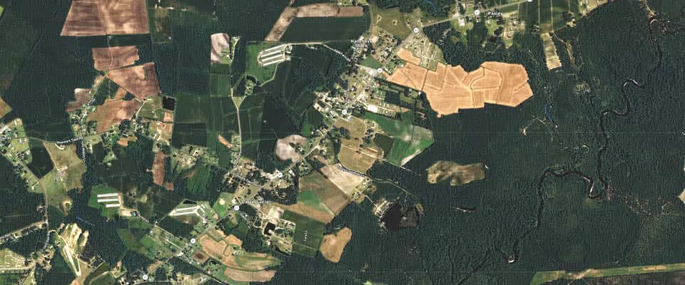
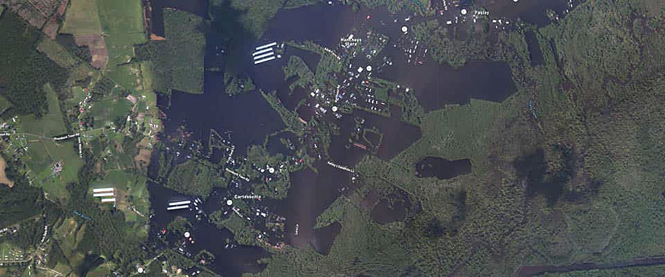
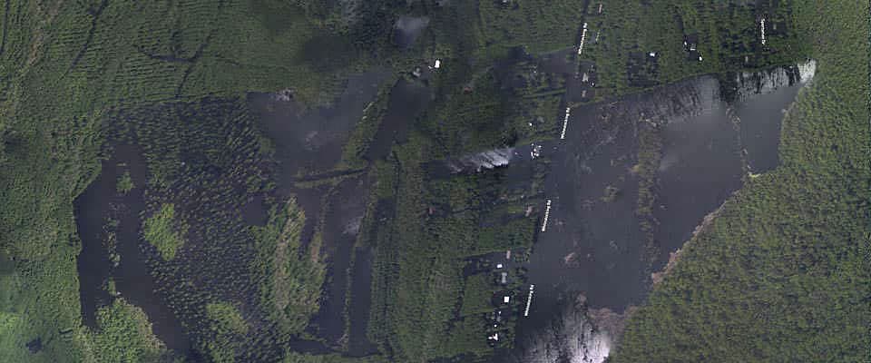
Near Cartersville, North Carolina | View this location on the map.

South of White Stocking, North Carolina | View this location on the map.

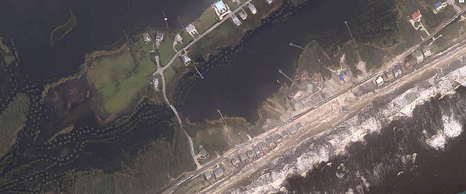
North Topsail Beach, North Carolina | View this location on the map.
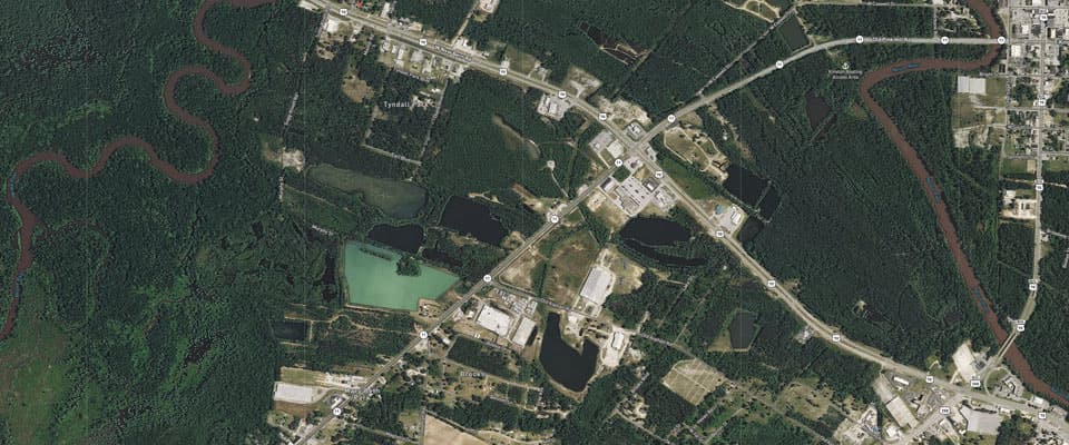
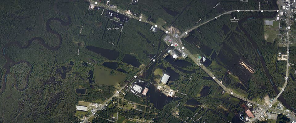
Near Kinston, North Carolina | View this location on the map.
Tips on Navigating the NGS Emergency Response Imagery Viewer

This is a sample of the NGS aerial imagery viewer to illustrate how you can use this mapping tool to locate imagery.
- 1. Zoom in/out. Plus and minus buttons are located in the top left corner of the image viewer. Tap or click on the appropriate symbol to control the zoom level of the map. The dynamic map zooms in or out from the center point. You can change the location of the map by dragging on the map with your finger or using your fingers on a mobile device.
- 2. Search for a specific location. Underneath the zoom controls in the upper left corner, you will find a magnifying glass. Use this tool to search for a specific location.
- 3. Available Imagery. Available NOAA imagery may be difficult to see when you first look at a map. Here, you can see the available aerial imagery near Houston, Texas. If you don't see any images on the map, try zooming in closer to the area you are interested in inspecting or search for a specific location.
- 4. Available images, listed by date collected by NOAA aircraft. On the top right corner of the map viewer, you will see an icon with three stacked rectangles, which indicates available map layers. Select this button to toggle the view of the base layer of the map between street view and satellite view. This button also reveals a list of all available imagery, listed by the date the images were collected by NOAA aircraft.
- For Advanced Users: Note that users may construct a custom URL for the imagery viewer by entering a known latitude and longitude in decimal degrees, along with a selected zoom level. For example, the following link will show Wilmington International Airport (ILM) in North Carolina. This URL will be "zoomed in" to level 16, which equates to about 2.4 meter resolution, at the coordinates for the airport, 34.2674 degrees latitude and -77.9020 degrees longitude: https://storms.ngs.noaa.gov/storms/florence/index.html#16/34.2674/-77.9020
National Geodetic Survey Imagery: Hurricane Florence
Tips on Viewing National Geodetic Survey Aerial Imagery
More Information
Did you know?
NOAA's National Geodetic Survey is the U.S. Government source for precise latitude, longitude, and elevation measurements. The NOAA fleet of ships and aircraft is operated, managed, and maintained by the NOAA Office of Marine and Aviation Operations, which includes commissioned officers of the NOAA Corps and civilian wage mariners.
