July 2019: Hurricane Barry
National Geodetic Survey damage assessment imagery available online.
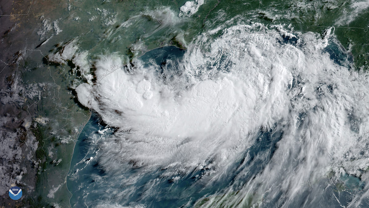
Tropical Storm Barry, seen here by GOES East on July 12, 2019, at 9 a.m. ET, strengthens over the warm waters of the northern Gulf of Mexico prior to reaching hurricane strength.
From July 16-19, 2019, the National Geodetic Survey (NGS) collected aerial damage assessment images in the aftermath of Hurricane Barry. Imagery was collected in specific areas identified by NOAA in coordination with FEMA and other state and federal partners. Collected images are available to view online via the NGS aerial imagery viewer. View tips on how to use the imagery viewer.
NOAA's aerial imagery aids safe navigation and captures damage to coastal areas caused by a storm. Aerial imagery is a crucial tool to determine the extent of the damage inflicted by flooding, and to compare baseline coastal areas to assess the damage to major ports and waterways, coastlines, critical infrastructure, and coastal communities. This imagery provides a cost-effective way to better understand the damage sustained to both property and the environment.
Available Imagery
View NOAA Emergency Response Imagery collected on the following days:
- July 16: East of Port Arthur, Texas, to near Houma, Louisiana. Note: there are some gaps in imagery coverage for July 16 due to low clouds over portions of the collection area, which forced the NOAA aircraft to fly at a lower altitude. As a result, the down-looking camera mounted on the aircraft was unable to cycle fast enough to ensure continuous coverage.
- July 17: The Mississippi River approach to New Orleans, Louisiana. Note: there are some gaps in imagery coverage for July 16 due to low clouds over portions of the collection area, which forced the NOAA aircraft to fly at a lower altitude. As a result, the down-looking camera mounted on the aircraft was unable to cycle fast enough to ensure continuous coverage.
- July 19: Port Fourchon, Grande Isle, and the Chandeleur Islands, Louisiana.
Before/After Imagery
Select the round icon with directional arrows using your mouse (or your finger) and slide back and forth to view a "before and after" comparison. "Before" imagery is provided by Mapbox, Digital Globe, and OpenStreetMap; "After" imagery was captured by NOAA's National Geodetic Survey in the aftermath of Hurricane Barry. View tips on how to use the imagery viewer
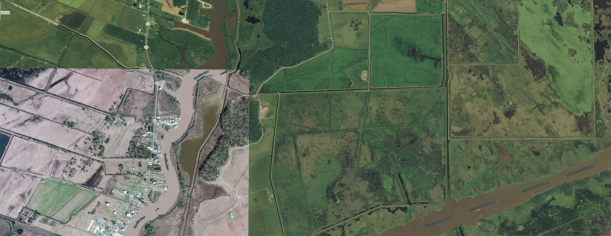
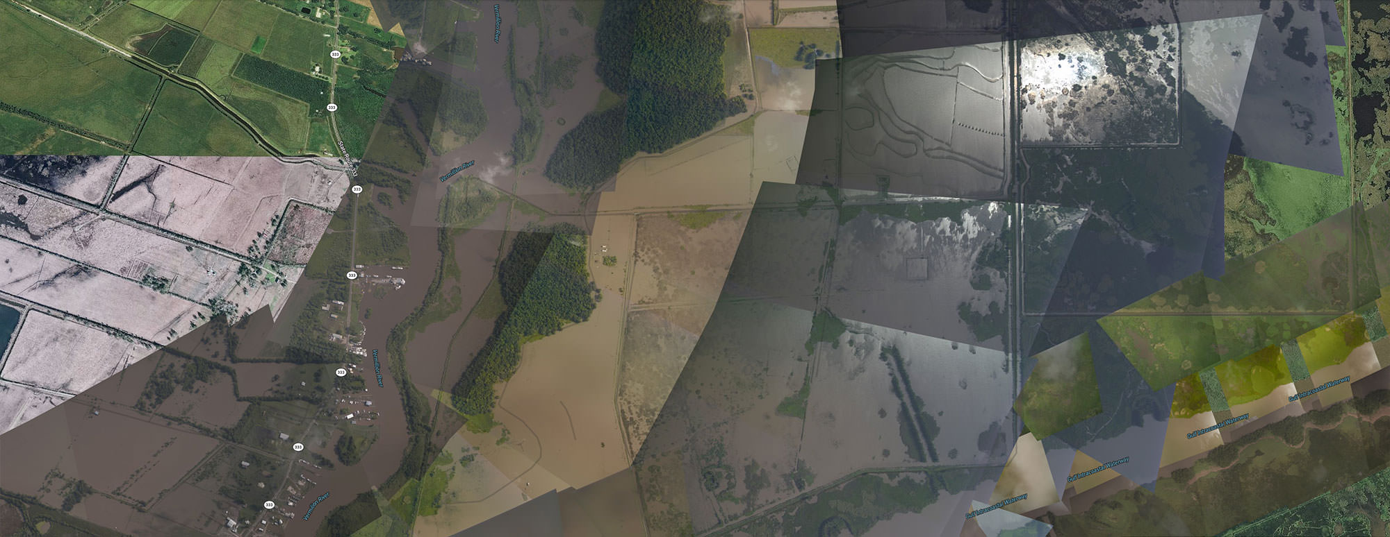
Flooding north of Intracoastal City, Louisiana | View this location on the map.
Tips on Navigating the NGS Emergency Response Imagery Viewer
Video overview of how to use the NOAA Emergency Response Imagery online viewer.

Graphic and text overview illustrating how to use the NOAA Emergency Response Imagery online viewer.
- 1. Zoom in/out. Plus and minus buttons are located in the top left corner of the image viewer. Tap or click on the appropriate symbol to control the zoom level of the map. The dynamic map zooms in or out from the center point. You can change the location of the map by dragging on the map with your finger or using your fingers on a mobile device.
- 2. Search for a specific location. Underneath the zoom controls in the upper left corner, you will find a magnifying glass. Use this tool to search for a specific location.
- 3. Available Imagery. Available NOAA imagery may be difficult to see when you first look at a map. Here, you can see the available aerial imagery near Houston, Texas. If you don't see any images on the map, try zooming in closer to the area you are interested in inspecting or search for a specific location.
- 4. Available images, listed by date collected by NOAA aircraft. On the top right corner of the map viewer, you will see an icon with three stacked rectangles, which indicates available map layers. Select this button to toggle the view of the base layer of the map between street view and satellite view. This button also reveals a list of all available imagery, listed by the date the images were collected by NOAA aircraft.
- For Advanced Users: Note that users may construct a custom URL for the imagery viewer by entering a known latitude and longitude in decimal degrees, along with a selected zoom level. For example, the following link will show Wilmington International Airport (ILM) in North Carolina. This URL will be "zoomed in" to level 16, which equates to about 2.4 meter resolution, at the coordinates for the airport, 34.2674 degrees latitude and -77.9020 degrees longitude: https://storms.ngs.noaa.gov/storms/michael/index.html#16/34.2674/-77.9020
National Geodetic Survey Imagery: Hurricane Barry
Tips on Viewing National Geodetic Survey Aerial Imagery
More Information
Did you know?
NOAA's National Geodetic Survey is the U.S. Government source for precise latitude, longitude, and elevation measurements. The NOAA fleet of ships and aircraft is operated, managed, and maintained by the NOAA Office of Marine and Aviation Operations, which includes commissioned officers of the NOAA Corps and civilian wage mariners.
