Photos: NOAA study uses latest technology to compute updated Washington Monument height
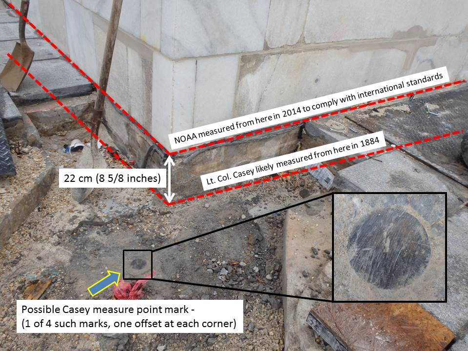
Illustration of the measuring points used by Lt. Col. Thomas Casey in 1884 and the 2014 measuring point used by NOAA to meet CTBUH standards. (NOAA photo) Download
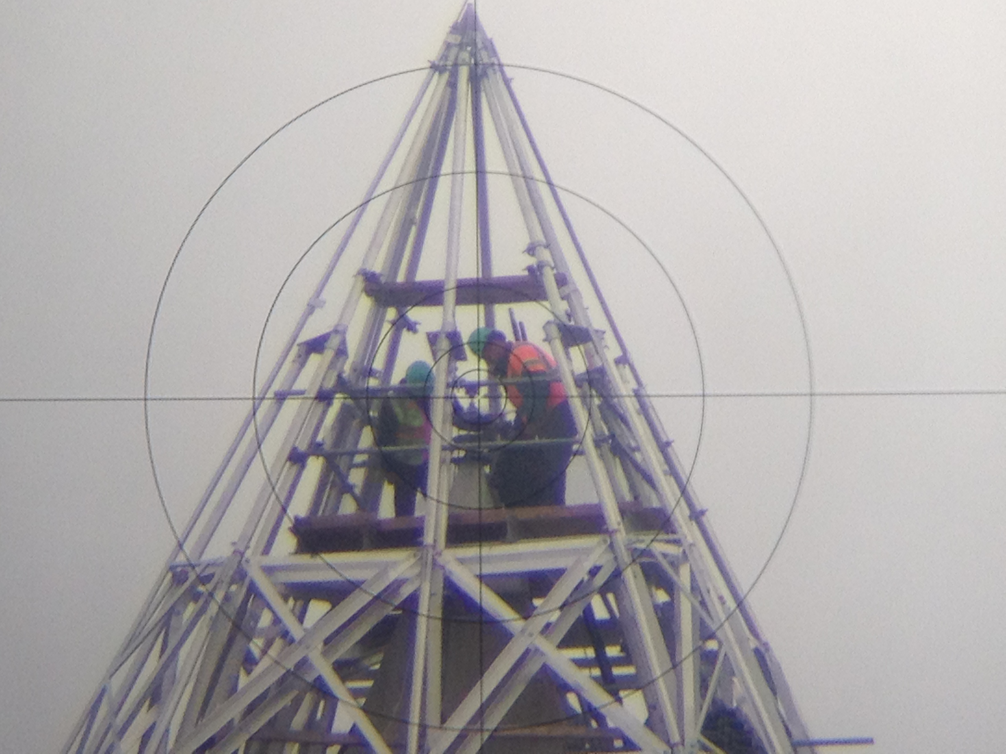
The view of the top of the Monument as viewed through the Total Station surveying tool, captured by placing a smartphone camera up to the eyepiece. (NOAA photo) Download
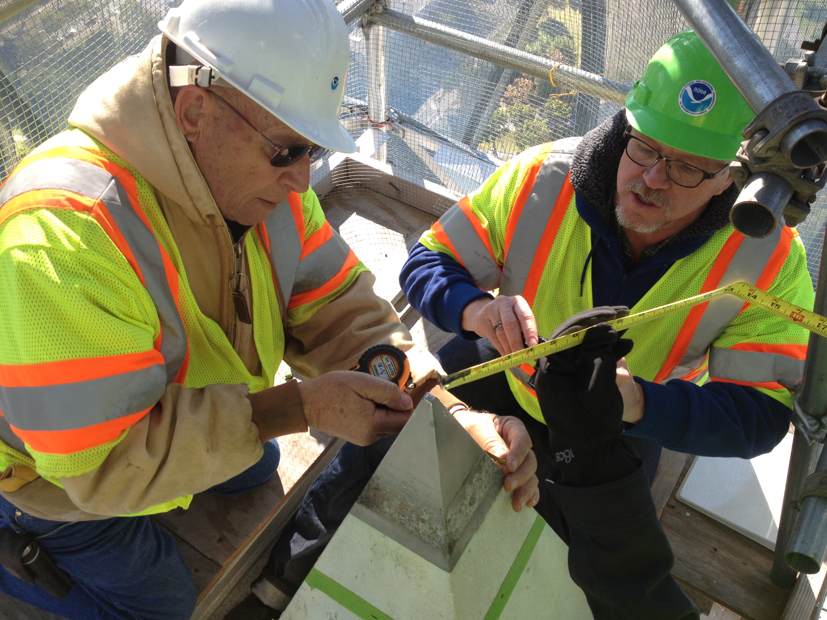
NGS crew members Don Breidenbach and Kendall Fancher take measurements to prepare for the construction of an adapter which will hold various survey instruments at the peak of the Washington Monument. (NOAA photo) Download
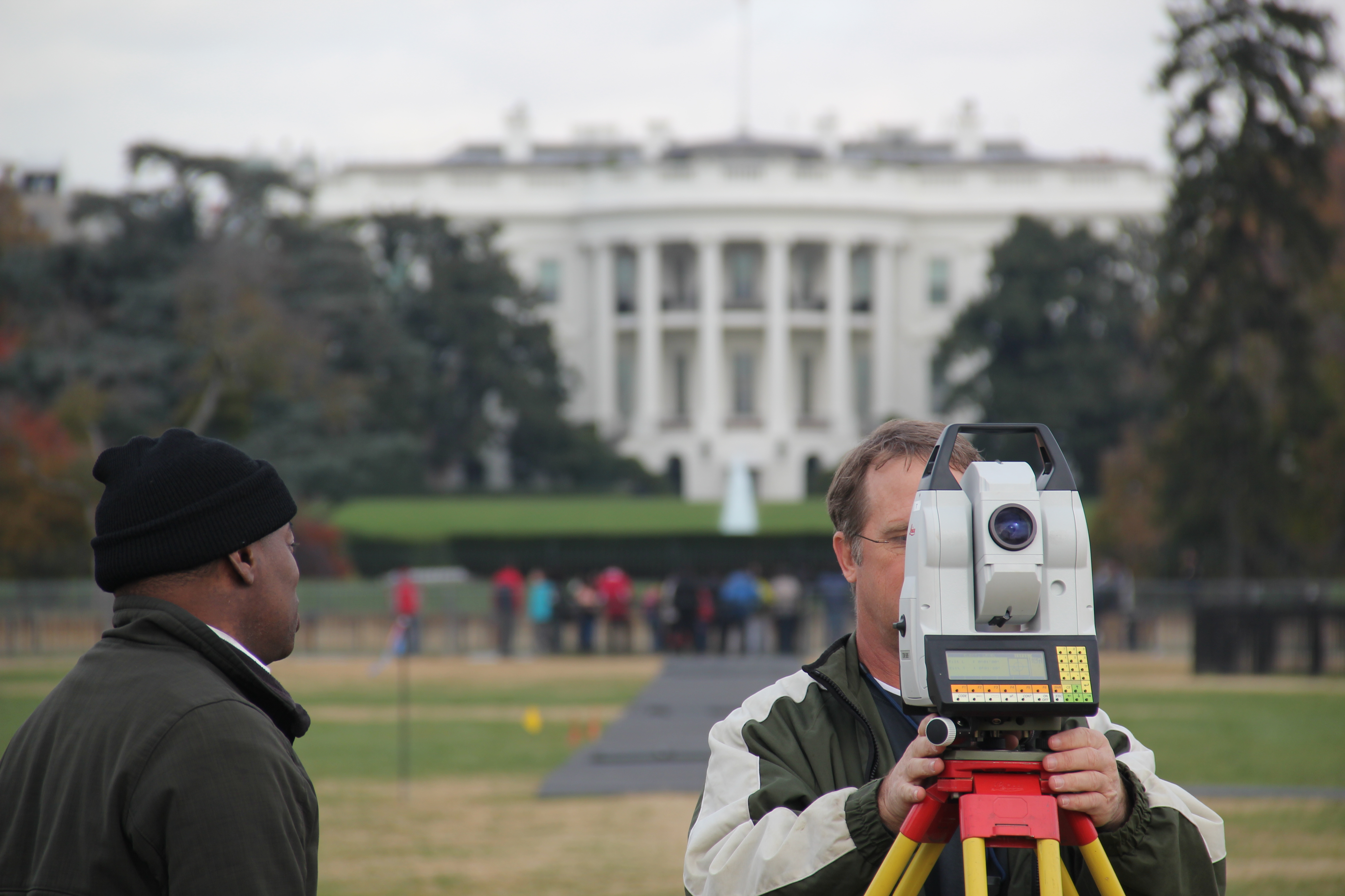
NGS's Steve Breidenbach takes the vertical angle and distance measurements from the Meridian Stone to the top of the Monument. (NOAA photo) Download
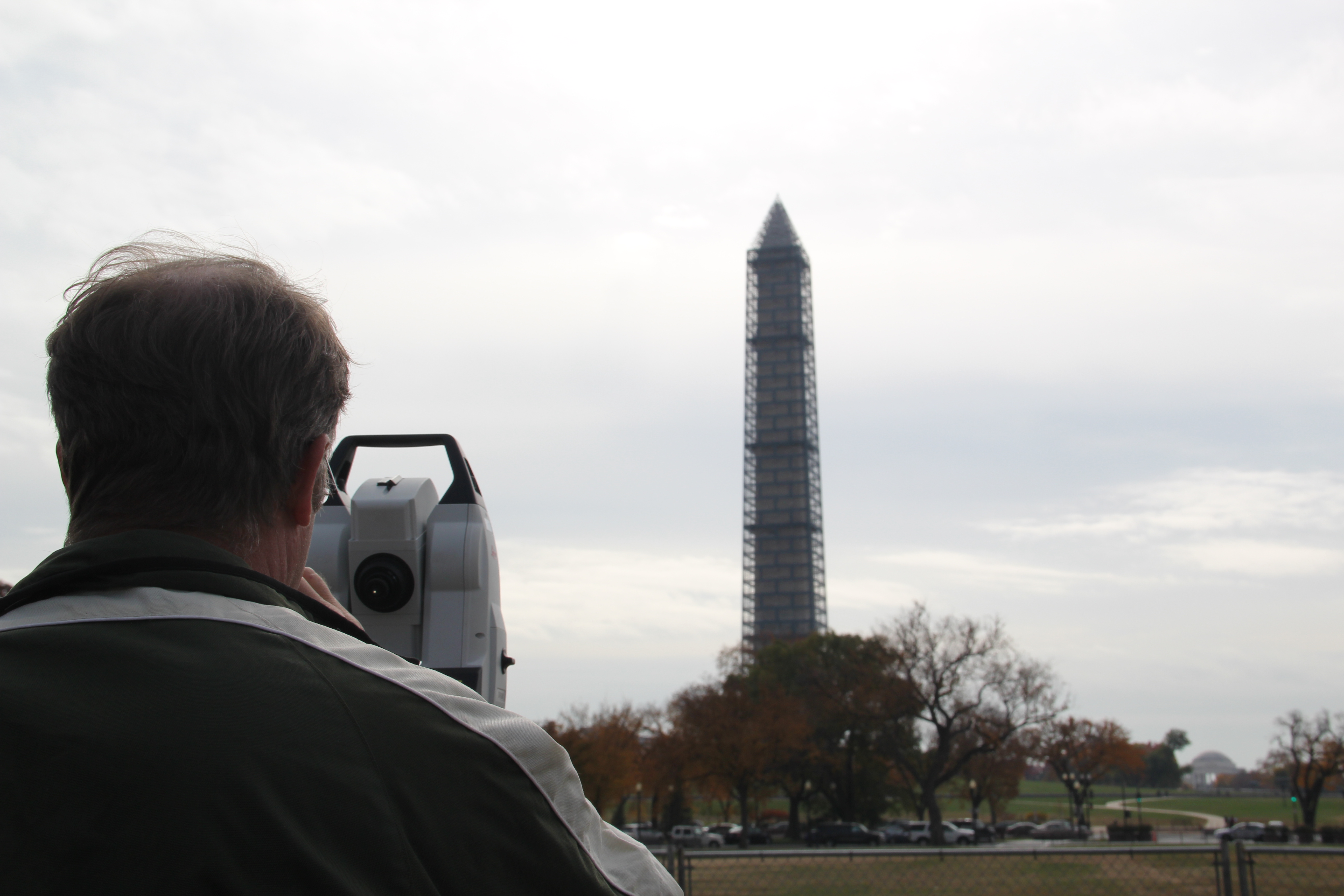
NGS crew member Steve Breidenbach measures the vertical angle and distance to the peak of the Washington Monument. (NOAA photo) Download
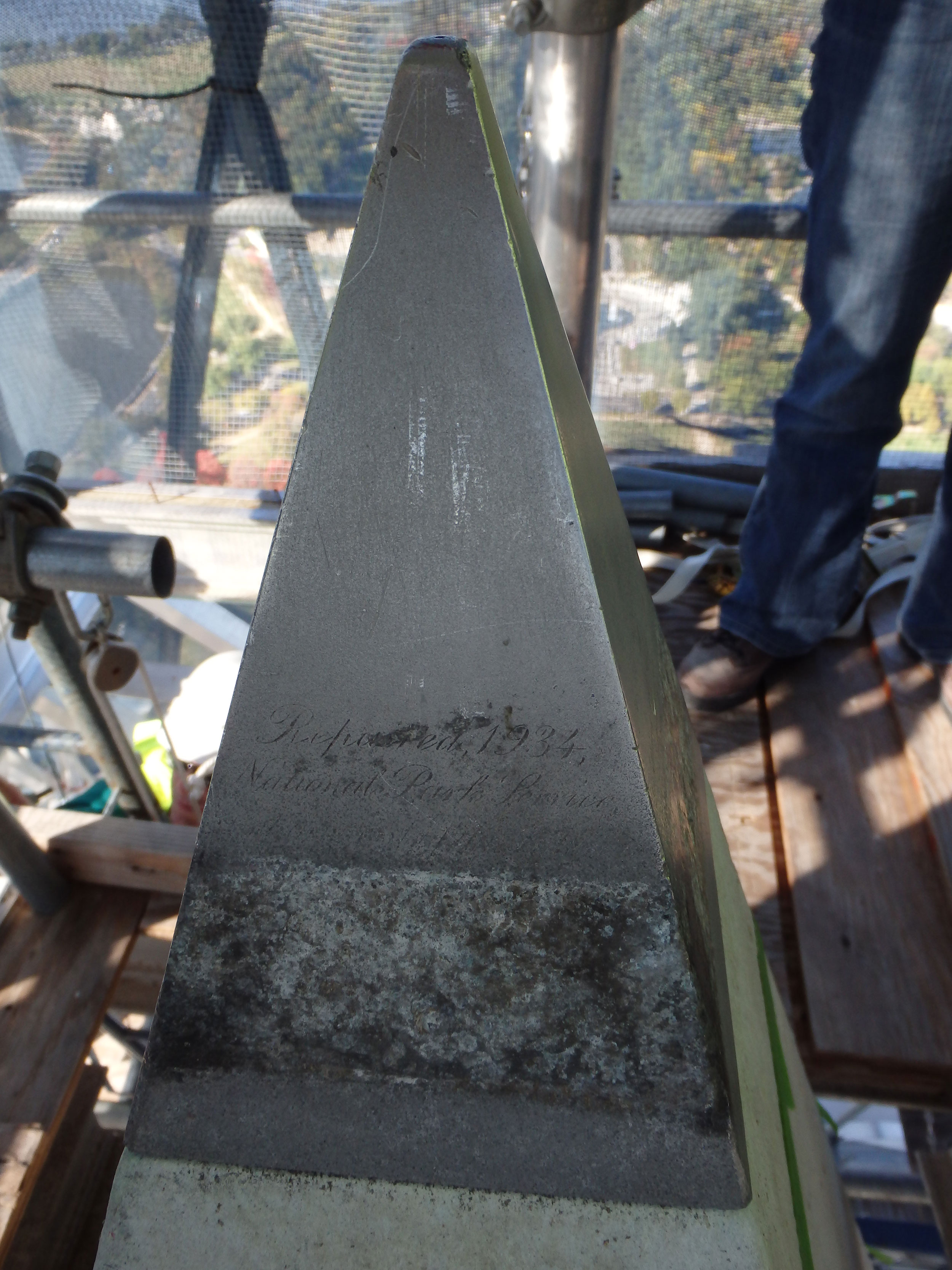
The pyramidion at the top of the Washington Monument. The original inscriptions are mostly visible on all four faces, though a band of the inscriptions have been obliterated by a long-standing collar which was part of an old lightning protection system. (NOAA photo) Download
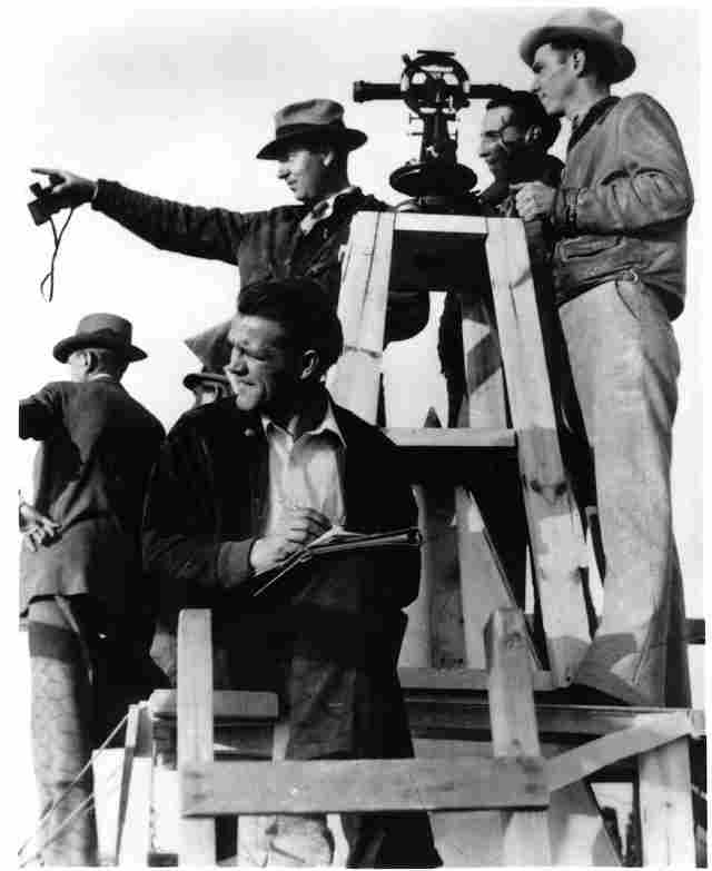
Triangulation Party, Coast Geodetic Survey, occupying top of the Washington Monument, 4:00 p.m., Monday, November 19, 1934. To reach the peak, the party scaled scaffolding constructed to clean the historic structure. A theodolite—an instrument to measure angles in the horizontal and vertical planes—is visible, which was placed on a specially constructed stand over the apex or pyramidian. (National Park Service photo) Download
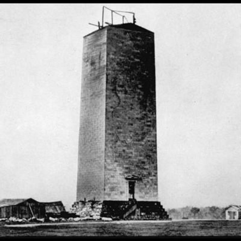
An early construction shot of the Washington Monument. (National Park Service photo) Download
Search Releases
More Information
NOS Media Contacts
- Ben Sherman (Email)
Phone:
301-713-3066
Cell: 202-253-5256
Fax: 301-713-9337
- Keeley Belva (Email)
Phone:
301-713-3066
Cell: 301-643-6463
Fax: 301-713-9337
