August 2016: Louisiana Flooding
National Geodetic Survey damage assessment imagery available online.
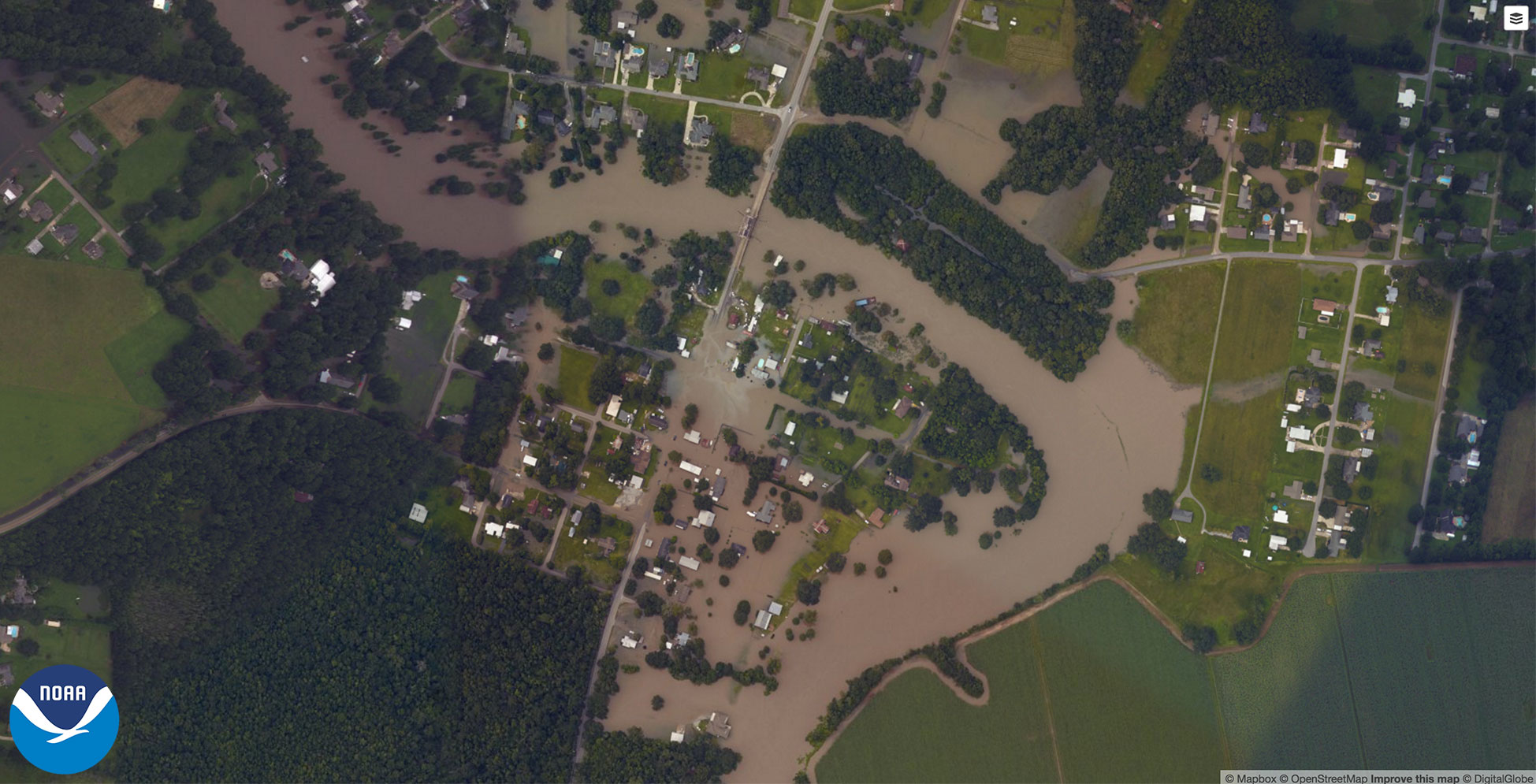
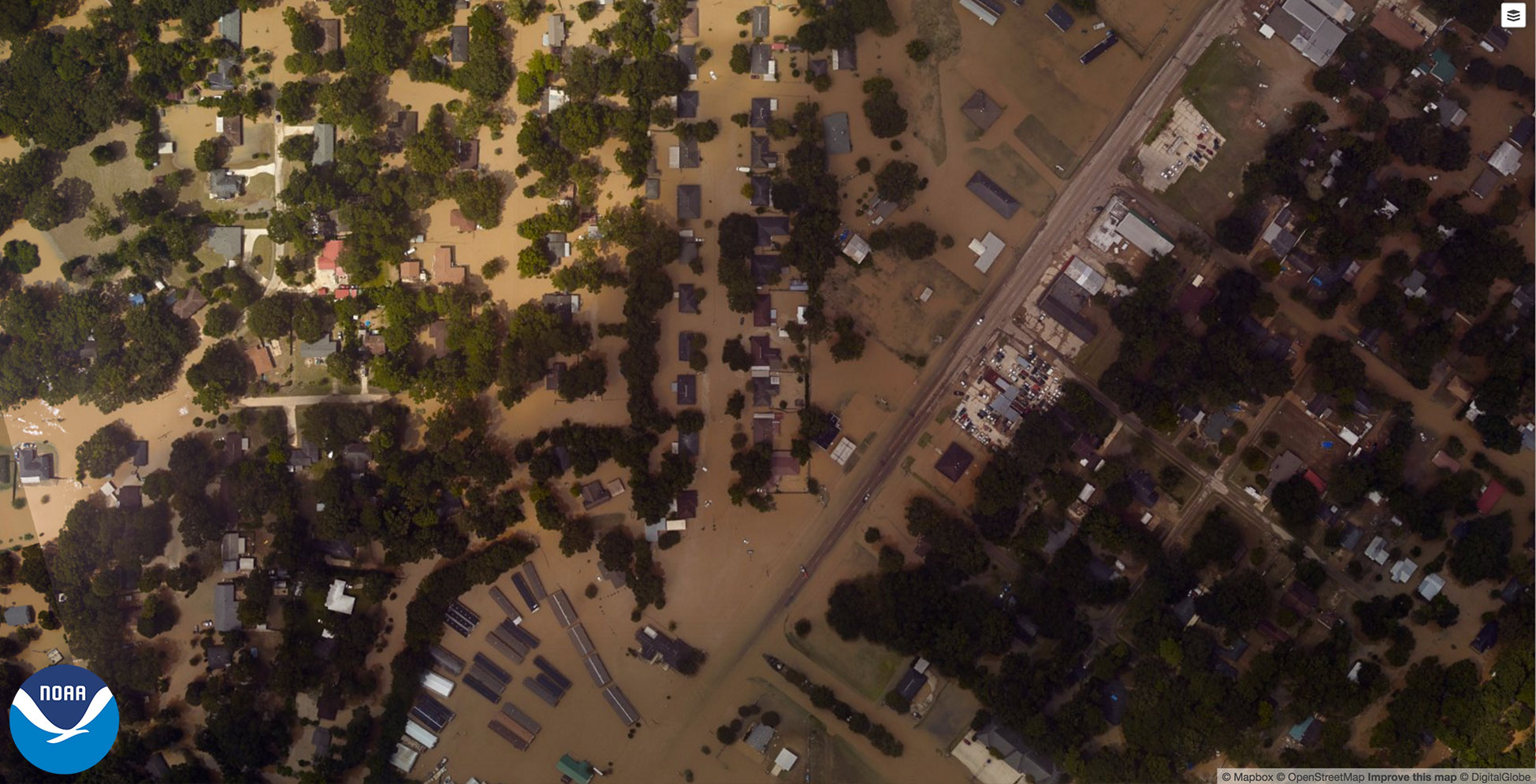
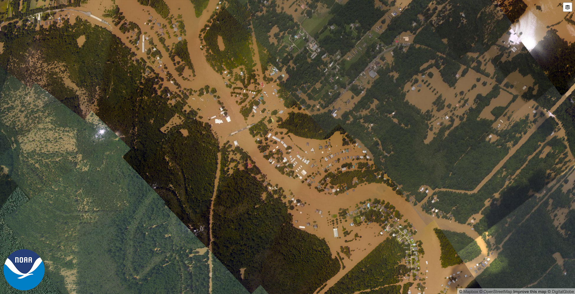
From August 14-19, the National Geodetic Survey (NGS) collected damage assessment imagery in the aftermath of the August 2016 severe storms that caused significant flooding in Louisiana. The aerial imagery was collected in specific areas identified by FEMA and the National Weather Service.
Select the round icon with directional arrows using your mouse (or your finger) and slide back and forth to view a "before and after" comparison. "Before" images are provided by Mapbox, Digital Globe, and OpenStreeMap; "After" images were captured by NOAA's National Geodetic Survey in the aftermath of the historically heavy rainfall.
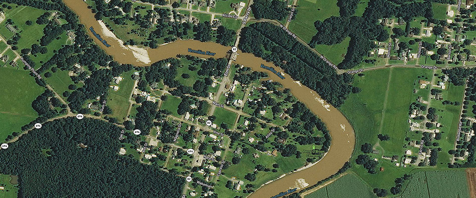
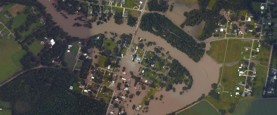
Abbeville, Louisiana | Download
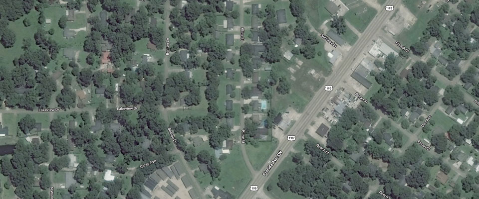
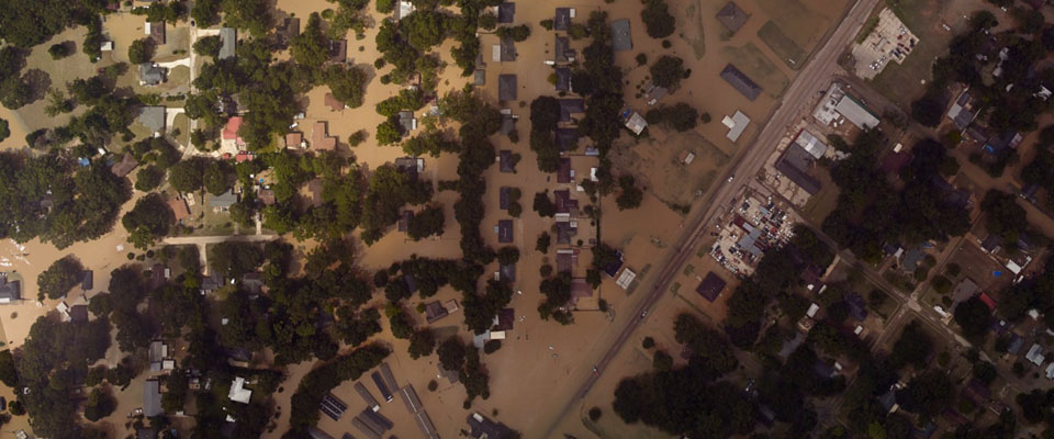
Denham Springs, Louisiana | Download
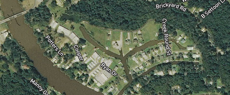
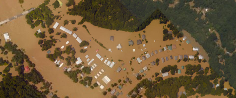
Port Vincent, Louisiana | Download
A team of NOAA aviators captured the images using specialized remote-sensing cameras aboard NOAA's King Air aircraft flying above the area at an altitude between 2000-3000 feet.
NOAA's aerial imagery aids safe navigation and captures damage to coastal areas caused by a storm. Aerial imagery is a crucial tool to determine the extent of the damage inflicted by flooding, and to compare baseline coastal areas to assess the damage to major ports and waterways, coastlines, critical infrastructure, and coastal communities. This imagery provides a cost-effective way to better understand the damage sustained to both property and the environment.
National Geodetic Survey Imagery: Louisiana Flooding
FEMA: Louisiana Severe Storms and Flooding (DR-4277)
Get Social
More Information
Did you know?
NOAA's National Geodetic Survey is the U.S. Government source for precise latitude, longitude, and elevation measurements. The NOAA fleet of ships and aircraft is operated, managed, and maintained by the NOAA Office of Marine and Aviation Operations, which includes commissioned officers of the NOAA Corps and civilian wage mariners.
