NOAA Sea Level Trends
Data helps Gulf Coast communities prepare for future storms.

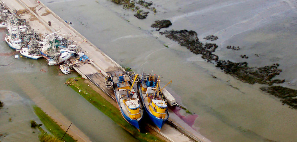
Flooded roads and stranded fishing vessels in South Plaquemines Parish, Louisiana, near Empire, Buras and Boothville where Hurricane Katrina made landfall on Aug. 29, 2005.
When Hurricane Katrina made landfall in the Gulf of Mexico ten years ago, it brought deadly storm surge flooding that caused catastrophic damage to communities across the coast. Katrina’s surge reached 25 to 28 feet above normal tide levels along parts of the Mississippi coast and 10 to 20 feet above normal tide levels along the southeastern Louisiana coast, flowing several miles inland.
Since the devastation, scientists have made progress finding ways to help communities better prepare for and bounce back from these types of disasters in the future. As climate change causes coastal storms to become more extreme and rising seas causes more frequent flooding, or "nuisance flooding," at high tide, it’s critical for communities to have tools that help protect life and property.
Sea Level Trend Data Aids Community Resilience from Coastal Storms and Flooding
One tool coastal planners and emergency managers can use while planning for coastal hazards is long-term sea level trend data. NOAA’s Center for Operational Oceanographic Products and Services has measured sea levels in the United States for more than 150 years and is the nation’s authoritative source for sea level trends through its National Water Level Observation Network. More than 140 of NOAA’s existing water level gauges have operated for more than 30 years, providing consistent, high-quality records of sea level change.
As of August 2015, 13 more stations are now providing sea level trends online, including four in the Gulf of Mexico: New Canal on Lake Pontchartrain in New Orleans; Mobile State Docks in Alabama; Bay Waveland in Mississippi; and Bob Hall Pier in Corpus Christi, Texas.
When it comes to extreme water levels due to hurricanes and other coastal storms, communities can integrate NOAA’s long-term sea level trend data into storm surge models to see how the surge will change over time with sea levels. If a hurricane with the same intensity and direction as Katrina occurred 40 years from now, it would likely have a higher level of flooding than Katrina because of sea level rise. More than a quarter of the major roads in the Gulf Coast region are on land less than four feet in elevation, and transportation infrastructure is well within range of sea level rise, storm surge, and tidal flooding. Vulnerable coastal cities must continue to plan for these extreme water levels, especially as they lose barrier islands and other natural storm surge protections.
Communities also need to know the rate that local sea levels are changing to prepare for more regular, climate-driven “nuisance flooding” and make long-term decisions about land use, infrastructure, and restoration projects. On Tybee Island, Georgia, for example, sea level data from the tide gauges helped that community create an award-winning project that assesses how rising seas and more frequent flooding could affect low-lying infrastructure in the area.
In the aftermath of storms like Katrina, communities are looking to make decisions today that will help them bounce back from coastal hazards of the future. Even though there is much work to be done preparing communities for coastal hazards, NOAA’s wealth of long-term and real-time water level data can improve resiliency.
Get Social
More Information
Did you know?
Once a tide station has been in operation for 30 or more years, that station can be used as a source for long-term sea level trend data. To date, over 140 communities around the U.S. have tide stations that meet this criteria. In August, 2015, thirteen more communities joined this list:
- Cutler, Maine
- Bergen Point, New York
- Tolchester Beach, Maryland
- Wachapreague, Virginia
- Lake Worth Beach, Florida
- Mobile State Docks, Alabama
- Bay Waveland, Mississippi
- New Canal, Louisiana
- Corpus Christi, Texas
- Arena Cove, California
- Hammond, Oregon
- Port Moller, Alaska
- Prudhoe Bay, Alaska
