What are the Totten Beacons?
These 19th-century aids to navigation are protected historical resources.
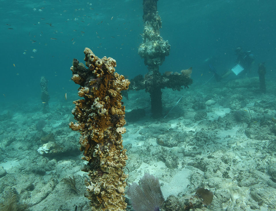
The rusty remnants of a Totten Beacon (foreground) located near American Shoal lighthouse. Photo credit: M. Lawrence.
Main beacon pile centered among three significantly shorter support posts. Photo credit: M. Lawrence.

In 1513, Spanish explorer Ponce de León sailed into the strong currents of the Florida Straits. Little did he know that within a few years, these uncharted waters, which feed into the Gulf Stream, would become a major international shipping route to and from Europe and the New World.
As Europeans explored and colonized the Americas, they took advantage of the Florida Straits' winds and currents. The winds changed direction often, however, easily pounding countless vessels against miles of treacherous submerged coral reefs off the southern Florida coast.
By 1852, Lieutenant James Totten, the U.S. Army's assistant to the Coast Survey, had installed 15 wooden signal poles in the reefs to create more accurate charts of the Florida Keys. Local mariners quickly recognized that the poles themselves helped them safely navigate the reefs, and by 1855, Totten and his team installed a second generation of 16 poles using a more permanent material—iron. The "beacons" each displayed a letter, starting with "A" and ending with "P." Today, remnants of Totten Beacons are protected as historical resources by the Florida Keys National Marine Sanctuary (FKNMS).
Today, GPS and sophisticated electronic navigation systems along with lighted navigational aids, buoys, radar beacons, and other visual aids maintained by the U.S. Coast Guard help warn mariners of dangerous coral reefs and shoals. FKNMS installs and maintains more than 700 buoys for resource management purposes. Mooring buoys, which are round with a blue stripe, make it possible for a vessel to linger on a reef without using an anchor and potentially damaging fragile marine resources. Round yellow regulatory buoys in the sanctuary mark areas which have specific regulations, while cylindrical white buoys delineate special zones.
Search Our Facts
Get Social
More Information
Beacon Locations
View an interactive map showing the location of Totten Beacons in Florida Keys National Marine Sanctuary.
Last updated: 06/16/24
Author: NOAA
How to cite this article