What is IOOS®?
The U.S. Integrated Ocean Observing System, or IOOS®, is a coordinated network of people and technology that work together to compile and distribute data on our coastal waters, Great Lakes, and oceans.

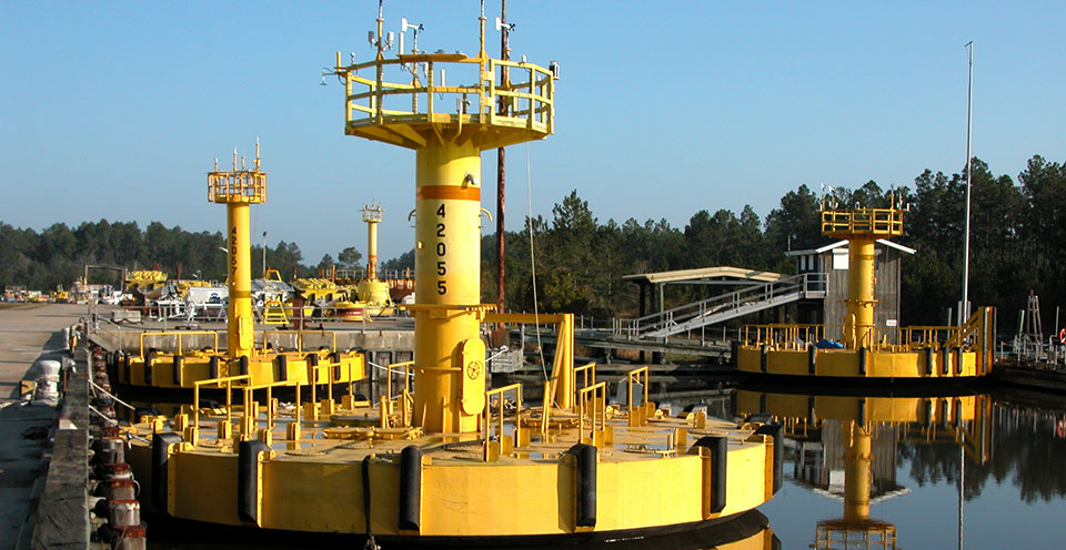
Buoys are just one of the many tools needed to collect ocean observation data. This image shows three ten-meter hurricane buoys prior to deployment.
IOOS coastal and marine data (e.g., water temperature, water level, currents, winds, and waves) are collected by many different tools including satellites, buoys, tide gauges, radar stations, and underwater vehicles. A variety of tools is needed to collect data on global, national, regional, and local levels. Some of these tools are in the water collecting data while others may be on land or in space. Most of the data collected are streamed to a database, making them easier to access.
While many of these data collection tools already exist, the benefit of IOOS is the one common system to connect all of these data so that scientists can quickly find information to track, predict, manage, and adapt to changes in our marine environment.
IOOS data supports environmental efforts such as tracking harmful algal blooms and emergency response needs by assisting with search and rescue operations. IOOS delivers the data and information needed to increase the understanding of our oceans, coasts, and Great Lakes so decision makers can improve safety, enhance our economy, and protect our environment.Search Our Facts
Get Social
More Information
Last updated: 07/18/25
Author: NOAA
How to cite this article