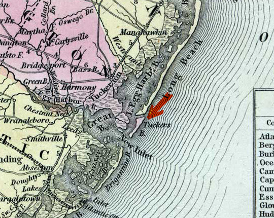
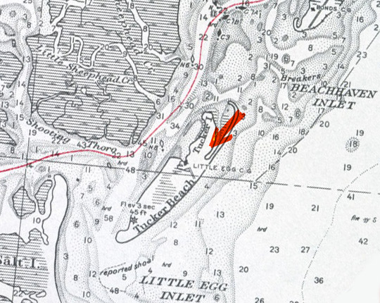
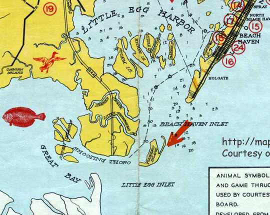
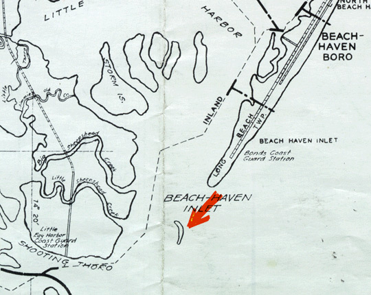
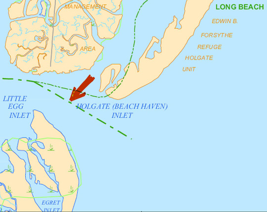
Powerful longshore currents causing longshore drift washed Tucker's Island, New Jersey, away. Scroll down the page to view a series of maps from 1856-2005 that show how Tucker's Island changed shape and eventually disappeared.
This map of New Jersey was printed in 1856 by Charles DeSilver of Philadelphia. The map is provided courtesy of the Special Collections and University Archives, Rutgers University Libraries. The full map may be viewed at: http://mapmaker.rutgers.edu/NJ_1856.jpg.
This map of inland waterways was printed in 1928 by the State of New Jersey Board of Commerce and Navigation. The map is provided courtesy of the Special Collections and University Archives, Rutgers University Libraries. The full map may be viewed at: http://mapmaker.rutgers.edu/HISTORICALMAPS/InlandWaterway_1928.jpg.
This 1938 road, municipal, and navigation map of Ocean County, New Jersey, was distributed by the New Jersey Ocean County Bureau of Publicity. The map is provided courtesy of the Special Collections and University Archives, Rutgers University Libraries. The full map may be viewed at: http://mapmaker.rutgers.edu/Ocean/OceanCo_pix_1938.jpg.
A 1953 road map of Ocean County, New Jersey. The map is provided courtesy of the Special Collections and University Archives, Rutgers University Libraries. The full map may be viewed at: http://mapmaker.rutgers.edu/Ocean/Ocean_County_1953.gif
A 2005 map of Ocean County, New Jersey. Created by the New Jersey Department of Transportation, Division of Information Technology, Bureau of Information Management and Technology Planning Geographic Information Systems, in cooperation with the U.S. Department of Transportation Federal Highway Administration.