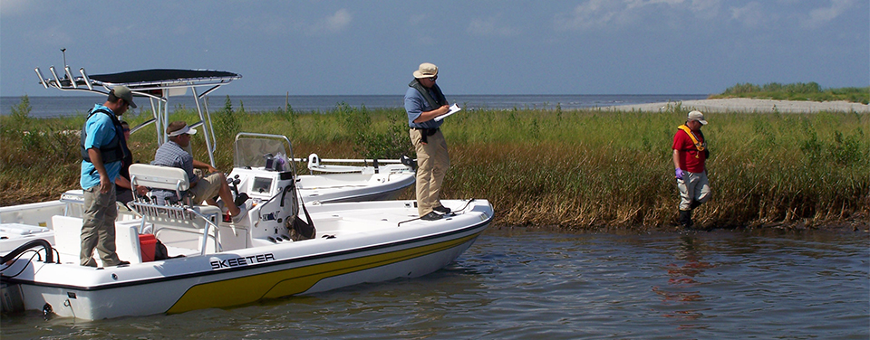
NOAA restoration project team assessing oiling of marshes in Barataria Bay, Louisiana. After an oil spill, NOAA conducts studies to identify the extent of damage, the best methods for restoring natural resources, and the type and amount of restoration required.
Marshes, forested wetlands, oyster reefs, seagrass beds, beaches, and tidal streams are vital habitats for fish, birds, and animals — and for humans, too! We depend on our coastal areas and estuaries for everything from food to storm protection to recreation and jobs. When these areas are damaged by events like hurricanes or oil spills, NOAA scientists explore restoration options to help return these fragile areas to how they were before the damage occurred.
Monitoring and assessment
In order to restore damaged coastal and estuarine habitats, it's necessary to know what these areas were like before any damage occurred. One way NOS scientists figure this out is through the use of geographic information systems — sophisticated digital mapping tools — to monitor changes in coastal and estuarine habitats over time. For example, the National Estuarine Research Reserve System-wide Monitoring Program tracks short-term variability and long-term changes in estuaries to better understand how human activities and natural events can change these ecosystems. Data collected at each of the nation's 27 estuarine reserves include water temperature, salinity, dissolved oxygen, and precipitation.
Scientists also carefully study specific habitats in our coastal areas such as seagrasses, coral reefs, and salt marshes. Understanding these systems and their relationships to one another before and after natural or manmade damage occurs helps researchers determine the best restoration options for recovery.
Natural resource damage assessment
After an oil spill or hazardous substance release, agencies like the U.S. Environmental Protection Agency or the U.S. Coast Guard respond immediately to clean up the substance and eliminate or reduce risks to human health and the environment. Typically, NOAA experts provide scientific and technical expertise to the on-scene commander during such situations. But these efforts may not fully restore injured natural resources or address their lost uses by the public. NOAA's Damage Assessment Remediation and Restoration Program conducts studies to identify the extent of damage, the best methods for restoring those resources, and the type and amount of restoration required.
Critical water level data
There are several key components essential for restoration projects to be properly designed and engineered. Because wetland vegetation is sensitive to how long and how often it is inundated or flooded, it is important for scientists and managers to understand the hydrodynamics of individual estuarine systems. The COASTAL Program (Coastal Oceanographic Applications and Services of Tides And Lakes) was designed to meet the need for accurate water-level information and vertical datums. With this data, researchers can evaluate any rise in sea level throughout the restoration process.
For example, restoration work was completed in 2012 at Lardner's Point Park in Philadephia, PA, one of many projects to restore resources injured by the Athos Spill where nearly 265,000 gallons of crude oil was spilled into the Delaware River in 2004. The spill resulted in lost recreational use, damage to wetlands and beach shorelines, and injuries to birds and waterfowl, fish and shellfish, and benthic (bottom-dwelling) plants and animals. This new 4.5-acre riverfront park includes a river overlook, restored tidal wetlands, fishing pier, connections to a trail system, and riverbank forest.
While there is still work to be done, NOAA and partners have completed a wide range of projects that have not only helped to restore the ecological health of the area, but have opened up new venues for recreational use such as canoeing and kayaking.
Natural Resource Damage Assessment (NRDA) is the legal process that federal agencies like NOAA, together with the states and Indian tribes, use to evaluate the impacts of oil spills, hazardous waste sites, and ship groundings on natural resources both along the nation's coast and throughout its interior.
 An official website of the United States government.
Here's how you know we're official.
An official website of the United States government.
Here's how you know we're official.