U.S. flag An official website of the United States government.

dot gov icon Official websites use .gov

A .gov website belongs to an official government organization in the United States.

https icon Secure websites use HTTPS

A small lock or https:// means you’ve safely connected to a .gov website. Share sensitive information only on official, secure websites.
Potential Storm Surge Flooding Map

NOS mapping and ocean data key for new experimental product.

storm surge flooding map graphic

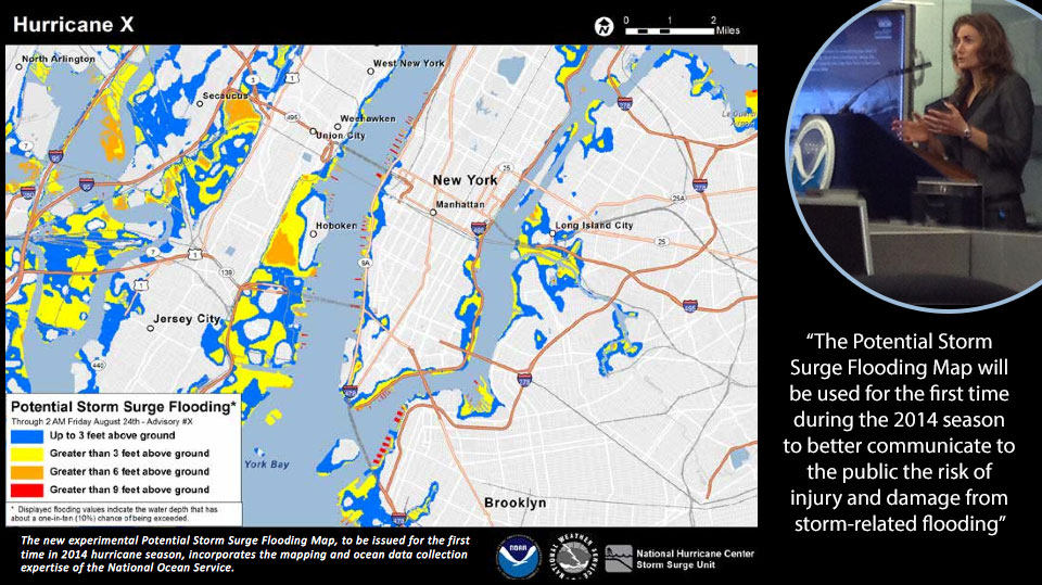
The experimental Potential Storm Surge Flooding Map, shown here, incorporates NOS mapping and ocean data. Dr. Holly Bamford, right, joined NOAA Administrator Dr. Kathryn Sullivan and National Weather Service Assistant Administrator Louis Uccellini for a press event on May 22 in New York City to discuss the 2014 Atlantic hurricane season outlook.

Today, NOAA issued the 2014 Atlantic hurricane season outlook. National Ocean Service products and services are being featured prominently this year. I joined NOAA Administrator Dr. Kathryn Sullivan and National Weather Service Assistant Administrator Louis Uccellini for the press event today in New York City.

NOAA introduced an experimental Potential Storm Surge Flooding Map which incorporates NOS mapping and ocean data. The product will be used for the first time during the 2014 season to better communicate to the public the risk of injury and damage from storm-related flooding.

NOS plays play a critical role before, during, and after hurricanes.

Holly A. Bamford, Ph.D.
Assistant Administrator for Ocean Services and Coastal
Zone Management, National Ocean Service