NOAA Helps ‘Rescue’ Century-old Data from the Grand Canyon
Surveyors add hundreds of updated geodetic control points to the National Spatial Reference System.

A Grand Mission
Surveyors from NOAA and the U.S. Geological Survey recently teamed up to update hundreds of geodetic control points in and around the Grand Canyon. If you want to determine where you are (in the Grand Canyon or anywhere in the U.S.), you need a known starting, or reference, point. Take a bunch of these points, and you have a spatial reference system. In the U.S., the National Spatial Reference System ensures that all U.S. positioning information, including every map made by any government agency, fits together.
Carved into the Earth by an ancient Colorado River, the Grand Canyon is one of few geographic features visible from space. Stretching across Arizona for more than 275 miles, the colossal chasm ranges up to 18 miles wide, a mile deep, and 8,800 feet above sea level.
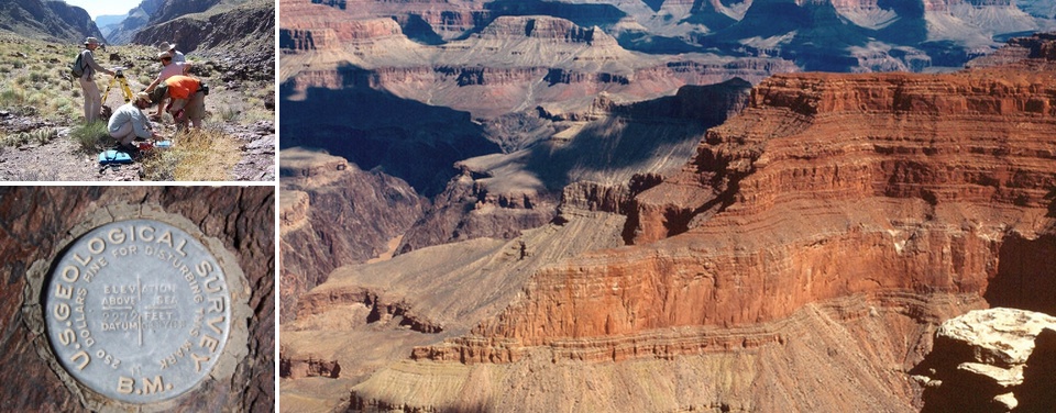
Nearly a century ago, intrepid surveyors hiked the canyon walls and rode the Colorado rapids, crisscrossing the canyon to painstakingly measure geodetic control points, install bench marks, physical points from which to take readings, and thus provide references for future geographic use. Bench marks may include a nail head hammered into a tree trunk, a buried rod that pokes out of the ground, or, more typically, a sturdy three-inch-round bronze disk set in stone. Once installed, they tend to “stay put” for a long time.
In an effort to accurately update geodetic control points for the Grand Canyon, NOAA’s National Geodetic Survey (NGS) recently teamed up with the U.S. Geological Survey’s Data Rescue Project to retrieve 346 historical bench marks from the canyon. NGS used advanced statistical methods and modern control points in combination with the old bench marks to create a collection of geographic points to add to the National Spatial Reference System (NSRS), the coordinate system maintained by NOAA that defines latitude, longitude, height, scale, gravity, and orientation for the United States. Every non-military U.S. geospatial product is tied to the NSRS so they all overlap and align accurately.
The surveyors who trekked the Grand Canyon a century ago could not even dream of the global satellite technology in use today, yet their legacy of scientific inquiry lives on in our modern world. Surveyors and others depend on the NSRS to ensure that positional coordinates are correct when creating or improving maps, setting property boundaries, planning and designing roads and bridges, and simply trying to predict if your backyard will flood the next time it rains.
Get Social
More Information
Did you know?
The Birdseye Expedition of 1923 was the first attempt to survey the Grand Canyon. The expedition’s name, which seems to poetically praise the toil of the nine-man crew, actually honors its leader, Colonel Claude Hale Birdseye, chief engineer of the USGS from 1918-1929. View historic video and images of this expedition.
