Midwest Flooding Damage Assessment Imagery
View National Geodetic Survey damage assessment images in aftermath of historic rainfall.
NOS's National Geodetic Survey (NGS) collected damage assessment imagery of flooding along the Mississippi and Arkansas River from Jan. 2-18, 2015. A team of NOAA aviators collected the photographs flying above the area at around 7,500 feet aboard NOAA's King Air aircraft equipped with specialized remote-sensing cameras. Imagery is available online to view and download.
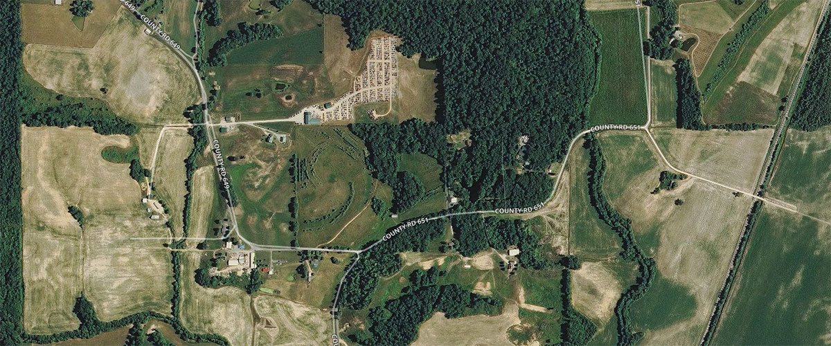
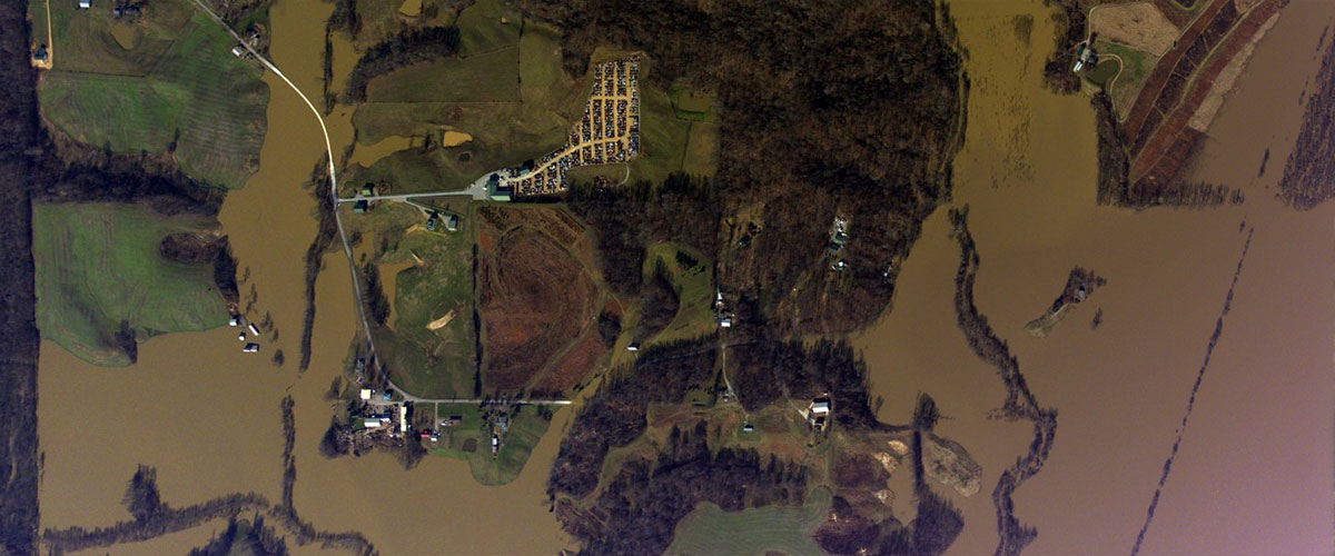
Flooding in farmland Northeast of Cape Girardeau, Missouri. Move your mouse or finger back and forth over each image to view a "before and after" comparison. "Before" images are OpenStreetMap satellite maps; "After" images were captured by cameras mounted in a National Geodetic Survey aircraft.
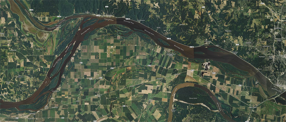
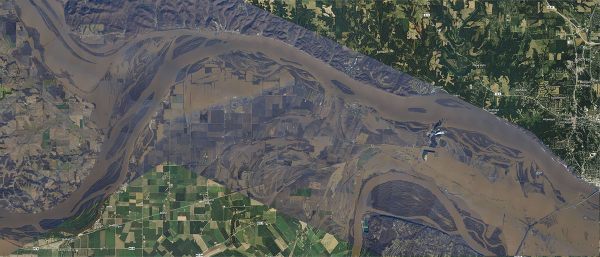
Flooding near Portage Des Sioux, Missouri. Move your mouse or finger back and forth over each image to view a "before and after" comparison. "Before" images are OpenStreetMap satellite maps; "After" images were captured by cameras mounted in a National Geodetic Survey aircraft.
Get Social
More Information
Did you know?
NGS aerial imagery is used to support the generation and maintenance of NOAA nautical charts and the assessment of damage to areas caused by natural or manmade disasters. Post-disaster survey priorities are centered on major ports and waterways supporting the Marine Transportation System; known or projected severe impacts to coastlines and critical infrastructure; and areas of severe flooding and/or damage to homes, roads, and infrastructure. In this case, the imagery provides a cost-effective way to better understand the flooding damage sustained to both property and the environment.
