Within the next two decades, scientists estimate that the Arctic Ocean will be free of multi-year ice in the summer.
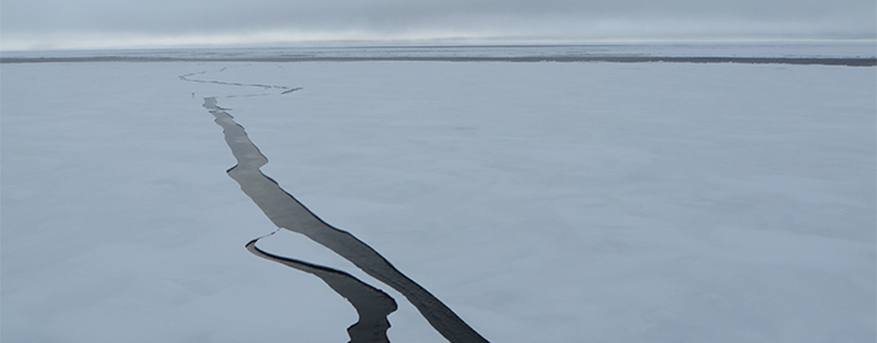
As multi-year sea ice continues to disappear at a rapid rate, vessel traffic in the Arctic is on the rise. This is leading to new maritime concerns, especially in areas increasingly transited by the offshore oil and gas industry, cruise liners, military craft, tugs and barges, and fishing vessels.
Keeping all of this new ocean traffic moving smoothly is a growing concern for safety's sake. It's also important to the U.S. economy, environment, and national security. That's why NOAA is striving to update Arctic nautical charts, add new tide and current monitoring stations, conduct geodetic surveys in the region, and prepare for potential incidents.
What we know now
Commercial and recreational vessels depend on NOAA to provide navigational charts and the U.S. Coast Pilot. These tools supply mariners with the latest information on depths, aids to navigation, accurate shorelines, and other features required for safe navigation.
Many of these tools, however, are unavailable or outdated for areas in the Arctic. Until recently, most of this region was relatively inaccessible by ship due to the presence of thick, impenetrable sea ice. Added to this, most Arctic waters that are charted were surveyed with imprecise technology, dating back to the 1800s, before the region was part of the United States. Most of the shoreline along Alaska’s northern and western coasts has not been mapped since 1960. As a result, confidence in the region’s nautical charts is low.
Establishing a geospatial foundation
Creating charts and other tools that depict spatial relationships requires a geospatial foundation—or consistent reference system—that describes the location of everything. Many areas of Alaska lack the geospatial foundation that is needed to fully support marine transportation and maritime domain awareness. For example, one percent of the Alaskan shoreline is updated annually using aerial and satellite imagery, compared to five percent elsewhere in the United States.
The Arctic region especially needs the gravity data necessary for a modern vertical reference system, so NOAA’s National Geodetic Survey is collecting airborne gravity data in Alaska. National Geodetic Survey also manages a network of GPS receivers that monitor three-dimension land movement over time. The Continuously Operating Reference Station network is critical for activities requiring precise positioning. NOAA is working with partners to fill in the gaps that exist in Arctic coverage, to improve the precision of survey positions and the measurement of land movement.
Hydrographic surveying
Of the 568,000 square nautical miles (SNM) in the U.S. Arctic Exclusive Economic Zone, less than half is what NOAA considers “navigationally significant.” Surveying over a quarter of a million SNM would take decades, so NOAA has designated 38,000 SNM as survey priority areas in the Arctic. Estimates range up to 25 years for surveying those priority areas, if resources remain at their current level.
NOAA began acquiring hydrographic data to support these emerging Arctic priorities in 2010 with a hydrographic survey of the Bering Strait and Port Clarence, Alaska. In 2012, NOAA conducted a 1,500 nautical mile reconnaissance survey, from Dutch Harbor, Alaska, to the Canadian border, checking historic data against current depth readings. That reconnaissance informs priorities for surveys in 2013 and beyond.
Modern U.S. navigational charts are a compilation of the best data available. Nevertheless, many of the soundings on the charts are from as early as the 1800s. As transportation pressures mount in Arctic seaways, NOAA is now working to update outdated Arctic nautical charts to meet modern needs.
In 2011, NOAA issued an Arctic Nautical Charting Plan after consultations with maritime interests and the public, as well as with other federal, state, and local governments. NOAA updated the plan in 2013, outlining the creation of 14 new charts to complement the existing chart coverage. Since the update, Coast Survey released a new nautical chart for the Arctic, helping mariners navigate the Bering Strait. Chart 16190 (Bering Strait North) incorporates precise depth measurements acquired recently by NOAA Ship Fairweather hydrographic surveys.
Monitoring tides and currents for navigation
NOAA's Center for Operational Oceanographic Products and Services' (CO-OPS) National Water Level Observation Network (NWLON) provides the reference system of tidal and water level datums. CO-OPS operates 10 longterm NWLON tide stations in the Arctic region of Alaska and 16 others throughout the rest of the state.
There are 27 identified gaps in watel level observation coverage in Alaska, and 19 of those are located within the Arctic region. The gaps encompass most of the Arctic. Longterm plans include establishing new NWLON stations in these harsh environments, ideally co-located with National Geodetic Survey’s Continually Operating Reference System stations, to simultaneously provide measurements of local sea level change and land movement from the same position.
In many Arctic locations, tide and current predictions have never been calculated. For many other locations, tide and current predictions have not been measured since the early 1950s when only a few days of data were collected. Today we know that accurate predictions require at least 30 days of continuous data collection.
Working with other nations
On October 6, 2010, NOAA led a U.S. delegation that formally established a new Arctic Regional Hydrographic Commission (ARHC) with four other nations known — together with the U.S. — as “Arctic coastal states.” The commission, which also includes Canada, Denmark, Norway, and the Russian Federation, promotes cooperation in hydrographic surveying and nautical charting. The Commission provides a forum for better collaboration to ensure safety of life at sea, protect the increasingly fragile Arctic ecosystem, and support the maritime economy.
For instance, at recent meetings of the ARHC held in January, 2014, efforts focused on data sharing, new technologies for improved hydrography, resolving duplicative efforts such as overlapping electronic charts, and the development of an arctic voyage planning guide to aid mariners who plan to transit arctic waters.
The agreement to form the ARHC was an historic event. Since the International Hydrographic Organization was formed in 1921, 15 regional hydrographic commissions have been established worldwide. The Arctic Ocean remained without such a commission until now.
Planning and preparing for potential accidents
As vessel traffic and energy exploration continues to increase in the Arctic, so does the likelihood of oil spills and other incidents. Through partnerships, cutting edge technology, and extensive data collection, NOAA works to prepare for potential incidents.
NOAA partnered with the U.S. Coast Guard on the Arctic Shield 2013 exercise, utilizing its unmanned aircraft system, the Puma, as one method to survey, identify, and monitor oil on and around ice floes from above. The data collected, including high resolution and infrared imagery, may be used in a variety of applications such as identifying and monitoring oiled environments and wildlife. NOAA’s Arctic Environmental Response Management Application (ERMA) was also utilized during this exercise. A stand-alone version of ERMA was developed as an internet-independent tool for use in remote locations such as the Arctic. Similar to the online site, Stand-alone ERMA displays prioritized NOAA data layers and key datasets from external sources and was used to quickly display data received from the Puma and other technologies during the exercise.
Arctic ERMA also includes information from the Alaska ShoreZone Coastal Inventory and Mapping Project, a partnership among NOAA and other government agencies, NGOs and private industry, is a comprehensive inventory of high-resolution imagery and descriptions of 80% of Alaska's coastal habitats. ShoreZone serves alongside NOAA's Environmental Sensitivity Index maps and data as a baseline for the coastal habitats of Alaska and is currently being used for environmental planning, preparedness, and Natural Resource Damage Assessment planning in Alaska.
 An official website of the United States government.
Here's how you know we're official.
An official website of the United States government.
Here's how you know we're official.