Seeing things more clearly
NOAA employs a new approach to aerial imagery for Hurricane Arthur.

A New Angle
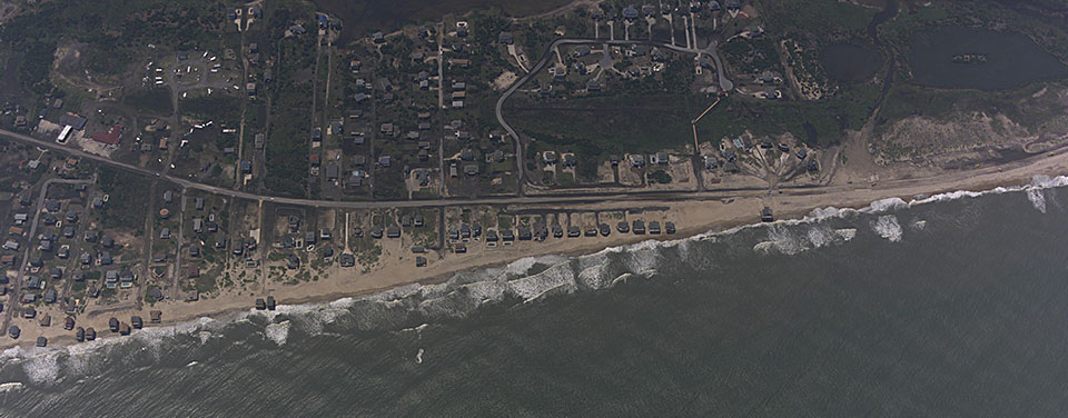
Imagery collected by NOAA in the aftermath of Hurricane Arthur tested new photographic techniques that may lead to more comprehensive post-storm surveys in the future. Shown here: the North Carolina coast near Rodanthe shortly after Hurricane Arthur passed through the area.
On the morning of July 4th, 2014, less than 12 hours after Hurricane Arthur roared up the coast of North Carolina and Virginia, NOAA's National Geodetic Survey began flying survey missions to take aerial photographs to document damage, erosion, and potential impacts to navigation. This collection of coastline imagery, now available online, employs new photographic techniques that NGS experts expect will lead to more comprehensive post-storm surveys in the future.
These missions marked the first time that surveyors collected oblique imagery, or images taken at an angle rather than straight down, in response to a tropical cyclone. The advantage to this type of approach is that it allows the team to photograph a wider area and also improves the visibility of vertical structures, such as the sides of buildings, as opposed to only the tops of buildings as typically seen in traditional imagery. In addition to the photos collected along the coast, the survey team evaluated a GoPro® to collect video during the flight. The goal of this new layered approach in aerial video and photo documentation is to provide and evaluate better visual context that might be missing in vertical photography alone — the sole type of imagery gathered by NOAA surveyors in past missions.
In the aftermath of events such as hurricanes, data contained in NOAA aerial photos provide emergency and coastal managers with the information they need to develop recovery strategies, facilitate search-and-rescue efforts, identify hazards to navigation and HAZMAT spills, locate errant vessels, and provide documentation necessary for damage assessment through the comparison of before-and-after imagery.
Search Our Posts
Get Social
More Information
Did you know?
Since the early 1900s, NOAA's National Geodetic Survey has been taking photographs from airplanes to capture the Earth below. Today, photos are used to define the national shoreline, create maps and charts, monitor environmental change, and provide damage assessment in response to manmade or natural disasters.
Learn More