What is lidar?
Lidar — Light Detection and Ranging — is a remote sensing method used to examine the surface of the Earth.
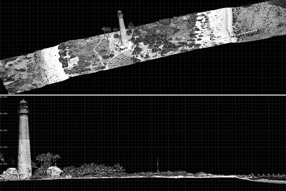
Lidar data collected using NOAA survey aircraft reveals a top-down and side view of Loggerhead Key Lighthouse, Dry Tortugas, Florida. NOAA scientists use lidar-generated products to examine both natural and manmade environments. Lidar data supports activities such as inundation and storm surge modeling, hydrodynamic modeling, shoreline mapping, emergency response, hydrographic surveying, and coastal vulnerability analysis.
Lidar, which stands for Light Detection and Ranging, is a remote sensing method that uses light in the form of a pulsed laser to measure ranges (variable distances) to the Earth. These light pulses—combined with other data recorded by the airborne system — generate precise, three-dimensional information about the shape of the Earth and its surface characteristics.
A lidar instrument principally consists of a laser, a scanner, and a specialized GPS receiver. Airplanes and helicopters are the most commonly used platforms for acquiring lidar data over broad areas. Two types of lidar are topographic and bathymetric. Topographic lidar typically uses a near-infrared laser to map the land, while bathymetric lidar uses water-penetrating green light to also measure seafloor and riverbed elevations.
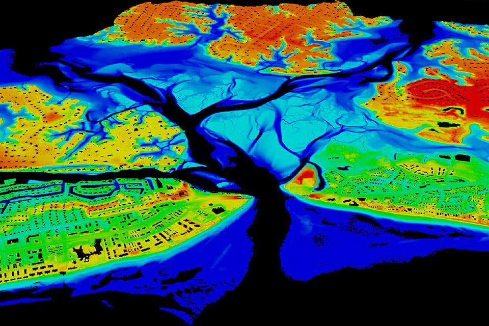
A lidar map of Lynnhaven Inlet, Virginia.
Lidar systems allow scientists and mapping professionals to examine both natural and manmade environments with accuracy, precision, and flexibility. NOAA scientists are using lidar to produce more accurate shoreline maps, make digital elevation models for use in geographic information systems, to assist in emergency response operations, and in many other applications.
Lidar data sets for many coastal areas can be downloaded from the Office for Coastal Management Digital Coast web portal.
How is lidar data collected?
When an airborne laser is pointed at a targeted area on the ground, the beam of light is reflected by the surface it encounters. A sensor records this reflected light to measure a range. When laser ranges are combined with position and orientation data generated from integrated GPS and Inertial Measurement Unit systems, scan angles, and calibration data, the result is a dense, detail-rich group of elevation points, called a "point cloud."
Each point in the point cloud has three-dimensional spatial coordinates (latitude, longitude, and height) that correspond to a particular point on the Earth's surface from which a laser pulse was reflected. The point clouds are used to generate other geospatial products, such as digital elevation models, canopy models, building models, and contours.
Social