Accurate Positioning Data for Alaska and the Arctic
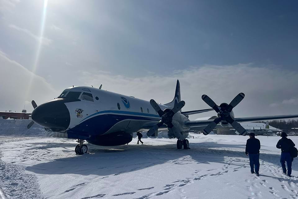
The Gravity for the Redefinition of the American Vertical Datum, or GRAV-D, crew with the plane affectionately named "Miss Piggy."
Alaska has the longest coastline of any state in the nation. The state is also tectonically active and known for its challenging weather and ocean conditions. Geospatial and mapping information is critical in this kind of environment, yet the supporting geospatial data and positioning framework are insufficient to meet current needs. Many federal agencies are involved with the modernization of critical geospatial data and mapping products for Alaska, with NOAA’s National Geodetic Survey, or NGS, playing a leading role. Here are a few examples of projects that will have major positive impacts.
Improving Heights and Positions
The Global Positioning System, or GPS, revolutionized surveying beginning in the 1980s, but using the GPS to obtain accurate elevation measurements proved more challenging. The National Height Modernization Program, or NHMP, was initiated in the 1990s and 2000s to provide access to accurate, reliable heights nationally. Heights and gravity are defined by NOAA’s National Spatial Reference System, a coordinate system that defines latitude, longitude, heights, gravity, and shorelines throughout the U.S.
The goals for the NHMP were to develop consistent national height standards; to provide data, technology, and tools that yield consistent results regardless of terrain and circumstances; and to establish a system or process that is maintainable over time. The NGS Gravity Program succeeded the NHMP in the 2010s, but with similar goals. A primary goal of the NGS Gravity Program is to model and monitor Earth's geoid, a model that approximates mean sea level. Heights that take into account gravity are orthometric heights, and they are roughly equivalent to elevations above sea level.
As part of the past and current programs, NGS continues improving measurements of both height at specific sites and gravity at the ground level in Alaska and the Arctic. One of the unique challenges of working in this environment relative to other parts of the U.S. is that there are glaciers on the coasts and in other parts of the region. In areas where temperatures are warming, the glaciers are retreating. The phenomenon of glaciers unloading on the ground brings vertical ground movement, or a rise in land masses that were once weighed down by immense ice sheets. This movement is also known as rapid isostatic rebound, and it affects height and gravity measurements.
Foundation CORS Network
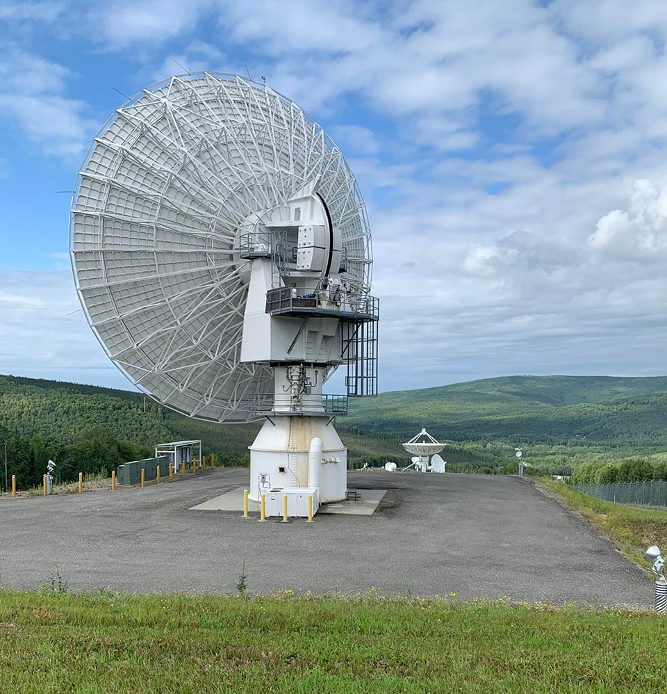
The Foundation Continuously Operating Reference Stations (FCORS) site at the NOAA Fairbanks Command and Data Acquisition Station site in Fairbanks, Alaska, is expected to be a key part of the NOAA FCORS Network.
Accurate positioning information is crucial to our weather and natural disaster prediction capabilities. One of the pillars of accurate positioning is the expanding national network of NOAA Foundation Continuously Operating Reference Stations, or FCORS, that track global navigation satellite system, or GNSS, signals. NGS is now overseeing the installation of key stations in Alaska and the Arctic. The technology will be installed at a French DORIS (Doppler Orbitography Radiopositioning Integrated by Satellite) station in Cold Bay, Alaska, and at the NOAA Fairbanks Command and Data Acquisition Station near Fairbanks, Alaska, 200 miles from the Arctic.
FCORS will provide continuous streaming GNSS data to NOAA data centers, contributing to a modernized and precise definition of the National Spatial Reference System. These stations will allow users to obtain positioning, navigation, and timing information rapidly and precisely. By collocating these GNSS stations with historic geodetic observing systems such as Very Long Baseline Interferometry, Satellite Laser Ranging, and DORIS, a high-accuracy spatial reference system is achieved, contributing to the realization of the International Terrestrial Reference Frame, or ITRF, global framework. These highly precise data sets will replace current, insufficient data sets that are not meeting the current accuracy requirements of critical scientific and surveying projects, such as measuring sea level change to within a few millimeters.
NGS is overseeing the installation of eight FCORS sites in the continental U.S. to meet the current accuracy requirements. In addition to the sites in Alaska, sites are being constructed in Hawaii, U.S. territories, and select foreign countries.
These improved capabilities will directly impact the people who are living in the most fragile parts of Alaska and the Arctic. When positioning data helps us see that coastal area erosion or sea level rise could affect citizens’ safety, we share the data and models at town and tribal council meetings, helping people make decisions about where it’s safe for them to live.
Shoreline Mapping
NGS began imaging the Earth from airplanes in 1919. Today, NGS uses the global positioning system and an inertial measurement unit sensor to geoposition aerial photography. The images have been used to define the national shoreline as well as create maps and charts, monitor environmental change, and provide damage assessment in response to manmade or natural disasters.
Mapping the rapidly changing shoreline is an important priority in Alaska, increasingly so as the climate changes. There are approximately 54,563 kilometers (33,904 miles) of coastline in the state, including the Aleutian Islands, and NOAA is filling the gaps in our understanding of that coastline. Partnerships are vital to accomplishing this work, especially in remote areas where it is challenging to deploy people, supplies, and equipment. One noteworthy partnership was the 2023 cooperation between the U.S. Geological Survey, NOAA, and the U.S. Army Corps of Engineers to use Typhoon Merbok supplemental funding for mapping Alaska's west coast communities that were heavily impacted by the disaster.
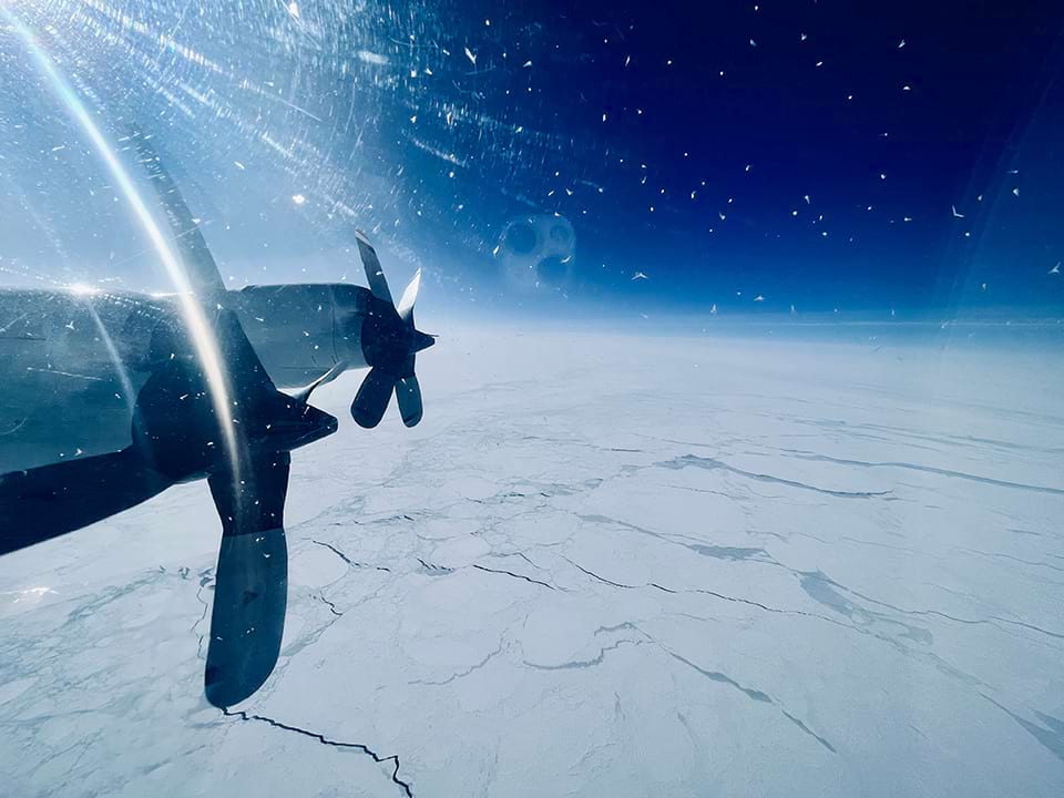
A NOAA Aircraft Operations Center’s NOAA WP-3D Orion aircraft flies a Gravity for the Redefinition of the American Vertical Datum, or GRAV-D, aerial survey over the Arctic Ocean.
GRAV-D
NGS has successfully flown the full target area for the Gravity for the Redefinition of the American Vertical Datum, or GRAV-D, aerial surveys in Alaska, with the final set of flights completed in the summer of 2023. Using NOAA aircraft, teams completed airborne gravity data collection of the remote and challenging Aleutian Islands. These surveys contributed to covering the first pass of the entire GRAV-D target area, which includes all U.S. states and territories — a monumental project that has been underway for more than16 years. NGS will soon move to processing the data. NGS has a federal mandate to provide accurate positioning, including heights, to all federal non-military mapping activities in the U.S. The overarching goal of GRAV-D is to model and monitor Earth’s geoid, a surface of the gravity field very closely related to global mean sea level, to serve as a zero reference surface for all heights in the nation. This will ultimately make accurate height measurement better, faster, and cheaper.
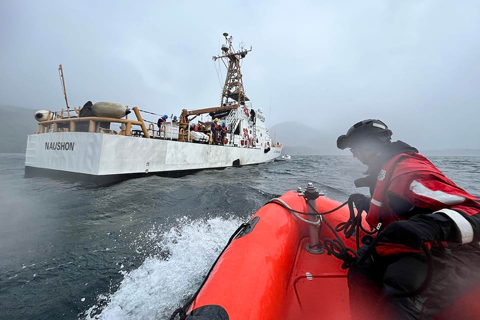
National Geodetic Survey staff shuttling back to the U.S. Coast Guard cutter Naushon after obtaining Global Navigation Satellite System measurements on remote islands in the Cook Inlet outside of Homer, Alaska.
Vdatum
NGS’s Field Operations Branch completed foundational Global Navigation Satellite System data observations along targeted tidal benchmarks in the Cook Inlet, the Kenai Peninsula, and within Kenai Fjords National Park in support of NGS’s Vertical Datum Transformation software tool, known as Vdatum. The effort was the beginning of filling coastal Vdatum observation gaps along the southern coast of Alaska, with more work planned for the Gulf of Alaska. NGS worked with partners from the U.S. Coast Guard and the National Park Service to obtain measurements along Alaska’s rugged coastline. Vdatum converts elevation data from various sources into a common reference system. The tool is able to transform between tidal, orthometric, and ellipsoidal reference systems, providing users with a method for establishing a common reference system for mapping and other applications.
 An official website of the United States government.
Social