Capturing Snapshots of the U.S. Population
NOAA Ocean Podcast: Episode 58
NOAA and the U.S. Census Bureau teamed up to capture snapshots of the U.S. population when the census is conducted. In this episode, we discover how this information reveals migration patterns over time, and how it helps you use GPS with your phone.
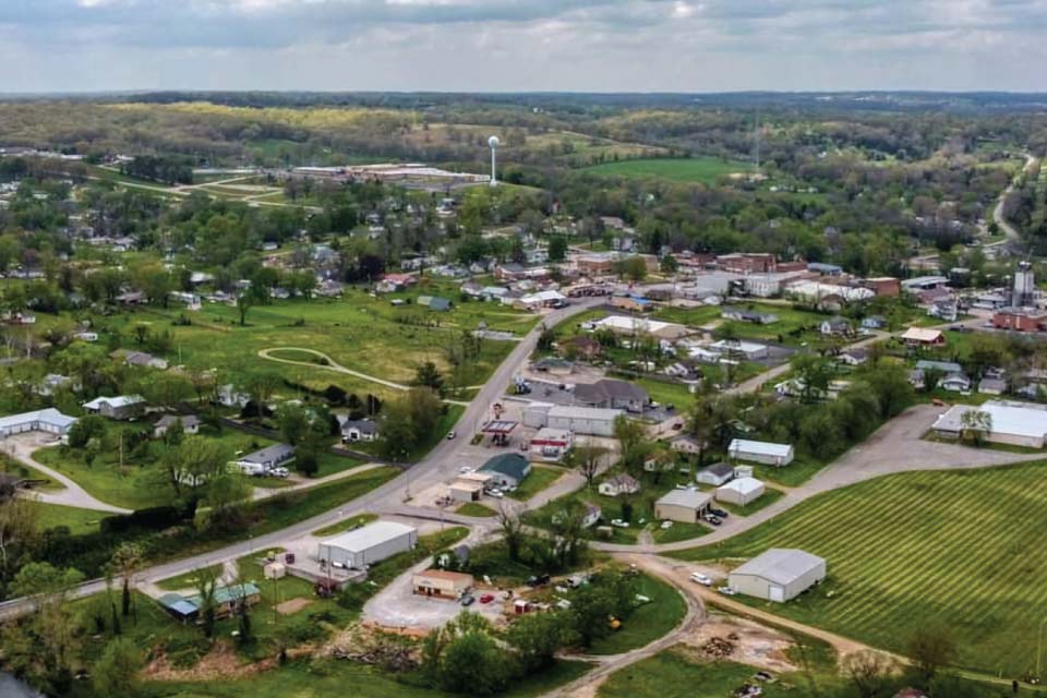
The 2020 U.S. center of population is located in Hartville, Missouri. This location was determined by data collected from the latest U.S. census.
Listen here:
Or listen in your favorite podcast player:


Transcript
HOST: This is the NOAA Ocean Podcast. I’m Marissa Anderson. For over six decades, NOAA’s National Geodetic Survey has partnered with the U.S. Census Bureau to capture snapshots of our nation’s population when the U.S. census is conducted. Every ten years, they calculate the U.S. Center of population. This is the location where an imaginary, flat, weightless, and rigid map of the United States would balance perfectly if all Americans were of identical weight.
By using the data provided by the Census Bureau, scientists from the National Geodetic Survey precisely locate the center of population at a point on the ground and place a survey disk to mark this spot. This important location has a lot to offer - including revealing migration patterns, and even helping you to find your way when you use your smartphone during a car ride!
To learn more about this, we are joined by an expert from the National Geodetic Survey, Galen Scott. Let’s dive right in...
HOST: Why exactly is the U.S. Center of Population important?
SCOTT: By itself, any particular center of population is like a snapshot in time based on information that the Census collects about people and the economy during that ten year stretch. The importance lies in what it tells us about the nation during a certain era, and really the importance of this concept grows as you consider that the Census has been taking these snapshots every 10 years since 1790. So together, you know, when you look at all of them, they begin to tell a story of how our nation has changed. It charts the history of the growth of our nation, the expansion of the infrastructure that we’ve built to support people and our growing economy.

Galen Scott, NOAA NOS NGS Constituent Resources Manager
HOST: Where was the first center of population?
SCOTT: The first center of population was actually on the eastern shore of Maryland in Kent County back in 1790. That was the center of the thirteen original colonies. Over the intervening years, its moved west really all the way through about 1920, pretty much due west. And then starting about a hundred years ago, it started to move south west. It’s moved west over time through Maryland, into West Virginia, Ohio, Indiana, Illinois, and then into Missouri. Over the years its location has been affected by the changing times, you know as patterns of migration have changed and our transportation networks have evolved. Think about the impact of the Transcontinental Railroad in 1869. Or the interstate highway system that was built in the 20th century. Right, it allowed people to move west and people did, you know moved west until 1920, but for the last 100 years or so, the center of populations has been trending to southwest, and that’s really due to the rise, the growth in population in the South West, in the sun belt. And this was supported by the advent of technologies like air conditioning and us building and water infrastructure. Now that westward growth has slowed in recent decades and now that we are facing droughts and things like power grid disruptions, we’ll see if those trends continue, if people continue to live in those places or if they need to move, start moving elsewhere.
HOST: That’s really interesting to be able to track that migration. So the Census Bureau is the organization that actually crunches the numbers to get the center of population, but what does the National Geodetic Survey do with this information? And when did they get involved?
SCOTT: The National Geodetic Survey where I work and our predecessor agencies have been providing the precise geospatial framework or a really accurate system of latitude and longitude and heights for surveying and mapping in the United States for the past 215 years. Over these years, our surveyors as well as those from some of our partner agencies have installed a variety of survey marks as part of our work. Survey marks are permanently placed, and stable objects that have precisely determined spatial reference coordinates, like latitude, longitude, and heights. Many of them these days are 3 ½ inch wide brass disks, and we’ve set them in rocks or concrete pillars buried in the ground. You can think of these marks as the “pins” connecting maps, charts, images, and environmental models to specific locations on the Earth’s surface. And once you know to look for these marks, you will begin to see them everywhere, but for most people they remain hidden. We consider them part of our Nation’s invisible, yet critical, geospatial infrastructure.
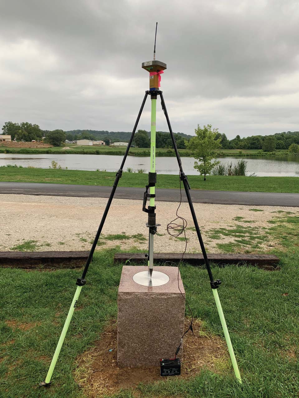
This survey tripod was used to precisely measure the location of the commemorative marker for the 2020 U.S. Center of Population in Hartville, Missouri.
Starting in about 1960, the National Geodetic Survey began to partner with Census and we put in survey marks at or near the locations where Census determines the center of population to be for each of those decennial censuses. Putting in a mark like that is a way to permanently mark the spot. Over the years we’ve started putting in commemorative marks, or bigger, fancier marks that look nice, but still serve the important purpose of providing access to our national precise system of latitude, long, and height. We call that system the National Spatial Reference System.
HOST: The information you talked about, the survey marks and the National Spatial Reference System, it's very useful to NOAA and various scientific communities. But does it have an impact on our everyday lives?
SCOTT: Absolutely. The National Spatial Reference System is the foundation for all maps. It helps to make sure that spatial data that comes in from all kinds of different sources all line up and can be used together. Think about maps of roads and maps of buildings, and maps of sewer lines or water lines. You know, you want to be able to take data from a lot of different sources and put them together so they line up and you can use them together. And this is especially important for building things that go over the horizon, where you have to take into account the curvature of the Earth like highways or railways or power lines or pipelines. Being able to have an accurate system, a National Spatial Reference System that does not change at state boundaries and remains consistent across the country is really important for building these kind of infrastructure that's critical to our daily lives. These days many of us really depend on our phones for navigation information, so you with the GPS receivers and the maps you have in your phone, making them all connected to the National Spatial Reference System makes sure they are all plotted against each other, and that they are all accurate enough to get us where we need to go and perhaps even avoid some traffic along the way.
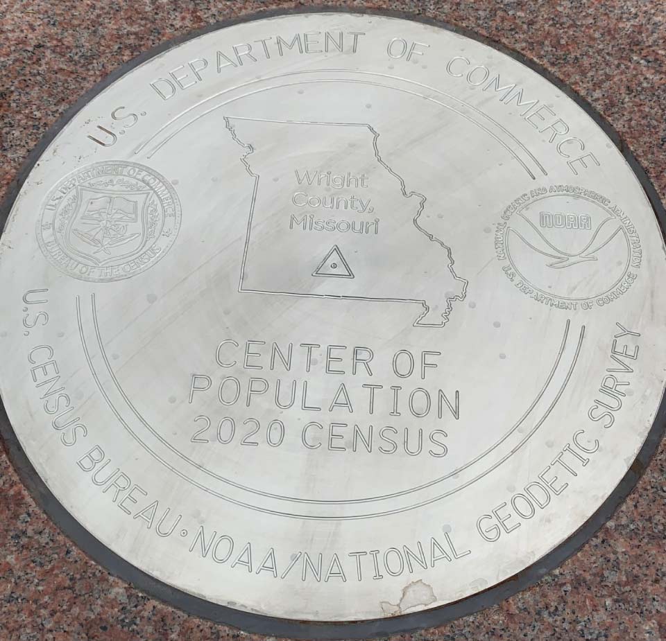
This commemorative survey mark was placed at the 2020 U.S. Center of Population in Hartville, Missouri. This location will become part of the National Spatial Reference System, the national precise system of latitude, long, and height.
HOST: I’m sure most of us when we get in our car and go driving to some place we’re not familiar with, we just take for granted using GPS to get there. So I strategically waited until the end of our podcast to tell our listeners the location for the 2020 center of population. Galen, can you please reveal to us where that is?
SCOTT: I am pleased to tell you that the 2020 U.S. center of population is in the heart of the country in Hartville, MO.
HOST: Galen left us with some final thoughts regarding the future and the importance of this work.
SCOTT: The National Spatial Reference System of today is built on old technology. People’s needs for accurate locations and accurate maps is greater than ever. Here at National Geodetic Survey, we’re in the process of modernizing the National Spatial Reference System using new, more accurate technology, using GPS and global positioning system technology and very accurate models of gravity to be able to give people the ability to determine very precise locations in short amounts of time. This modernized system is really a critical investment in that invisible infrastructure that will really go a long way to help our nation realize these visions we have for a future where we can safely navigate in a world of autonomous vehicles and where we have the ability to measure and monitor how our world is changing and provide information on those changes to help us plan for a more resilient future.
HOST: If you’d like to learn more about the center of population and the work of the National Geodetic Survey, be sure to check out our show notes. This is the NOAA Ocean Podcast. Subscribe to us in your podcast player of choice and never miss an episode.

From corals to coastal science, connect with ocean experts to explore questions about the ocean environment.
Social